

автордың кітабын онлайн тегін оқу Third Biennial Report of the Oregon State Highway Commission / Covering the Period December 1st, 1916 to November 30th, 1918
The Project Gutenberg EBook of Third Biennial Report of the Oregon State
Highway Commission, by S. Benson, W. L. Thompson, R. A. Booth, Herbert Nunn
This eBook is for the use of anyone anywhere at no cost and with
almost no restrictions whatsoever. You may copy it, give it away or
re-use it under the terms of the Project Gutenberg License included
with this eBook or online at www.gutenberg.org
Title: Third Biennial Report of the Oregon State Highway Commission
Covering the Period December 1st, 1916 to November 30th, 1918
Author: S. Benson, W. L. Thompson, R. A. Booth, Herbert Nunn
Release Date: February 21, 2011 [EBook #35344]
Language: English
*** START OF THIS PROJECT GUTENBERG EBOOK OREGON STATE HIGHWAY COMMISSION ***
Produced by Harry Lamé, Jason Isbell and the Online
Distributed Proofreading Team at http://www.pgdp.net
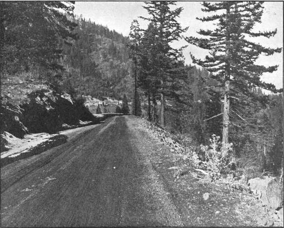
ON THE PACIFIC HIGHWAY IN THE SISKIYOU MOUNTAINS, JACKSON COUNTY.
MACADAMIZED IN 1917
Third Biennial Report of the
Oregon State Highway Commission Covering the Period December 1st, 1916 to November 30th, 1918
OREGON STATE HIGHWAY COMMISSION
S. Benson, Chairman
W. L. Thompson, Commissioner; R. A. Booth, Commissioner
Herbert Nunn, State Highway Engineer
Salem, Oregon:
State Printing Department
1919
LETTER OF TRANSMITTAL
Salem, Oregon, December 1, 1918.
HONORABLE JAMES WITHYCOMBE,
Governor of the State of Oregon,
Dear Sir: In compliance with Section 5, Article II, Chapter 237, Laws of 1917, we have the honor to submit herewith the report of the State Highway Commission for the period December 1, 1916 to November 30, 1918.
The Commission desires at this time to express its appreciation of the courtesies and assistance rendered to it by the various state officers and county officials in the work of the past two years.
Respectfully submitted,
OREGON STATE HIGHWAY COMMISSION,
S. Benson, Chairman
W. L. Thompson, Commissioner
R. A. Booth, Commissioner
Attest:
Roy A. Klein, Secretary
TABLE OF CONTENTS
Page
Letter of Transmittal to the Governor
4Table of Contents
5Report of the State Highway Commission
7
General Resume of the Work of the Biennium
7
Proposals Received on Construction Jobs
9
Bond Sales
10
Financial Statement
11State Highway Engineer’s Report to the Highway Commission
13
Letter of Transmittal
14
Work Accomplished
17
Moneys Available and Expended
17
Paving
18
Macadamizing
18
Grading
19
Bridges
19
Elimination of Grade Crossings
21
Federal Cooperation
22
Post Road Projects
23
Forest Road Projects
23
The Pacific Highway
27
The Columbia River Highway
28
County Work Supervised by the Highway Department
29
Construction Work by State Forces
29
State Highway Funds
30
Equipment
31
Office Organization
32
Cost Keeping
34
Employes in the Army Service
35Tabulated Statements of Expenditures and Costs
39
Allotments to Various Highway Funds
40
Summary of Fund Allotments and Fund Expenditures
40
Expenditures Segregated by Counties
41
Expenditures Segregated Under the Heads of General Administrative, Surveys, Construction Engineering, Construction, Equipment, Etc.
41
Expenditures for Construction Detailed by Jobs
42
Expenditures for Surveys Detailed by Jobs
45
Expenditures for Equipment, Bond Interest and Overhead
47
Summary of County Funds Expended by the Department
48General Tabulated Information and Highway Maps
51
Miles of Highway Construction by the Department During 1917 and 1918
52
Tabulation of Bridge Design and Construction
54
Miles of Location Surveys Made by the Department during 1917 and 1918
58
Miles of Different Types of Roads in Each County
59
Motor Vehicle Registration by Counties
60
County Bond Issues
60
Tabulation of Contract Prices
—
Yearly Expenditure of State Funds in Counties
61
Mileage Table of Main Travelled Roads
62
Map of Main Travelled Roads
—
Official Designation of State Highways
63
Employes of the Highway Commission
65
Numbers and Mileages of State Highways
66
Map of State Highway System
67General Description of Work in Various Counties
69
Baker County
69
Benton County
71
Clackamas County
71
Clatsop County
75
Columbia County
80
Coos County
89
Crook County
89
Curry County
90
Deschutes County
91
Douglas County
92
Gilliam County
100
Grant County
101
Harney County
104
Hood River County
106
Jackson County
112
Jefferson County
117
Josephine County
117
Klamath County
122
Lake County
122
Lane County
122
Lincoln County
123
Linn County
123
Malheur County
124
Marion County
125
Morrow County
129
Multnomah County
131
Polk County
132
Sherman County
132
Tillamook County
133
Umatilla County
135
Union County
138
Wallowa County
141
Wasco County
142
Washington County
143
Wheeler County
146
Yamhill County
150LIST OF ILLUSTRATIONS
- On The Pacific Highway In The Siskiyou Mountains, Jackson County. Macadamized In 1917
- Little Jack Falls On The Columbia River Highway Between Goble And Rainier In Columbia County
- Reinforced Concrete Bridge Over Hood River, Nearing Completion, On The Columbia River Highway At Hood River City. Built In 1918
- Mount Ashland From The Pacific Highway In Jackson County. Elevation Of Highway 4,480 Feet
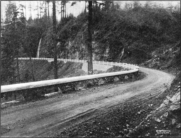
- Reinforced Concrete Half Viaduct On The Columbia River Highway Between Goble And Rainier In Columbia County, Constructed In 1918
- Reinforced Concrete Cribbing Near Prescott On The Columbia River Highway In Columbia County. Built In 1918
- Automobile Road Map, Showing The Main Traveled Roads Of Oregon With Mileages. Prepared by the Oregon State Highway Department
- State Of Oregon. System Of State Highways. Proposed By State Highway Commission, 1918
- The Pacific Highway In Pass Creek Canyon, Douglas County. Graded And Macadamized In 1917 And 1918
- At The Top Of Canemah Hill On The Pacific Highway In Clackamas County. Graded And Paved In 1918
- Bituminous Pavement On The Pacific Highway South Of Oregon City In Clackamas County. Graded And Paved In 1918
- Bituminous Paving Near Svenson In Clatsop County On The Columbia River Highway. Paved In 1917
- Covered Wood Drawbridge On The Columbia River Highway In Clatsop County, Over The John Day River East Of Astoria. Built In 1918. Lift Span—40 Feet
- On The Columbia River Highway Near Goble In Columbia County. Graded And Macadamized In 1917 And 1918
- One Of Nine Reinforced Concrete Bridges In The Beaver Creek Valley, Columbia County, On The Columbia River Highway Between Rainier And Clatskanie. All Built In 1917 And 1918
- Bridge On Pass Creek—20 Ft. Span. On Pacific Highway Near Comstock In Douglas County
- Along The Umpqua River North Of Myrtle Creek In Douglas County. Graded In 1917 And 1918
- Van Tyne Creek Viaduct North Of Myrtle Creek In Douglas County. Built In 1918
- The John Day River Highway South Of Condon In Gilliam County Macadamized In 1917
- The Columbia River Highway West Of Lindsay In Hood River County
- The Columbia River Highway Near Viento In Hood River County. Graded And Graveled In 1917 And 1918
- On The Columbia River Highway In Hood River County Two Miles East Of Cascade Locks. Graded And Graveled In 1917 And 1918
- Heavy Grading On Ruthton Hill In Hood River County. Constructed In 1917 And 1918
- Concrete Pavement On Ashland Hill In Jackson County, On The Pacific Highway North Of Ashland. Graded And Paved In 1918
- On The Pacific Highway South Of Wolf Creek In Josephine County. Constructed In 1917 And 1918
- On The Wolf Creek-Grave Creek Section Of The Pacific Highway In Josephine County. Graded In 1918
- On The Wolf Creek-Grave Creek Section Of The Pacific Highway In Josephine County. Graded In 1918
- Intercounty Bridge Over The Willamette At Salem. Built By Marion And Polk Counties In 1917 And 1918. Cost $250,000.00. Total Length 2,220 Feet.
- On The Paved Road Between Pendleton And Adams In Umatilla County. Paved In 1917
- A Survey Camp In Eastern Oregon
- Covered Wood Bridge Over The Tualatin River On The West Side Highway In Washington County. Built In 1918
- State Owned Paving Plant In Operation Near Sheridan In Yamhill County. On The Yamhill Nestucca Highway
Third Biennial Report of the
State Highway Commission of the
State of Oregon 1917-1918
The law establishing this Commission was approved by Governor Withycombe on February 19, 1917 and on March 1 the following appointments were made: S. Benson, Portland, for the three-year period; W. L. Thompson, Pendleton, two-year period; E. J. Adams, Eugene, one-year period. The first meeting was held on March 6, 1917, when this Commission was organized and S. Benson elected Chairman and G. Ed Ross, Secretary.
The former Commission, consisting of James Withycombe, Governor, Ben W. Olcott, Secretary of State, and Thos. B. Kay, State Treasurer, held meetings on December 15, 1916 and January 15, 1917 and on the qualification of the members of the new commission, as provided in Section 14, Article II, Chapter 237, Laws of 1917, transferred all records, maps, equipment and property in its possession. The former Commission, in view of proposed legislation providing for a new highway code, made no appropriations nor were policies outlined, so that when the new Commission entered upon its duties, it was not embarrassed by policies made by its predecessors.
At a meeting on April 10, 1917, Herbert Nunn was appointed State Highway Engineer. On April 1, 1918, Robert A. Booth, of Eugene, was appointed by Governor Withycombe to succeed E. J. Adams. On August 6, 1918, Roy A. Klein was appointed Secretary to succeed G. Ed Ross, resigned.
The Commission has held fifty-one meetings for the transaction of its business. The State highway system as outlined in the law has been adopted and the work of the biennium confined to the various units of this system. Specifications covering hard surface pavement have been prepared by the State Highway Engineer and adopted by the Commission, as well as specifications for grading and bridge construction which have been acceptable to the United States Office of Public Roads and are used on all Federal Aid Projects in the State.
Surveys have been made on State highway routes to determine the best and most economical location, at the request of the counties, and also several important bridges have been designed and constructed under the supervision of the Department. Engineers have been furnished at State expense to supervise construction work being done by the counties on State highways in several instances.
The program for 1917 depending upon the passage of the $6,000,000.00 Bonding Act, the working season remaining after ratification by the voters was short, but engineering parties were sent out and the first contract under this act was let on June 30, 1917. All except the smaller contracts entered into were carried over into the 1918 working season. No new paving or grading contracts of any magnitude have been awarded this year due to the rising costs of material and scarcity of labor.
There was early seen the necessity of conserving labor and capital in the national emergency and for that reason the Commission has been unable to give aid to many meritorious projects submitted by various sections of the State. At a meeting held on June 25, the Commission went on record, as a war measure, to devote its resources to the completion of the two trunk line highways, the Columbia River Highway and the Pacific Highway, completing projects under construction, temporary surfacing to keep trunk highways open or roads to develop resources which are an aid in the prosecution of the war. Notwithstanding the mandatory nature of the State law which created the Commission and provides funds for work under it, the Commission believes this course was warranted and that its action will be supported.
Due to the uncertainty of materials, supplies, labor conditions, etc., contractors have been unable to make satisfactory bids and on several occasions no satisfactory bids being received, the Commission undertook to do the work by day labor, in each case effecting a saving under the low bid.
In a few cases, either no bids being received or the ones received being considered excessive, work has been let on the cost plus basis with definite cost limit set, beyond which no percentage would be paid. Three of these force account jobs have later been taken over by the Commission, as it was felt that the work could be handled more economically with its own forces.
To determine the legality of the State and Federal co-operative bonds for co-operation on post and forest roads, a friendly suit was brought in the Supreme Court which was decided favorable to the issue.
The interpretation placed on the Federal Aid Road Law by the Secretary of Agriculture requiring actual carriage of the mails or a reasonable prospect before approving as eligible for Federal co-operation eliminated from the classification practically all of the Columbia River Highway and especially links in the Pacific Highway in Douglas county on which it was desired to receive Federal aid.
Under the post road law seventeen projects have been agreed upon, and to date ten have been approved, three disapproved, two pending and two in preparation. Construction work has been started on two of these projects. Under the forest road law fourteen projects have been approved. Construction has been started on four of these projects. Several will carry over into the 1920 program.
A railroad asphalt paving plant was purchased but not used during the 1918 season, since no bituminous pavements were constructed, under new contracts, in that period. Three concrete pavers are owned by the Commission, as well as three road rollers, four rock crushers, and six auto trucks, besides considerable grading construction equipment. A large part of this equipment has been in use this season and not only has saved the cost of rented equipment but has been available at times when it was impossible to get the same elsewhere.
A total of seventy-one projects have been advertised as follows. It will be noted that the number of proposals exceeds the number of bidders which may be explained by the fact that on paving work bidders have made proposals on more than one type of pavement.
Project
Date
Number of
Proposals
Number of
Bidders
Sheridan Paving
May
29,
1917
2
2
Sheridan Grading
May
29,
1917
8
2
Cummings Hill Grading
June
19,
1917
1
1
Pendleton Paving
June
29,
1917
8
4
Rex-Tigard Grading
July
20,
1917
5
4
Rex-Tigard Paving
July
20,
1917
9
4
Clackamas-Marion Paving
July
20,
1917
9
5
Siskiyou Grading
July
20,
1917
1
1
Siskiyou Paving
July
20,
1917
1
1
Astoria-Svenson Grading
July
20,
1917
4
4
Astoria-Svenson Paving
July
20,
1917
7
4
Goble Section Grading
July
30,
1917
2
2
Rainier Hill Section Grading
July
30,
1917
4
4
Cascade Locks Section Grading
July
30,
1917
3
3
Viento Section Grading
July
30,
1917
4
4
Ruthton Hill Section Grading
July
30,
1917
7
7
Columbia County Bridges, Wood
Aug.
7,
1917
5
5
Columbia County Bridges, Concrete
Aug.
7,
1917
5
5
Wasco County, Macadam
Aug.
7,
1917
1
1
Cummings Hill, Macadam
Aug.
7,
1917
1
1
Condon-Thirty Mile Creek, Macadam
Aug.
7,
1917
1
1
Mult. County Line-Scappoose, Paving
Aug.
7,
1917
3
2
Bend-Lapine, Cindering
Aug.
7,
1917
2
2
Clatsop County Line-Goble, Macadam
Aug.
7,
1917
2
2
New Era Grading
Aug.
7,
1917
1
1
Divide-Latham Macadam
Aug.
7,
1917
...
...
Pioneer Mountain Section, Grading
Aug.
7,
1917
...
...
Lakeview-Paisley Macadam
Aug.
7,
1917
...
...
Svenson-Westport Macadam
Aug.
7,
1917
1
1
Tillamook-Cloverdale Paving
Aug.
7,
1917
9
3
Oregon City-Canby Paving
Sept.
4,
1917
1
1
Lane County Line-Comstock Grading
Sept.
5,
1917
2
2
Comstock-Leona Grading
Sept.
5,
1917
2
2
Yoncalla-Oakland Grading
Sept.
5,
1917
3
3
Locust Hill Section Grading
Sept.
25,
1917
4
4
Wolf Creek-Grave Creek Grading
Nov.
6,
1917
9
9
Myrtle Creek-Dillard Grading
Nov.
27,
1917
7
7
Bridge Creek Section Grading
Nov.
27,
1917
2
2
John Day Bridge
Nov.
27,
1917
4
4
Goble Creek Bridge
Nov.
27,
1917
5
5
Onion Flat Bridge
Nov.
27,
1917
3
3
Canemah-New Era Grading
Dec.
10,
1917
4
4
Tualatin Bridge
Jan.
1,
1918
3
3
Umpqua Bridge 2
1⁄
2miles south of Dillard
Jan.
9,
1918
4
4
Umpqua Bridge 1 mile north of Dillard
Jan.
9,
1918
5
5
Pendleton-Echo Grading and Macadam
Feb.
5,
1918
3
3
Echo-Morrow County Line Grading and Macadam
Feb.
5,
1918
5
4
Umpqua Bridge 2
1⁄
2miles south Dillard
Feb.
5,
1918
4
4
Hood River Bridge
Mar.
5,
1918
4
4
Umpqua Bridge 2
1⁄
2miles south Dillard
Mar.
5,
1918
3
3
Beaver Creek Bridge No. 11
Mar.
23,
1918
1
1
Half Viaduct Little Jack Falls
Mar.
23,
1918
1
1
Svenson-Columbia County Line Macadam
Mar.
23,
1918
1
1
Sheridan-McMinnville Section Paving
Mar.
23,
1918
1
1
Graham Creek Bridge
Mar.
23,
1918
...
...
Plympton Creek Bridge
Mar.
23,
1918
...
...
Little Creek Bridge
Mar.
23,
1918
...
...
Big Creek Bridge
Mar.
23,
1918
...
...
Clatsop County Line-Tide Creek Macadam
Mar.
23,
1918
...
...
2 half viaducts in Columbia CountyMar.
23,
1918
...
...
Stone Wall Construction Columbia County
Mar.
23,
1918
...
...
Cascade Locks Section Gravel
May
14,
1918
1
1
Salem-Aurora Paving unit No. 1
June
25,
1918
3
2
Salem-Aurora Paving unit No. 2
June
25,
1918
3
2
Fanno Creek Bridge
July
9,
1918
6
6
Elgin-Minam Section Grading
July
9,
1918
1
1
Union-Telocaset Section Grading
July
9,
1918
4
4
Elgin-Minam Section Grading
July
9,
1918
3
3
Ashland Paving
July
9,
1918
3
2
Divide-Comstock Macadam
July
9,
1918
1
1
Divide Overhead Crossing
Sept.
10,
1918
1
1
Divide Overhead Crossing Grading
Sept.
10,
1918
1
1
Marshfield-Coquille Macadam
Oct.
8,
1918
2
2
216
182
Under the provisions of the Six Million Dollar Bonding Act, bonds to the amount of $2,190,000.00 par value have been sold. These bonds bear four per cent interest and mature in from five to twenty-five years from date of issue. An average of six proposals were made for each issue.
Date of Sales
Date of Bonds
Numbers
Highest Bidder
Par Value
Price Paid
Aug.
7,
1917
Aug.
1,
1917
1
-
520
Lumbermen’s
Trust Company
$ 500,000
$ 471,300
Sept.
12,
1917
Sept.
1,
1917
521
-
1040
E. H. Rollins & Sons
500,000
472,130
Mar.
15,
1918
April
1,
1918
1041
-
1560
Henry Teal
500,000
455,850
July
9,
1918
July
1,
1918
1561
-
2280
E. H. Rollins & Sons
and A. B. Leach
690,000
643,770
Totals
$ 2,190,000
$ 2,043,050
Under the provisions of Chapter 175 of the Laws of 1917, (Bean-Barrett) bonds to meet Federal co-operation are authorized. Four hundred thousand dollars par value of these bonds were sold August 18, 1918 by the Board of Control to the highest bidder, Clark-Kendall & Co., whose proposal was $381,160.00. These bonds are four per cent and mature in from four to eight years.
The work accomplished during the biennium may be summed up as follows:
50 miles of hard surface.
111.8 miles of broken stone or gravel surface.
134.5 miles of graded roadbed.
40 bridges.
With the close of the war and the prospect of declining prices of material and a more plentiful supply of labor, the Commission looks forward to 1919 as a year in which a great deal can be accomplished and at this date a tentative program has been prepared providing for improvement of the State Highways in every county of the State.
The report of the State Highway Engineer to the Commission is hereto appended, showing in detail the work accomplished and the expenditures during the biennium.
FINANCIAL STATEMENT OREGON STATE HIGHWAY COMMISSION
STATEMENT FOR THE BIENNIUM ENDING NOVEMBER 30, 1918
ONE-QUARTER MILL TAX FUND—
Balance on hand December 1, 1916
$ 94,418.14
Turnover January 1, 1917
219,690.98
Turnover January 1, 1918
232,151.39
Total receipts
$ 546,260.51
Expenditures from
1⁄
4mill tax fund to
Nov. 30, 1918
528,789.99
Balance on hand December 1, 1918
$ 17,470.52
AUTOMOBILE LICENSE FUND—
Turnover October 1, 1917
$ 150,000.00
Turnover April 1, 1918
300,000.00
Turnover October 1, 1918
125,000.00
Total receipts
$ 575,000.00
Total expenditures to Nov. 30, 1918
281,902.67
Balance, December 1, 1918
$ 293,097.33
SIX MILLION DOLLAR BOND FUND—
August 7, 1917, $500,000.00 bonds
$ 471,300.08
Accrued interest
2,333.33
Sept. 12, 1917, $500,000.00 bonds
472,130.00
Accrued interest
1,833.33
March 15, 1918, $500,000.00 bonds
455,850.00
Accrued interest
222.22
July 9, 1918, $690,000.00 bonds
643,770.00
Accrued interest
2,606.54
Total receipts from bond sales
$ 2,050,045.42
Expenditures to November 30, 1918
2,049,025.47
Balance on hand December 1, 1918
$ 1,019.95
STATE AND FEDERAL CO-OPERATIVE BONDS—
August 18, 1917, sold $400,000.00
$388,040.00
Accrued interest
2,844.44
$ 390,884.44
Expenditure of Board of Control
this issue
400.00
Turnover by Board of Control to
State Highway Commission
$ 390,484.44
Expenditures to Nov. 30, 1918
28,539.55
Balance on hand December 1, 1918
$361,944.89
SUMMARY
1
⁄
4-Mill
Auto
Six
Million
Federal
Co-
operative
Bonds
State and
Bean-Barrett
Total Funds
$ 546,260.51
$ 575,000.00
$ 2,050,045.42
$ 390,484.44
$ 3,561,790.37
Expenditures
528,789.99
281,902.67
2,049,025.47
28,539.55
2,888,257.68
Balance
$ 17,470.52
$ 293,097.33
$ 1,019.95
$ 361,944.89
$ 673,532.69
The law provides that these funds be transferred on April 1 and October 1 of each year. The 1918 receipts from this fund were $425,000.00 and with the rapid increase of the number of automobiles, it is expected that this amount will be increased from year to year. The fund provides for the payment of principal and interest, as the same shall become due, on the bonded indebtedness of the State of Oregon, contracted for road purposes under the provisions of the Six Million Dollar Bonding Act and the State and Federal Road Bonding Act. The unexpended balance may be expended on such State highway projects as the Commission approves.
The total estimated cost of this bridge is between $70,000.00 and $75,000.00. The State Department plans call for a reinforced concrete structure about 600 feet in length.
the name of the County in which the expenditure is incurred, the name of the particular job, whether it is an engineering cost or a construction cost, the particular part of the work involved, the fund from which it is paid, and a reference to the original invoice or statement upon which the payment is made. These records are so arranged and so summarized each month that almost any desired combination of costs is available, such as the totals for each county, for each job, for each fund, for engineering, for construction, for surveys, for administration, for construction engineering, etc.
total distance of 48 miles. This survey was made by Locating Engineer R. H. Coppock. The plans are complete except for the eight miles west from the Grant County line.
The structures paid for out of county funds consist of thirteen reinforced concrete bridges, fourteen wood and steel bridges, and four culverts; the total cost of these structures being $378,343.24.
This road is a very vital one to the Rogue River and Klamath Valleys. At present it is only passable during summer months for auto traffic, while a road built on standard line and grades would soon make it an all year highway.
Via Liberty and Ankeny Hill:
Washington County
A total of seventy-one projects have been advertised as follows. It will be noted that the number of proposals exceeds the number of bidders which may be explained by the fact that on paving work bidders have made proposals on more than one type of pavement.
Highway construction by the State Highway Department with its own forces has its limitation, however, in spite of the fact that it is often possible to do work at less cost than by contract. The Oregon State Highway Department is by law and of necessity an engineering organization and, in order to have the best success in handling construction work, it is necessary to have a distinct organization.
between John Day and Fisk Creek. This project is five and seventy-two hundredth miles in length and the total estimated cost is $145,051.50. The co-operation is to be on the basis of fifty per cent of the cost from each the State and Government.
The sections upon which broken stone or gravel surfacing was placed are as follows:
per cubic yard. It, however, has made an excellent macadam, and because of its lightness can be handled and placed cheaper than either rock or gravel. The results are as favorable as if the best pit-run gravel could have been had.
the State Highway Department simply approving the projects and auditing the claims presented by the Federal Government against the State’s share of the funds.
Gilliam County Court and the road district in the north end of the County through heroic efforts have raised $60,000.00 for grading the Columbia River Highway between Arlington and Blalock, a distance of eight and sixty-eight one-hundredths miles. This work is to be started at once and rushed during the winter season. The State Highway Department will supply engineering supervision.
Union County—
working up of maps, profiles, specifications and estimates for new projects; the checking of monthly and final estimates for payments on contract work; the filing of engineering records of all kinds; the keeping of cost distribution and the compilation of reports, statistics and other data.
as the already graded bank of the Government canal. Near Celilo, another overhead crossing of the O.-W. R. R. & N. Co. tracks is proposed, and from this point to the Deschutes River the highway is located between the Oregon Trunk Railroad and the O.-W. R. R. & N. Co., using about two miles of abandoned railroad roadbed.
width of the roadbed on solid ground, the slopes being too steep for fill to catch. Considerable bridging is required and a gravel surface provided throughout the entire length to insure an all year road, so the cost of even this narrow roadbed will be high.
the State, and it is impossible to get this money back into highway funds without a special act of the Legislature. Despite this fact, however, some equipment was disposed of during the past year and the money turned into the General Fund.
route was only 160 feet and its length 5.8 miles. However, the railroad company was contemplating a revision in the alignment of their tracks on this section, as well as the construction of a second track, which would still further lessen the space available for a highway. Also taking into consideration the difficult nature of the work and the uncertain cost due to track protection in blasting operations and the limited conditions under which the work must lie done to avoid interference with the railroad traffic, this route was revised in favor of a route further away from the tracks up on the side-hill. The summit reached is 522 feet and the length of this line is 6.3 miles, which includes a development of 5 per cent grade at each end and provides for a 24 foot roadbed.
2 half viaducts in Columbia County
of the Cow Valley-Brogan Road, and the Burrell-Vale Project will be submitted within a short time. It is hoped construction will begin early in 1919.
cuts across the property of E. M. Miller, paralleling the Southern Pacific tracks with a net saving of 1,600 feet in distance over that of the present road. Near Miller Station the line again leaves the old road, eliminating four dangerous right angle turns by cutting diagonally across. The new location also provides for the elimination of the present grade crossing on the W. E. Fisher property by means of an overhead crossing just north of the grade crossing.
The immediate purpose of the survey is to gather definite data for the consideration of the State Highway Commission. The County authorities have made application for State aid and request early consideration of the matter.
In 1916, the United States Congress enacted a law making available $85,000,000.00 of Federal Government moneys for co-operation with the several States in the construction and improvement of roads. Of this amount, $75,000,000.00 is appropriated for co-operation on “Post Roads,” roads over which either rural or star post routes are operated, and $10,000,000.00 is appropriated for co-operation on “Forest Roads,” roads within or partly within National Forests.
During 1919, work will be undertaken on the Columbia River Highway to the amount of $1,400,000.00, comprising 10 miles of pavement, 85 miles of gravel macadam and 80 miles of grading. This work when completed will provide a surfaced highway between Astoria and Pendleton.
LITTLE JACK FALLS ON THE COLUMBIA RIVER HIGHWAY BETWEEN GOBLE AND
RAINIER IN COLUMBIA COUNTY
Report of the State Highway Engineer to the
State Highway Commission of the
State of Oregon 1917-1918
Herbert Nunn, State Highway Engineer
LETTER OF TRANSMITTAL
Salem, Oregon, December 18, 1918.
TO THE HONORABLE STATE HIGHWAY COMMISSION,
S. BENSON, Chairman,
W. L. THOMPSON, Commissioner,
R. A. BOOTH, Commissioner.
Gentlemen:
I have the honor to submit report covering the operations of the Highway Department for the fiscal years ending November 30, 1917, and November 30, 1918.
In view of the fact that the State Highway Department did not complete its organization until late in the season of 1917 and due to the further fact that practically all contracts were awarded after the first day of July, 1917, it was impossible to place before the State Highway Commission a report which would be of any particular value to the general public at the end of the last fiscal year. Therefore, it has been decided to submit the two fiscal years under one cover in order that the public may have at its command a statement of public highway expenditures and the accomplishments of the State Highway Department under the supervision of the State Highway Commission.
It was considered advisable by the Highway Commission to award contracts and get work under way as early in 1917 as the necessarily late organization of the Department would permit. The matter of preparing estimates and calling for bids was therefore carried out as rapidly as possible, using the data and surveys of the previous administration as a basis for estimates.
It is believed that by awarding the contracts during the year 1917, approximately twenty per cent was saved on all construction for the reason that the shortage in labor and material did not become serious in the State of Oregon until late in that season.
I wish to call the attention of the Commission to the law which requires the State Highway Commission to make county surveys upon the State highway system within the boundaries of any county making application. I believe the law to be a good one, inasmuch as it furnishes free to counties engineering skill which they cannot afford and places at their command an organization which is in a position to carry out preliminary location and estimates. The law states that this work shall be charged to the counties under any future appropriation which may be made to them.
The law limiting the expenditures of the State Highway Department for engineering and administrative purposes to ten per cent of the total moneys appropriated for construction, is sufficient for all purposes of the State Highway Department, as an examination of the tabulated report will show. However, as there are no separate funds set aside for the county work as above noted, it has been necessary for this Department to charge in all such work against our own engineering forces, and when I state to you that the total sum for strictly county work, as requested by the county courts, amounts to $137,954.74 in two years, you will see that the Department is carrying a rather heavy burden which in reality does not belong to it. So far the Department has been able to carry the burden and still live within the ten per cent, but at any time the counties increase their construction and engineering work and request our supervision, this might exceed the lawful limit which we are allowed. I recommend that this law be made clearer and that certain funds be set aside for engineering work handled by the State Highway Department for counties.
In order to anticipate the large amount of construction for 1919, the State Highway Department has worked a rather large engineering force throughout the summer of 1918 and will continue it through the winter of 1918 and 1919. This preliminary work is absolutely necessary in order to award contracts early in the spring of 1919. The Federal Government requires very carefully prepared plans and estimates for all future Government work and this has been anticipated also, and practically every project has been completed as to engineering features and submitted to the Federal Government for approval.
Respectfully submitted,
HERBERT NUNN,
State Highway Engineer.
Report of the State Highway Engineer To the
Oregon State Highway Commission December 1, 1916, to November 30, 1918
WORK ACCOMPLISHED
During the two-year period covered by this report, conditions have been unusually unfavorable for highway construction work. Labor and materials of all kinds have been difficult to secure, wages and prices have been very high, transportation facilities have been inadequate and many other conditions have operated to interfere with highway construction. During the last year public sentiment has been opposed to the prosecution of construction work and the restrictions imposed by the Federal Government have prevented the undertaking of any extensive program of road improvement. For these reasons the Highway Department has not handled nearly the amount of work that it would have handled under normal conditions, but nevertheless a great stride has been made in the development of Oregon’s good roads system, and the Department feels that a fairly good showing has been made. The actual construction work undertaken and completed during the two years consists of fifty miles of paving, one hundred and eleven and eight-tenths miles of macadamizing, one hundred and thirty-four and five-tenths miles of grading and forty bridges and large culverts.
In addition to this actual construction work the Department has made surveys of nine hundred and two miles of State roads and has prepared designs for forty-two bridges for county authorities.
MONEYS AVAILABLE AND EXPENDED
From December 1, 1916, to November 30, 1918, the State Highway Department has had available for expenditure a total of $4,271,515.16 of State and County funds. Of this amount $3,597,982.47 has been expended. These amounts distributed over funds are as follows:
Funds
Amounts
Available
Amounts
Expended
State Funds:
One-quarter mill tax fund
$ 546,260.51
$ 528,789.99
Automobile license fund
575,000.00
281,902.67
Six million dollar bond fund
2,050,045.42
2,049,025.47
State and Federal Co-operative bond fund
390,484.44
28,539.55
Total State funds
$ 3,561,790.37
$ 2,888,257.68
County funds
709,724.79
709,724.79
Grand total
$ 4,271,515.16
$ 3,597,982.47
PAVING
A total of fifty miles of pavement was completed by the Department during the 1917 and 1918 seasons. Had it not been for the entrance of the United States into the war, this mileage would have been more than doubled, but with need of paving materials, labor and capital for war uses, the Commission felt that it must curtail its paving program to the greatest possible extent. To this end, only three miles of pavement was started during the 1918 season, whereas under normal conditions the mileage of new work would have been greatly in excess of the forty-seven miles undertaken in 1917.
The sections of pavement completed are as follows:
Clackamas County—
Miles
Oregon City to Canby
7.5
Clatsop County—
Astoria to Svensen
3.5
Columbia County—
Scappoose to Multnomah County Line
2.5
Jackson County—
Ashland Hill Section
0.8
Tillamook County—
Tillamook-Cloverdale Section
5.0
Umatilla County—
Pendleton to Adams
10.0
Pendleton to State Hospital
1.0
Washington County—
Multnomah County Line to Yamhill County Line
12.5
Yamhill County—
Newberg to Washington County Line
3.2
Sheridan east
4.0
Total miles paved
50.0
All of the above pavements are sixteen feet in width, and despite the fact that the prices of material and labor increased greatly during the period between the inauguration of the six million dollar paving program and the actual commencement of work, the cost of these paved roads has been only slightly in excess of $1,000.00 per mile per foot width contemplated at the time the six million dollar bond issue was voted. The actual cost of the fifty miles of completed pavement was approximately $872,500.00 which gives a unit cost of $1,090.00 per mile per foot width.
Each of the sections paved is described in full in an article under the heading of the particular county in which it is located.
MACADAMIZING
One hundred and twelve miles of State roads have been surfaced with broken stone and gravel macadam. Practically all of this surfacing is sixteen feet wide; there are, however, a few short stretches of nine-foot width necessitated by the coming on of wet weather before the full sixteen-foot width could be completed. The total quantity of broken stone and gravel placed in these 112 miles of surface was 247,925 cubic yards, an average of 2,210 cubic yards per mile, which quantity of material per mile gives an average loose thickness of eight and one-half inches for macadam sixteen feet wide. The Department’s specifications call for a minimum thickness of six inches. In many places, however, particularly on the lower Columbia River work it was found necessary to place as much as eighteen and twenty-four inches of rock before a satisfactory foundation could be secured.
The sections upon which broken stone or gravel surfacing was placed are as follows:
Clatsop County—
Miles
Astoria to Columbia County Line
24.4
Columbia County—
Clatsop County Line to Goble
27.2
Deschutes County—
Bend-Lapine Section (cinder macadam)
12.5
Douglas County—
Divide to Leona
7.0
Gilliam County—
Condon to Thirty Mile Creek
6.7
Hood River County—
Cascade Locks to Hood River
18.0
Jackson County—
Siskiyou Mountain Section
6.5
Lake County—
Lakeview-Paisley Section
4.0
Lane County—
Divide-Cottage Grove Section
1.0
Wheeler County—
Cummins Hill Section
4.5
Total miles of macadam surfacing
111.8
A complete description of each of the above sections will be found in the chapter devoted to the county in which the work was performed.
GRADING
The grading work of the Highway Department is confined to the building of those sections of State roads which are so located that the counties in which they occur are not directly interested in their construction or which are so expensive that county funds are inadequate for their construction. The total number of miles graded during the last two-year period was 134.5 miles, most of which was on the Pacific and Columbia River highways.
While the grading work was greatly curtailed during 1918 on account of war conditions, work was continued in those localities where resident labor was available and where the work interfered in no way with more essential war industries.
A complete tabulation of the grading jobs is given elsewhere in this report, and a detailed outline of each is given under the respective county headings. A few of the more important grading jobs are as follows:
Miles
Grading between Cascade Locks and Hood River in Hood River County
14.2
Elimination of Roberts Mountain grades in Douglas County
12.8
Grading of Rice Hill section between Oakland and Yoncalla
10.4
Elimination of Wolf Creek-Grave Creek grades in Josephine County
4.9
Reduction of Cummins Hill grade in Wheeler County
3.5
Grading between Oregon City and New Era in Clackamas county
4.5
BRIDGES
The State Highway Department has, during the period covered by this report, prepared designs for ninety-six bridges and fourteen special culverts. Of these structures sixty bridges and ten culverts have been constructed at a total cost to State and Counties of $617,388.09.
The structures paid for out of State funds consist of twenty-two reinforced concrete bridges, ten wood bridges, and seven culverts. The total expenditure of State funds for these bridges and culverts was $239,044.85.
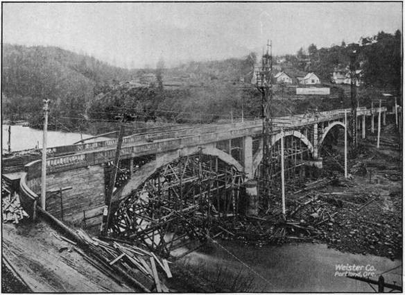
REINFORCED CONCRETE BRIDGE OVER HOOD RIVER, NEARING COMPLETION, ON THE
COLUMBIA RIVER HIGHWAY AT HOOD RIVER CITY. BUILT IN 1918.
The structures paid for out of county funds consist of thirteen reinforced concrete bridges, fourteen wood and steel bridges, and four culverts; the total cost of these structures being $378,343.24.
Of the structures paid for by the counties, the State Highway Department supervised the construction for three reinforced concrete bridges, four steel and wood bridges, and one culvert; the cost of which totaled $288,743.24.
A complete tabulation of the bridges designed and constructed is given in another part of this report, and complete descriptions of the more important structures will be found in the articles devoted to the particular counties in which the structures are located.
The $250,000.00 intercounty bridge across the Willamette River at Salem was completed, and has attracted more than local attention. While the cost of this structure was borne by Marion and Polk Counties the design and construction engineering were handled by this Department.
The reinforced concrete arch bridge at Hood River, the largest concrete bridge yet constructed in this State was designed and built under State supervision, although the County also contributed toward its cost.
Among the proposed bridges of considerable magnitude for which county officials have requested designs from this Department may be mentioned the Deschutes and Oregon City. The former will be located between the present toll bridge and the railroad bridge across the Deschutes River and will thus obviate the necessity of toll payments. It will consist of a series of reinforced concrete arches. The Oregon City bridge will replace the old suspension bridge across the Willamette. Studies are being made and comparisons of various types of bridges and locations of site are being made.
During the war period, both for patriotic and economic reasons the employment of steel bridges was discontinued and wooden truss bridges used instead. Now that the demand for steel for war purposes has subsided, and there are indications of a decline in the price of structural steel in the near future, the resumption of use of that material in the construction of bridges will probably be more general.
ELIMINATION OF GRADE CROSSINGS
The Department is working consistently for the elimination of dangerous grade crossings. No less than ten grade crossings have been done away with as far as through traffic on State Roads is concerned, during the past two years. Most of these eliminations have been brought about by holding roads on the same side of railway tracks instead of crossing over and back. Two of the eliminations, however, were brought about by grade separations; one near Rex in Washington County and another near Ashland in Jackson County, both of these grade separations being undercrossings.
An agreement was also reached whereby a reinforced concrete overhead crossing will be constructed to eliminate a very dangerous grade crossing on the Pacific Highway near Divide, in Lane County. This structure would have been built in 1918, but on account of the requirements of material for war purposes, the United States Highway Council ordered the construction delayed. It will undoubtedly be constructed during the 1919 season.
FEDERAL CO-OPERATION
In 1916, the United States Congress enacted a law making available $85,000,000.00 of Federal Government moneys for co-operation with the several States in the construction and improvement of roads. Of this amount, $75,000,000.00 is appropriated for co-operation on “Post Roads,” roads over which either rural or star post routes are operated, and $10,000,000.00 is appropriated for co-operation on “Forest Roads,” roads within or partly within National Forests.
During the five year period prior to July 1, 1921, there will become available to the State of Oregon from the Government Funds set aside by this Act the following amounts:
For
Post Roads
For
Forest Roads
July 1, 1916, to July 1, 1917
$ 78,687.00
$ 127,794.00
July 1, 1917, to July 1, 1918
157,375.00
127,794.00
July 1, 1918, to July 1, 1919
236,062.00
127,794.00
July 1, 1919, to July 1, 1920
314,749.00
127 794.00
July 1, 1920, to July 1, 1921
393,437.00
127,794.00
Totals
$ 1,180,310.00
$ 638,970.00
Total amount of government funds apportioned to the State of Oregon for co-operative work. $1,819,280.00.
With the funds thus apportioned to the State, the Government will co-operate on approved road projects to not to exceed fifty per cent of their cost. Therefore, the State, or the State co-operating with the Counties, must provide amounts at least equal to the amounts set aside by the Federal Government in order to avail itself of the funds apportioned to it.
In 1917, the State Legislature passed a bill accepting the terms of the Federal Government’s co-operative offer and authorizing the issue of bonds to the amount of $1,819,280.00 to provide the funds necessary to match the Government funds. There is thus available for expenditure on post and forest roads in the State during the five years prior to July 1, 1921, the following amounts:
For Post Road Projects:
Federal Government Funds
$ 1,180,310.00
State Funds
1,180,310.00
$ 2,360,620.00
For Forest Road Projects:
Federal Government Funds
$ 638,970.00
State Funds
638,970.00
1,277,940.00
Total
$ 3,638,560.00
For Post Road Projects the plans are prepared, contracts let and work supervised by the State Highway Department, subject, of course, to approval and acceptance by the Secretary of Agriculture through the Federal Office of Public Roads and Rural Engineering. For Forest Road Projects, the plans are prepared, contracts let and work supervised by the Federal Office of Public Roads and Rural Engineering acting for the Secretary of Agriculture. The State Highway Department is, therefore, directly responsible for the work done on Post Road Projects, whereas on Forest Road Projects the responsibility rests with the Office of Public Roads and Rural Engineering, the State Highway Department simply approving the projects and auditing the claims presented by the Federal Government against the State’s share of the funds.
It is the policy of the Highway Department to match the Government Funds with equal amounts from State Funds only, any County Funds which may be available being used to increase the total amounts available rather than to reduce the amount of State co-operation. On projects approved to November 30, 1918, the amount of these additional funds provided by counties is approximately $325,000.00.
POST ROAD PROJECTS
Up to November 30, 1918, fifteen Post Road Projects had been submitted to the Office of Public Roads for approval. Of these fifteen projects nine have received approval, three have been rejected as not complying with the government requirements as regards rural and star route mail service over them, and three are pending action by the Secretary of Agriculture. The rejected projects were the Wolf Creek-Grave Creek project in Josephine county, the Canyonville-Galesville project in Douglas County, and the Myrtle Creek-Dillard project also in Douglas County. The first and third of these projects have since been constructed without government co-operation, and the second is under construction as a “Forest Road.”
Construction is now under way on two Post Road Projects both of which are in Union County. These are the Elgin-Minam project, estimated to cost $41,151.00, and the Union-Telocaset project, estimated to cost $30,000.00. The contracts for the construction of both jobs were let on July 9, 1918, to Union County, represented by the County Court, the lowest bidder. Subsequent to the letting, however, the Attorney General gave the opinion that the County Court had no legal authority to enter into a contract of this nature, and in order to facilitate matters and prevent delay in construction the State Highway Commission on September 10, 1918, agreed to take the work over at the prices bid by the County, the County agreeing to reimburse the State in case the cost of the work exceeded the bid prices.
The total estimated cost of all projects agreed upon to date is $1,409,993.24 of which $627,496.62 is to be paid by the Federal Government, $627,496.62 by the State, and $155,000.00 by the Counties interested. On page 24 is given a tabulation of the Post Road Projects approved, giving the estimated cost of each project with the respective amounts to be paid by the State, the Federal Government and the Counties.
FOREST ROAD PROJECTS
The Federal authorities and the State Highway Commission have to date agreed upon co-operation on fourteen Forest Road Projects. The total estimated cost of these fourteen projects is $1,246,204.65; $538,231.78 to be provided by the Government, $538,231.78 by the State, and $169,741.09 by the Counties.
Construction is already under way on three of the Forest Projects, namely: the Canyonville-Galesville section of the Pacific Highway in Douglas County, the Three Rivers Project in Tillamook County, and the Ochoco Canyon Project in Crook County.
POST ROAD PROJECTS
PROJECTS AGREED UPON TO NOVEMBER 30, 1918
Projects
Project
Number
Miles and Kind of Work
Total Cost
Funds Provided
By
Government
By State
By Counties
Baker County:
Baker-Middle Bridge Section
10
17.0
miles—grading
$ 71,235.45
$ 28,117.73
$ 28,117.72
$ 15,000.00
Sag Section of Baker-Cornucopia
Road
9
4.9
miles—grading and gravel
41,926.00
17,963.00
17,963.00
6,000.00
Canyon Section of Baker-
Cornucopia Road
11
4.5
miles—grading
22,498.00
8,249.00
8,249.00
6,000.00
Grant County:
John Day to Fiske Creek Section
13
7.2
miles—grading and gravel
143,817.14
71,908.57
71,908.57
...
Hall Hill to Prairie City Section
14
2.2
miles—grading and gravel
43,282.47
21,641.23
21,641.24
...
Harney County:
Burns-Crane Project
15
6.0
miles—grading and gravel
48,000.00
20,000.00
20,000.00
8,000.00
Malheur County:
Project to be selected
100,000.00
40,000.00
40,000.00
20,000.00
Marion County:
Salem-Aurora Project
7
18.0
miles—grading
347,232.60
173,616.30
173,616.30
...
Union County:
Elgin-Minam Project
5
9.3
miles—grading
41,151.00
20,575.50
20,575.50
...
Union-Telocaset Project
8
6.0
miles—grading
30,000.00
15,000.00
15,000.00
...
Wasco County:
The Dalles-Three Mile Creek
Project
...
2.0
miles—paving
44,000.00
20,000.00
20,000.00
4,000.00
Wheeler County:
Fossil-Sarvice Creek Project
4
9.5
miles—grading
36,733.40
18,366.70
18,366.70
...
Wheeler and Grant Counties:
Sarvice Creek-Valades Ranch
Project
6
48.5
miles—grading
400,433.80
157,216.90
157,216.90
86,000.00
Yamhill County:
Grande Ronde Project
12
2.8
miles—grading and gravel
39,683.38
14,841.691
4,841.69
10,000.00
Total estimated cost of all Projects
$ 1,409,993.24
Federal Government Funds
$ 627,496.62
State Funds
$ 627,496.62
County Funds
$ 155,000.00
The Canyonville-Galesville section is what is generally known as Cow Creek Canyon, one of the worst stretches on the Pacific Highway. This section is 9.7 miles in length, and is to be graded sixteen feet wide; the estimated total cost being $211,000.00. The work is under contract to John Hampshire & Co., of Grants Pass.
The Three Rivers Project is 10.35 miles in length and lies between Hebo and Dolph on the Portland-Tillamook Highway in Tillamook County. The County of Tillamook, represented by its County Court was the low bidder on this work, but before the contract was entered into, the Attorney General ruled that the County Court had no authority to contract work of this kind. The State Highway Department having available the necessary equipment and desiring to get this important piece of road work under way, agreed with the Federal Government to take the work over at the prices bid by Tillamook County.
A tabulation of Forest Road Projects approved to date and giving the estimated cost and amounts of County, State and Government Funds is given below.
FOREST ROAD PROJECTS
PROJECTS APPROVED TO NOVEMBER 30, 1918
Projects
Estimated
Total
Cost
Funds Provided
By
Government
By State
By County
Clackamas County:
Zigzag Section of Mt.
Hood Road
$ 48,000.00
$ 24,000.00
$ 24,000.00
...
Crook County:
Ochoco Canyon Project
52,500.00
17,500.00
17,500.00
17,500.00
Curry County:
Curry-Coos Project
110,000.00
55,000.00
55,000.00
...
Deschutes-Lane Counties:
McKenzie Pass Project
190,455.00
82,078.00
82,078.00
26,299.00
Douglas County:
Canyonville-Galesville
211,000.00
94,000.00
94,000.00
23,000.00
Tiller Trail Project
123,603.00
48,439.00
48,439.00
26,725.00
Lake County:
Lapine-Lakeview Project
79,419.00
39,709.50
39,709.50
...
Jackson County:
Medford-Crater Lake
Project
72,372.00
34,436.00
34,436.00
3,500.00
Josephine County:
Grants Pass-Crescent
City Project
31,476.00
15,738.00
15,738.00
...
Klamath County:
Anna Creek Section of
Crater Lake Road
6,780.40
3,390.20
3,390.20
...
Lane County:
Eugene-Florence Project
123,951.25
41,317.08
41.317.08
41,317.09
Tillamook County:
Three Rivers Project
122,000.00
50,250.00
50,250.00
21,500.00
Wallowa County:
Flora-Enterprise Project
29,648.00
12,324.00
12,324.00
5,000.00
Wheeler County:
Ochoco Canyon Project
45,000.00
20,050.00
20,050.00
4,900.00
Total estimated cost
of all Projects
$ 1,246,204.65
Federal Govt. Funds
$ 538,231.78
State Funds
$ 538,231.78
County Funds
$ 169,741.09
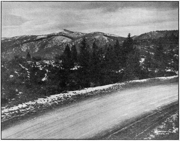
MOUNT ASHLAND FROM THE PACIFIC HIGHWAY IN JACKSON COUNTY.
ELEVATION OF HIGHWAY 4,480 FEET
THE PACIFIC HIGHWAY
The Pacific Highway running from Portland, through Oregon City, Salem, Albany, Eugene, Roseburg, Grants Pass, Medford and Ashland to the California line, is probably the most important through highway in the State. Along it are situated nine of the most important cities of the State. It traverses the immensely productive valleys of the Willamette, the Umpqua and the Rogue Rivers. It is the intercommunicating road for nine of the thirty-five counties of the State, and passes through the county seats of all but one of the nine. It is the only continuous and direct road along the Pacific Coast west of the Cascade Mountains, and connecting as it does the metropoli of the three Pacific Coast States it is the most important interstate highway in the West. From the standpoint of the tourist, Oregon would not be on the map if it had no Pacific Highway. It is the road that makes Oregon accessible to tourists from other states.
Being the most important highway in the State, the Pacific Highway should be the best highway in the State. To make it the best and at the same time to bring it up to the standard of the same highway in the adjacent states of Washington and California is one of the ends toward which the Highway Commission has been working during the past two years. During that time 53.3 miles of the very worst stretches of this highway have been newly graded to trunk highway standards. This grading has eliminated practically all of those heavy and dangerous grades which have made Oregon notorious for bad roads and which have kept thousands of auto tourists from visiting the State. In addition to grading 53.3 miles on the Pacific Highway, the Highway Commission has put down 8.3 miles of pavement and 14.5 miles of macadam, the total cost of all of these improvements being $971,000.00. As a part of the 1919 program, the Highway Commission has already appropriated for the improvement of the Pacific Highway the sum of $1,147,000.00, with which it is planned to build 46 miles of pavement and 38 miles of macadam surface.
The particular sections of the Pacific Highway constructed during 1917 and 1918, together with their mileages and total costs are given below. All of these sections are completed with the exception of the Canyonville-Galesville Forest Road Project which is well under way.
Sections
Miles
Total Cost
Grading (including bridges)—
Oregon City to New Era
4.0
$ 75,000.00
Divide to Leona
7.0
50,000.00
Yoncalla to Oakland
10.8
101,100.00
Myrtle Creek to Dillard
12.8
165,500.00
Canyonville to Galesville
9.7
211,000.00
Wolf Creek to Grave Creek
4.9
68,300.00
Grants Pass to Jackson County Line
3.3
13,000.00
Ashland Undercrossing
.8
9,800.00
Macadam—
Cottage Grove to Divide
1.0
6,100.00
Divide to Leona
7.0
64,000.00
Siskiyou to California Line
6.5
56,300.00
Paving—
Oregon City to Canby
7.5
135,000.00
Ashland Hill Section
.8
15,900.00
Total cost of improvements completed and under
way on Pacific Highway, 1917-1918
...
$ 971,000.00
THE COLUMBIA RIVER HIGHWAY
The Columbia River Highway is second only to the Pacific Highway as a commercial necessity in the state of Oregon; furthermore, the Columbia River Highway is the only connecting link between Eastern and Western Oregon that can be kept open for vehicular traffic throughout the entire year.
From a scenic standpoint, the Columbia River Highway has now become world famous, not only because of its wonderful natural advantages of location, but because of the high standard of construction. A large part of this combined commercial and scenic road is now open to traffic and the coming year will see the elimination of the last almost impassable barrier—the summit between Hood River and Mosier, a piece of construction 5.8 miles in length which will cost approximately $350,000 for the grading alone.
The Columbia River Highway parallels the Columbia River from the Pacific Ocean to Umatilla, a distance of 320 miles, thence southeast an additional 40 miles to Pendleton, where it connects with the Old Oregon Trail. The Old Oregon Trail continues southeast for a distance of 190 miles, crossing the Idaho-Oregon line at Huntington; making a continuous highway 550 miles in length.
At this date, the grading of the Columbia River Highway is practically complete from Astoria to Hood River, a total distance of 174 miles, and the greater part of it is now either paved or macadamized.
The cost of work completed on the Columbia River Highway between Astoria and Portland during the period covered by this report, after all payments are made will be approximately $866,000.00, of which amount $832,078.35 has been expended to date. The work accomplished consists of 9.4 miles of grading, 51.6 miles of macadamizing, 6 miles of paving, 15 reinforced concrete bridges and one covered wood draw bridge.
On the upper Columbia River Highway between Hood River and Cascade Locks, 14.2 miles have been graded, 18 miles gravelled, and a number of reinforced concrete bridges built, among which is the Hood River bridge at Hood River, costing $48,000.00. The total cost of the work completed between Hood River and Cascade Locks will amount to $466,000.00.
The sections improved during this period, with their mileages and costs are as follows:
Sections
Miles
Total Cost
Grading—
Cascade Locks to Hood River
14.2
$ 355,000.00
Goble to Clatskanie
8.2
78,500.00
Astoria to Svensen
1.2
15,000.00
Bridges—
Hood River Bridge
...
48,000.00
Beaver Valley Bridges
...
32,000.00
John Day River Bridge
...
25,000.00
Other Bridges
...
31,000.00
Paving—
Astoria to Svensen
3.5
65,000.00
Scappoose to Multnomah County Line
2.5
37,500.00
Macadamizing—
Astoria to Svensen
5.5
30,000.00
Svensen to Columbia County Line
18.9
215,000.00
Clatsop County Line to Goble
27.2
335,000.00
Cascade Locks to Hood River
18.0
65,000.00
Total Expenditures 1917 and 1918
...
$1,332,000.00
During 1919, work will be undertaken on the Columbia River Highway to the amount of $1,400,000.00, comprising 10 miles of pavement, 85 miles of gravel macadam and 80 miles of grading. This work when completed will provide a surfaced highway between Astoria and Pendleton.
COUNTY WORK SUPERVISED BY THE HIGHWAY DEPARTMENT
That the Counties of the State have confidence in the Highway Department and recognize the ability of the Department to get results is evidenced by the fact that $709,724.79 of county funds have been voluntarily turned over to the Department during 1917 and 1918 to be expended under its supervision.
This, $709,724.79, is the actual amount of money paid out by Counties on vouchers audited and approved by the Department. In addition to this a large amount of work has been done by Counties under the supervision of the Department, for which payment was made direct by the Counties without being audited by the Highway Department. No record of the total amount thus expended is available, but it is estimated to be about $200,000.00. No part of this amount is included in any of the tabulations of expenditures given in this report. The cost of engineering and supervision of work handled in this manner, has been paid by the Highway Department and is included in Table VI of the Financial Report as “Engineering County Construction.”
For co-operation on Post and Forest Road Projects, a total of $325,000.00 of County Funds have already been pledged. Of this amount $155,000.00 will be expended under State supervision, and $170,000.00 under Federal Government supervision.
CONSTRUCTION WORK BY STATE FORCES
While the major part of the work supervised by the State Highway Department is handled under the contract system, it has been found to be good business for the Department to go into competition with contractors and where satisfactory bids are not received to proceed to handle the work with State forces.
During 1917 and 1918, the Department handled in this manner the construction of 45.5 miles of macadam surfacing, 3.0 miles of concrete paving, and 27.3 miles of grading.
Although war conditions prevailed during the past year and every possible obstacle had to be surmounted, the work done with State forces made a creditable showing when compared with cost plus and contract jobs. Especially is this true of paving work where a comparison of costs with bid prices show a very substantial saving to the State, as illustrated by the following table:
Length
in
Miles
Preliminary
Estimate
of Cost
Cost
Based on
Lowest Bid
Price
Actual Cost
With State
Forces
Saving to
State
Sheridan Paving
2.2
$ 42,535.50
$ 52,438.00
$ 40,065.61
$ 12,372.39
Ashland Hill Paving
.8
16,962.00
19,858.66
15,908.03
3,950.63
Total
3.0
$ 59,497.50
$ 72,296.66
$ 55,973.64
$ 16,323.02
Highway construction by the State Highway Department with its own forces has its limitation, however, in spite of the fact that it is often possible to do work at less cost than by contract. The Oregon State Highway Department is by law and of necessity an engineering organization and, in order to have the best success in handling construction work, it is necessary to have a distinct organization.
In the hiring of men for handling such construction, it is necessary for the State to compete with contractors for the higher priced and more experienced men, and the contractor is often in a position to offer more salary than the State. Furthermore, it is necessary for the State to carry large quantities of expensive equipment which is idle at least a part of the year, and, in fact, the amount of equipment necessary to handle all of the State work by force account would represent too large a portion of the year’s available money for road work.
In handling its construction work direct, however, the Department has the advantage of not being required to make a profit on the work, neither has it to pay interest on the necessary moneys to carry payrolls and other incidentals, neither is there any loss in retained percentage. The State does not have to carry a construction bond and, in fact, there are many reasons why a state should handle its construction direct, cheaper than by contract.
There is much to be said on both sides of the question, but the Department at this time does not believe that it is justified in attempting to handle all of the State work, believing that only under certain conditions where the State does not receive reasonable bids the work should be handled direct.
The State Highway Department has many large construction jobs under contract at one time, and it is obvious, even to the layman, that an organization to handle all of this work with State forces is impossible under the present laws of the State of Oregon, and the Department recommends that force account be limited to such cases as are mentioned above and work for which the quantities and cost can not be closely estimated in advance of construction, such as maintenance work and light grading.
STATE HIGHWAY FUNDS
The funds at the disposal of the Highway Department are divided as follows:
The State Highway Fund provides for one-quarter mill tax on the assessed valuation of the State. This fund amounted to $219,690.98 in 1917; $232,151.39 in 1918 and in 1919 will equal $246,883.47. The money available in this fund provides a sufficient sum for the salaries and expenses of the State Highway Department, and the cost of maintaining State highways which have been constructed or improved. It is provided also, that with the proceeds of this fund, the Commission may enter into co-operative agreements with any County for the survey, construction, improvement or maintenance of any State highway upon such basis or contribution as may be agreed upon. The Bridge Department is maintained out of this fund and furnishes designs for structures desired by the counties.
The Automobile License Fund. Under the provision of Section 12, Chapter 423, Laws of 1917, the Secretary of State is directed to transfer to an account under the jurisdiction of the State Highway Commission, the receipts from the automobile license fees, less the cost of administration. The law provides that these funds be transferred on April 1 and October 1 of each year. The 1918 receipts from this fund were $425,000.00 and with the rapid increase of the number of automobiles, it is expected that this amount will be increased from year to year. The fund provides for the payment of principal and interest, as the same shall become due, on the bonded indebtedness of the State of Oregon, contracted for road purposes under the provisions of the Six Million Dollar Bonding Act and the State and Federal Road Bonding Act. The unexpended balance may be expended on such State highway projects as the Commission approves.
This fund is also used for co-operative work in counties where the Six Million Dollar Fund may not be used and on State Highways not eligible for improvement under the Post and Forest Road Acts.
The Six Million Dollar Road Bond Fund provides for the issuance of six million dollars in bonds during the next five years. It provides for the sale of one million dollars in bonds in 1917; two million dollars in 1918, and the balance as the Commission may think advisable. The primary purpose of this act was to provide paving on the main highways of the State, contingent upon the counties preparing the road bed according to the plans of the State Highway Engineer.
It also provides funds for the grading of the road bed on the Columbia River Highway in Clatsop, Columbia and Hood River Counties and on the Pacific Highway in Jackson County.
At this date a total of $2,190,000 par value of bonds have been sold.
State and Federal Co-operative Road Bonds. Under the Federal Aid Road Act there is provided for expenditure by the Federal Government during the next five years, $1,180,310.85 for the construction of Post Roads in the State of Oregon and there is also available during the same period the sum of $638,970.00 for the construction of highways within or partly within the National Forests of the State. The purpose of this Act is to meet Federal Aid in an equal amount and under this provision a total of $1,819,280.85 in bonds is authorized to be issued by the Board of Control and placed in a special fund to be used in carrying out the provisions of this Act. A total of $400,000.00 par value of these bonds have been sold.
EQUIPMENT
The State Highway Department owns construction and hauling equipment to the approximate value of $100,000.00. This equipment is too varied and extensive to be shown in detail in this report. However, it includes six heavy auto trucks, two light auto trucks, twenty-two touring cars, three concrete mixers, two gasoline locomotives, three road rollers, one Brown hoist, one asphalt paving plant, three rock crushers and an extensive supply of camp equipment, small tools, drills, steel, pipe, etc.
Most of this equipment is in fine working condition and adaptable to general highway work and has been used during the past year. However, we have on hand a certain amount of machinery which was bought for special purposes in former years, and while it has no doubt made a saving sufficient to justify its original cost, the Department has no more use for it and it would be advantageous to the Department if this equipment could be disposed of and the money invested in more necessary machinery. Under present conditions, the State law makes it necessary to return any money from the sale of materials, supplies or equipment into the General Fund of the State, and it is impossible to get this money back into highway funds without a special act of the Legislature. Despite this fact, however, some equipment was disposed of during the past year and the money turned into the General Fund.
If the State Highway Department is to proceed with any considerable amount of work with State forces, it will be necessary to purchase some additional equipment so that the work may be prosecuted more economically, especially is this true of concrete bridge work and general maintenance work. These are special types of work and special types of equipment are necessary to handle them properly.
During the past year a great amount of equipment has been rented from private contractors and in case of short jobs and on special types of work, this is economical, but on long jobs, it is much more economical to purchase the necessary machinery as the amount paid out in rentals for a period of six or eight months is a considerable portion of the purchase price.
During the past season a warehouse was built by the Department for the purpose of housing construction equipment. This warehouse is located on State property near the Penitentiary. It is 40 by 80 feet in size and has railroad facilities.
All idle equipment and left over material is shipped to Salem, for storage, at the close of the season. There the equipment is overhauled, repaired, repainted, and placed in readiness for the next season’s work. The warehouse was built by the Department with day labor.
It will probably be advisable during the coming year to erect two more units to the warehouse to take care of a larger amount of equipment and provide for repair shop and garage.
A garage was rented at 660 North Capitol Street, Salem, and an efficient automobile mechanic was placed in charge. By this means the automobiles of the Department are kept in good repair, oiled and tires vulcanized. Facilities are provided also for overhauling and repainting, which effects a considerable saving.
OFFICE ORGANIZATION
The work handled in the offices of the State Highway Department is of four classes, each requiring specialized training, and, in a way, of little or no relation to each other. For this reason, the office organization consists of four different offices or departments: the General Office, the Auditing Department, the Office Engineering Department and the Bridge Department. The work of these departments is outlined in the following paragraphs.
General Office.—All business of the Highway Commission and all business of the Department with the public is transacted through the General Office. Under the direction of the Secretary of the Commission and the First Assistant Engineer, this office handles all correspondence, the issuance of bonds, the execution of contracts, the purchase of supplies and equipment, and all general office detail.
The seal of the State Highway Commission and the minutes of the Commission meetings are in the custody of the Secretary. All mail is received and distributed through the Secretary’s office, and in it filed all correspondence, legal documents, etc. This office also keeps a record of all State equipment and takes care of the charging out of rental and depreciation on same.
The purchase of office, engineering and construction supplies and equipment is handled by this department and a considerable saving is realized by buying in quantities. On all stock supplies, each job is charged with the amount furnished and similarly rental on our own engineering instruments and automobiles is charged, so that the cost of each job may be determined. On construction projects which are furnished with our own trucks, road rollers, etc., each piece of equipment is rented out to the job in the same manner. A record is kept of the rental charged on each piece of equipment so that its value can be determined at any time.
Auditing Department.—This department, working under the supervision of the Auditor, handles all claims against the Commission, verifies each one, prepares the vouchers to cover, sends them out to claimants to be certified, and mails out the warrants when received from the Secretary of State. All vouchers drawn from the counties for co-operative work or projects over which the Commission has supervision, are also audited in this department. In 1917 there were 1,782 State vouchers passed, aggregating a total of $682,321.98; in 1918, 3,371 were passed, aggregating $2,205,935.70. In 1917 there were 544 County vouchers totaling $270,162.37, and in 1918, 410 vouchers totaling $439,562.79. A total of all such vouchers for the biennium aggregating $3,597,982.84.
Employes of the Commission are paid by payroll warrants drawn in favor of the State Highway Engineer and bank checks issued against the same. The total number of paychecks issued in 1917 was 2,771, and in 1918 there was a total of 7,350.
It will be noted that in the past two years the Commission has done considerable work by day labor and the above statement includes all direct employes. It is desirable to expedite payment of labor claims, especially to men who quit on short notice. The present law requires that claims be prepared in voucher form, approved by the Commission for payment and then sent to the Secretary of State for audit. The warrant when received is deposited in a bank and a paycheck issued. It is recommended that a revolving payroll fund be created on which pay checks could be drawn and sent out immediately as requested. These could later be listed and the payroll voucher prepared in the usual manner in favor of the State Highway Engineer. The warrant when received, to be refunded to the payroll fund which would be kept intact. The State Highway Engineer should furnish a payroll bond to cover. This fund could also be used for emergency claims to take advantage of trade discounts and permit the payment of small claims which it is desired to pay promptly.
In the numerous cases in which the Commission has taken over the work to do with its own forces, the necessary bookkeeping and detail records for handling material, supplies and labor payrolls have been carried by this office. On several force account jobs each invoice and payroll of the contractor has been carefully checked and verified before being paid.
The record of both State and County funds have been audited by reputable certified public accountants and found correct.
Mr. G. Ed Ross served in the capacity of Auditor until his resignation in July, 1918, when his duties were taken over by Roy A. Klein, Assistant Engineer.
Office Engineering Department.—In the Office Engineering Department are handled the numerous office details in connection with the engineering work of the Department. The more important of these duties are the working up of maps, profiles, specifications and estimates for new projects; the checking of monthly and final estimates for payments on contract work; the filing of engineering records of all kinds; the keeping of cost distribution and the compilation of reports, statistics and other data.
During the past year this department, in addition to its other work, prepared and had published a road map of the State of Oregon. This map shows all of the main traveled roads of the State and is believed to be the most authentic as well as the most complete road map of Oregon yet published. A small reproduction of the map is contained in this report. Single copies of a larger size, 13 by 22 inches will be supplied upon application.
Bridge Department.—The Bridge Department prepares designs, plans, specifications and estimates for all bridges and similar structures. The inspection and the supervision of construction of bridges is also in charge of this department.
The laws of the State require that bridge designs be prepared for counties by the Highway Department, upon the request of County Courts. Twelve counties have taken advantage of this law during the past two years and have called upon the Department for designs for a total of thirty-four bridges and six culverts, and of these structures twenty-seven bridges and four culverts have been built.
A total of ninety-five bridges and fifteen culverts were designed by the Bridge Department, of which fifty-nine bridges and eleven culverts have been constructed.
COST KEEPING
The keeping of an accurate segregation of expenditures and a detailed distribution of costs for an organization handling the amount of work and the character of work handled by the Highway Department is a matter of the greatest importance. The Highway Department seldom has under way less than eighty or ninety separate and distinct jobs. These jobs are scattered all over the State, and few of them are of sufficient size to warrant the employment of timekeepers on the jobs to keep exact records of expenditures and costs. The records for all of these jobs must be kept in the main office where it is impossible for those keeping the records to be personally familiar with the details of the numerous expenditures made on each of the many jobs.
To secure proper records of expenditures, therefore, a system of cost keeping must be used which requires little attention from the engineers and superintendents in charge of the various jobs, and at the same time gives sufficient information to those keeping the records in the main office to enable them to segregate all expenditures so that detailed information as regards total expenditures, monthly expenditures, expenditures from different funds, expenditures for different purposes, unit costs, etc., are readily available at any time, and in such form that all jobs may be combined to give total expenditures of various kinds, so that the Department is always Informed as to the financial status of each job and of all jobs.
The system of cost keeping now in use by the Department has been evolved from a number of other systems in use on work of a similar nature, and is a system specially devised to meet the requirements of the Department. For every cent expended by the Highway Department or under its supervision, there appears in the cost records, entries which give at a glance the name of the County in which the expenditure is incurred, the name of the particular job, whether it is an engineering cost or a construction cost, the particular part of the work involved, the fund from which it is paid, and a reference to the original invoice or statement upon which the payment is made. These records are so arranged and so summarized each month that almost any desired combination of costs is available, such as the totals for each county, for each job, for each fund, for engineering, for construction, for surveys, for administration, for construction engineering, etc.
The expenditure tabulations given in various parts of this report, and especially those in the part devoted to the Financial Report, give a good idea of the results being obtained with the system in use although they do not give the detail which is readily available in the records themselves.
EMPLOYES IN THE UNITED STATES ARMY SERVICE
The State Highway Department is very proud of its representation in the Army Service and in recognition of the patriotism of those employes who have gone to the Front, the Department has maintained a Service Flag upon which there are now sixty stars. The men represented by these stars are listed on the following Roll of Honor:
HONOR ROLL
Name and Company
Former Position
with Department
Abbott, Charles H., 23d Engineers
Inspector
Brown, Merle, Batt. F, 5th Field Artillery
Chainman
Chittick, Ernest
Chainman
Chrisman, William
Chainman
Coats, Solomon
Chainman
Conway, M. A., Navy
Timekeeper
Cook, Harold, Private, S. A. T. C., Willamette University
Blueprinter
Cooley, Lorrin D., Company Mechanic, 11th Co., Coast Artillery
Chainman
Cowgill, W. C. Jr., 1st Provisional Co., 32d Engineers
Resident Engineer
Cutler, Oscar, 472d Engineer Reg.
Locating Engineer
Glass, D. G., 2d Lieut., Co. D, 42d Engineers
Locating Engineer
Grabenhorst, Eugene B., Private, Co. P, 5th Bn., 22d Engineers
Instrumentman
Green, E. R., Private, Co. A, 23d Engineers
Resident Engineer
Greenwood, P. S.
Transitman
Grey, Ulric R., Camp 4-C, Spruce Squadron
Instrumentman
Hale, E. E.
Chainman
Harris, Milton, 2d Lieut.
Transitman
Hodgman, K. E., Captain, Spruce Division, Signal Corps
Resident Engineer
Hyatt, Waldron, 22d Co., 1st Regiment, U. S. Marine Corps
Instrumentman
Ingels, Hollis G., H. Q. Co., 62d Inf.
Levelman
Ingram, R. C., Corporal, Co. L, 23d Engineers
Draftsman
Isakson, C. O., 1st Lieut., 12th Engineers
Instrumentman
Jones, Melville S., Master Engineer, Co. C, 116th Engineers
Computer
Judd, Henry C., 3d Co., Coast Artillery
Chainman
Junken, Fred S., Navy
Rodman
Kelley, C. C., 1st Lieut., Co. E, 2d Bn., 20th Engineers
District Engineer
Kinsey, Claude, Co. A, 20th Engineers
Instrumentman
Lawrence, Perry, Amb. Co. No. 361
Topographer
Lytle, K. D., Co. C, 43d Engineers
Transitman
McClintock, John, Hospital Unit, Coast Artillery
Chainman
McClintock, Leon, Hospital Unit, Coast Artillery
Rodman
May, Aloys H.
Transit Rodman
Metzger, Floyd S., Co. C. Q. M. Unit No. 305
Timekeeper
Miller, E. V.
Draftsman
Miller, Ralph W. E., Corporal, Co. I, 62d Infantry
Costkeeper
Minton, Joseph, Co. M, 162d Infantry
Rodman
Moe, Forrest L., 9th Co. Coast Artillery
Chainman
Moore, Don H., Co. A, 116th Engineers
Chainman
Moore, Merton, Co. A, 116th Engineers
Chainman
Moore, Royal, Co. C, S. A. T. C., U. of California
Chainman
Morgan, Silas B.
Rodman
Murdock, R. B., 2d Lieut., Co. C, 42d Engineers
District Engineer
Murphy, Thomas, Hospital Corps, 40th Division
Chainman
Noble, Chas. S., Y. M. C. A.
Locating Engineer
Nunn, Roy, Sergeant, H. Q. Co., 166th Depot Brig.
Resident Engineer
Oerding, Chas., Engineers
Chainman
Oerding, Harry, Co. A, 20th Engineers
Chainman
Quine, Ralph, Hospital Unit, Coast Artillery
Chainman
Reiter, C. G., 1st Lieut.
Locating Engineer
Rynning, P. B., Co. H, 23d Engineers
Resident Engineer
Schaffenberg, H.
Chainman
Smith, Frederic W., Co. C, Q. M. Unit No. 305
Timekeeper
Smith, Thos. P.
Stakeman
Stretchberry, Ray, 17th Co., 23d Engineers
Rodman
Sutter, L. R., Co. F, 4th Engineers
Chainman
Tilley, Walker B., Co. K, 18th Railway Engineers
Instrumentman
Welborn, Forrest, Sergeant, 44th Machine Gun Company
Clerk
Wilson, Otis E.
Inspector
Withycombe, Earl, 20th Engineers
Resident Engineer
Vester, Albert
Chainman
SUMMARY
The classification of employes lost to the Department through enlistment in the Army is as follows:
District engineers
2
Timekeepers
3
Locating engineers
4
Inspectors
2
Resident engineers
6
Office clerks
1
Transitmen
9
Blue Printer
1
Draftsmen
2
Rodmen
6
Levelmen
1
Chainmen
20
Computers
2
——
Topographers
1
Total number
60
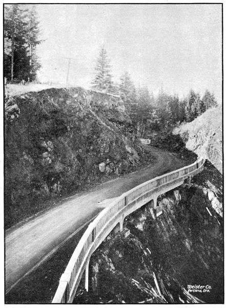
REINFORCED CONCRETE HALF VIADUCT ON THE COLUMBIA RIVER
HIGHWAY BETWEEN GOBLE AND RAINIER IN COLUMBIA COUNTY,
CONSTRUCTED IN 1918
Financial Report Fund Allotments and Expenditures During the Fiscal Period
December 1, 1916, to November 30, 1918
Grand Total of Funds Allotted
$ 4,271,515.16
Grand Total of Expenditures
3,597,982.47
Balance on hand December 1st, 1918
$ 673,532.69
The details of fund allotments and expenditures are set forth in tables as follows:
Table I.Fund Allotments from all sources.
Table II.Summary of Fund Allotments and Fund Expenditures.
Table III.Expenditures Segregated by Counties.
Table IV.Expenditures Segregated under the Headings of General Administrative, Surveys,
Construction Engineering, Construction, Equipment and Unclassified.
Table V.Expenditures for Construction Detailed by Jobs.
Table VI.Expenditures for Surveys Detailed by Jobs.
Table VII.Expenditures for Equipment, Bond Interest and Overhead.
Table VIII.Summary of County Funds Expended by Department.
TABLE I
FUND ALLOTMENTS FROM ALL SOURCES—DECEMBER 1ST, 1916, TO NOVEMBER 30TH, 1918
One-Quarter Mill Tax Fund
—
Balance on hand Dec. 1, 1916
$ 94,418.14
Turnover January 1, 1917
219,690.98
Turnover January 1, 1918
232,151.39
Total
$ 546,260.51
Automobile License Fund
—
Turnover October 1, 1917
$ 150,000.00
Turnover April 1, 1918
300,000.00
Turnover October 1, 1918
125,000.00
Total
$ 575,000.00
Six Million Dollar Bond Fund
—
Bond Sale, August 7, 1917
$ 471,300.00
Accrued Interest
2,333.33
Bond Sale, September 12, 1917
472,130.00
Accrued Interest
1,833.33
Bond Sale, March 15, 1918
455,850.00
Accrued Interest
222.22
Bond Sale, July 9, 1918
643,770.00
Accrued Interest
2,606.54
Total
$ 2,050,045.42
State and Federal Co-operative Bond Fund
—
Bond Sale, August 18, 1917
$ 388,040.00
Accrued Interest
2,844.44
Less expenditures by Board of Control
400.00
Total
$ 390,484.44
County Funds
—
Payments on Vouchers drawn by Department
709,724.79
Grand Total Funds Allotted to Highway Department, December 1,
1916 to November 30, 1918
$ 4,271,515.16
(For description of the several funds provided for the work of the Highway Department see pages 30 and 31.)
TABLE II
SUMMARY OF FUND ALLOTMENTS AND FUND EXPENDITURES— DECEMBER 1ST, 1916, TO NOVEMBER 30TH, 1918
Funds
Allotments
Expendi-
tures
Balance
December 1,
1918
One Quarter Mill Tax Fund
$ 546,260.51
$ 528,789.99
$ 17,470.52
Automobile License Fund
575,000.00
281,902.67
293,097.33
Six Million Dollar Bond Fund
2,050,045.42
2,049,025.47
1,019.95
State and Federal Co-operative Bond
Fund
390,484.44
28,539.55
361,944.89
Total State Funds
$ 3,561,790.37
$ 2,888,257.68
$ 673,532.69
County Funds
709,724.79
709,724.79
...
Grand Total
$ 4,271,515.16
$ 3,597,982.47
$ 673,532.69
TABLE III
EXPENDITURES SEGREGATED BY COUNTIES (INCLUDING COUNTY FUNDS EXPENDED UNDER STATE SUPERVISION)—DECEMBER 1ST, 1916, TO NOVEMBER 30TH, 1918
County
State
Funds
County
Funds
Total
Baker
$ 7,578.68
...
$ 7,578.68
Benton
47.56
$ 479.20
526.76
Clackamas
155,861.10
43,091.14
198,952.24
Clatsop
344,387.23
...
344,387.23
Columbia
488,302.15
...
488,302.15
Coos
16,967.68
170,781.83
187,749.51
Crook
3,053.72
...
3,053.72
Curry
5,629.24
...
5,629.24
Deschutes
20,716.37
...
20,716.37
Douglas
159,769.58
173,550.18
333,320.76
Gilliam
35,999.48
...
35,999.48
Grant
7,468.78
291.10
7,759.88
Harney
1,873.45
...
1,873.45
Hood River
433,928.22
3,968.49
437,896.71
Jackson
86,619.88
...
86,619.88
Josephine
77,998.14
...
77,998.14
Klamath
819.23
...
819.23
Lake
15,391.67
...
15,391.67
Lane
14,529.52
...
14,529.52
Lincoln
2,997.47
...
2,997.47
Linn
791.07
5.00
796.07
Malheur
866.65
...
866.65
Marion
5,083.59
223,794.99
228,878.58
Morrow
10,863.10
1,009.44
11,872.54
Polk
802.92
17,200.70
18,008.62
Sherman
3,052.14
...
3,052.14
Tillamook
68,274.29
26,009.84
94,284.13
Umatilla
173,942.50
3,542.75
177,485.25
Union
32,188.17
78.59
32,266.76
Wallowa
765.07
...
765.07
Wasco
4,313.79
19.45
4,333.24
Washington
246,769.05
9,395.00
256,164.05
Wheeler
69,214.78
18,233.60
87,448.38
Yamhill
124,958.84
18,273.49
143,232.33
Total
$ 2,621,825.11
$ 709,724.79
$ 3,331,549.90
TABLE IV
EXPENDITURES SEGREGATED UNDER THE HEADINGS OF GENERAL ADMINISTRATION, SURVEYS, CONSTRUCTION ENGINEERING, CONSTRUCTION, EQUIPMENT AND UNCLASSIFIED.
Classification
Total
State
Funds
County
Funds
General Administration and Supervision
$ 97,621.82
$ 97,621.82
...
Surveys and Engineering County Work
144,086.67
137,954.74
$ 6,131.93
Construction Engineering
127,805.58
127,803.08
2.50
Construction
3,059,657.65
2,356,067.29
703,590.36
Equipment
86,717.55
86,717.55
...
Unclassified (Interest on Bonds, etc.)
82,093.20
82,093.20
...
Grand Total Expenditures
$ 3,597,982.47
$ 2,888,257.68
$ 709,724.79
TABLE V
EXPENDITURES FOR CONSTRUCTION WORK DETAILED BY JOBS—DECEMBER 1ST, 1916, TO NOVEMBER 30TH, 1918
JOBS
TOTALS
STATE FUNDS
COUNTY FUNDS
Construction
Engineering
cost
Included in
preceding
columns
Estimated
total
cost of
job
Expended
to date
State’s
share of
estimated
cost
Expended
from State
funds
to date
County’s
share of
estimated
cost
Expended
from County
funds
to date
Clackamas County:
Paving—Oregon City to Canby
$ 135,000.00
$ 102,114.85
$ 135,000.00
$ 102,114.85
$ ...
$ ...
$ 2,444.57
Grading—Canemah Hill Section
27,500.00
24,037.20
2,500.00
1,944.67
25,000.00
22,092.53
1,944.67
Grading and Rock Crushing—New Era
66,000.00
63,047.79
50,240.09
47,287.88
15,759.91
15,759.91
3,552.82
Grading—Multnomah Co. Line to Oswego
5,746.80
7,746.68
507.98
507.98
5,238.70
5,238.70
507.98
Clatsop County:
Grading and Paving—Astoria to Svensen
236,000.00
96,955.97
236,000.00
96,955.97
...
...
5,906.19
Macadamizing—Svensen to Columbia Co. Line
216,000.00
210,079.16
216,000.00
210,079.16
...
...
4,443.18
John Day River Bridge east of Astoria
25,000.00
21,051.52
25,000.00
21,051.52
...
...
734.91
Plympton Creek Bridge at Westport
6,413.19
6,413.19
6,413.19
6,413.19
...
...
255.08
Big Creek Bridge near Knappa
8,446.70
8,446.70
8,446.70
8,446.70
...
...
140.99
Little Creek Culvert near Knappa
929.69
929.60
929.69
929.69
...
...
37.02
Miscellaneous charges on work prior to 1917
247.94
247.94
247.94
247.94
...
...
25.00
Columbia County:
Paving—Multnomah Co. Line to Scappoose
37,652.59
37,652.59
37,652.59
37,652.59
...
...
1,364.28
Macadam—Clatsop Co. Line to Clatskanie
121,000.00
118,922.90
121,000.00
118,922.90
...
...
554.62
Macadam—Clatskanie to Delena
142,000.00
136,560.40
142,000.00
136,560.40
...
...
5,998.96
Macadam—Delena to Goble
49,955.08
49,955.08
49,955.08
49,955.08
...
...
2,902.35
Macadam—Goble Section
23,000.00
21,478.97
23,000.00
21,478.97
...
...
548.12
Grading—Goble Section
46,262.64
46,262.64
46,262.64
46,262.64
...
...
2,925.64
Grading—Rainier Hill Section
6,350.61
6,350.61
6,350.61
6,350.61
...
...
468.88
Grading—Beaver Valley Section
20,978.22
20,978.22
20,978.22
20,978.22
...
...
...
Grading—Deer Island Section
2,398.10
2,398.10
2,398.10
2,398.10
...
...
163.30
Concrete Viaduct, Cribbing and Masonry Wall,
near Prescott
9,039.86
9,039.86
9,039.86
9,039.86
...
...
580.53
Beaver Valley Bridges
32,000.00
29,808.58
32,000.00
29,808.58
...
...
922.54
Scappoose Culvert
1,834.60
1,834.60
1,834.60
1,834.60
...
...
...
Goble Creek Bridge near Goble
5,907.14
5,907.14
5,907.14
5,907.14
...
...
77.47
Graham Creek Culvert near Clatskanie
804.49
804.49
804.49
804.49
...
...
31.98
Coos County:
Coast Highway and Myrtle Point-Coquille Road
180,235.18
180,235.18
9,453.35
9,453.35
170,781.83
170,781.83
14,612.33
Crook County:
Ochoco Canyon Forest Road Project
52,500.00
3,053.72
17,500.00
3,053.72
17,500.00
...
...
(Federal Government cooperates on this project
to the amount of $17,500.00)
Deschutes County
Cinder Macadam—Bend to LaPine
20,183.60
20,183.60
20,183.60
20,183.60
...
...
...
Douglas County:
Grading—Divide to Comstock
19,146.74
19,146.74
2,027.30
2,027.30
17,119.44
17,119.44
2,029.80
Grading and Macadam—Comstock to Leona
80,000.00
79,092.87
5,650.28
4,743.15
74,349.72
74,349.72
4,766.13
Grading—Oakland to Yoncalla
101,096.12
101,096.12
17,565.28
19,015.10
83,530.84
82,081.02
5,864.31
Grading—Myrtle Creek to Dillard
120,000.00
88,376.99
120,000.00
88,376.99
...
...
7,499.22
Macadamizing—Divide to Comstock
15,185.09
15,185.09
15,185.09
15,185.09
...
...
302.09
Maintenance—Glendale to Stage Road Pass
74.65
74.65
74.65
74.65
...
...
...
Umpqua River Bridges near Dillard
45,500.00
24,802.85
45,500.00
24,802.85
...
...
839.18
Gilliam County:
Macadam—Condon to Thirty Mile Creek
32,500.00
31,096.05
32,500.00
31,096.05
...
...
1,292.39
Hood River County:
Grading—Cascade Locks Section
152,904.85
152,904.85
152,904.85
152,904.85
...
...
8,744.41
Grading—Viento Section
102,750.00
86,933.00
102,750.00
86,933.00
...
...
4,513.24
Grading—Ruthton Hill Section
107,000.00
90,257.53
107,000.00
90,257.53
...
...
4,074.19
Macadam—Cascade Locks to Hood River
68,000.00
62,895.48
68,000.00
62,895.48
...
...
826.18
Hood River Bridge
48,000.00
40,528.29
43,968.49
36,559.80
4,031.51
3,968.49
1,410.63
Jackson County:
Macadam—Siskiyou to California Line
56,252.98
56,252.98
56,252.98
56,252.98
...
...
962.27
Ashland Under-crossing
9,768.88
9,768.88
9,768.88
9,768.88
...
...
275.21
Paving—Ashland Hill Section
15,908.03
15,908.03
15,908.03
15,908.03
...
...
630.87
Maintenance—Siskiyou Section
748.34
748.34
748.34
748.34
...
...
Josephine County:
Grading—Wolf Creek to Grave Creek
68,301.53
68,301.53
68,301.53
68,301.53
...
...
4,872.94
Grading—Locust Hill Section
4,869.97
4,869.97
4,869.97
4,869.97
...
...
162.88
Miscellaneous charges on construction in 1916
409.43
409.43
409.43
409.43
...
...
219.23
Lake County:
Grading and Macadam—Lakeview to Paisley
15,391.67
15,391.67
15,391.67
15,391.67
...
...
...
Lane County:
Macadam—Divide to Cottage Grove
6,099.86
6,099.86
6,099.86
6,099.86
...
...
175.84
Construction prior to 1917
424.44
424.44
424.44
424.44
...
...
30.64
Lincoln County:
Grading—Pioneer Mountain Section
2,054.05
2,054.05
2,054.05
2,054.05
...
...
...
Marion County:
Salem Bridge over Willamette River
223,902.99
223,902.99
108.00
108.00
223,794.99
223,794.99
265.26
Polk County:
Approach to Salem Bridge
4,548.10
4,548.10
...
...
4,548.10
4,548.10
...
Reinforced Concrete Bridge at Dallas
10,755.68
10,755.68
1.25
1.25
10,754.43
10,754.43
55.10
Reinforced Concrete Bridge between Monmouth
and Dallas
1,898.17
1,898.17
...
...
1,898.17
1,898.17
...
Charges on work prior to 1917
418.69
418.69
418.69
418.69
...
...
15.79
Tillamook County:
Grading and Paving—Tillamook to Hebo
109,250.00
89,213.74
74,925.00
63,203.90
34,325.00
26,009.84
6,391.47
Grading—Three Rivers Forest Road Project
122,000.00
2,076.78
50,250.00
2,076.78
21,500.00
...
...
(The Federal Government cooperates on this
project to the amount of $50,250.00.)
Umatilla County:
Paving—Wild Horse Creek Section
162,626.56
162,626.56
162,626.56
162,626.56
...
...
2,609.88
Union County:
Grading—La Grande to Hot Lake
5,000.16
5,000.16
5,000.16
5,000.16
...
...
821.68
Grading—Elgin-Minam Post Road Project
41,151.00
3,838.44
20,575.50
3,838.44
...
...
377.80
(The Federal Government cooperates on this
project to the amount of $20,575.50)
Grading—Union-Telocaset Post Road Project
30,000.00
16,642.29
15,000.00
16,642.29
...
...
1,183.22
(The Federal Government cooperates on this
project to the amount of $15,000.00.)
Washington County:
Grading and Paving—Multnomah Co. Line to Newberg
332,000.00
278,976.93
322,605.00
269,581.93
9,395.00
9,395.00
9,445.56
Onion Flat Trestle near Sherwood
8,372.22
8,372.22
8,372.22
8,372.22
...
...
197.87
Tualatin River Bridge near Tigardville
12,968.60
12,968.60
12,968.60
12,968.60
...
...
...
Fanno Creek Bridge near Tigard
1,882.81
1,882.81
1,882.81
1,882.81
...
...
...
Wheeler County:
Grading—Cummins Hill Section
14,532.35
14,532.35
7,005.15
7,005.15
7,527.20
7,527.20
1,402.73
Macadam—Cummins Hill Section
34,000.00
32,465 44
34,000.00
32,465.44
...
...
1,313.82
Grading—Bridge Creek Section
24,235.45
24,235.45
14,235.45
14,235.45
10,000.00
10,000.00
635.30
Resurfacing between Fossil and Condon
15,000.00
444.88
15,000.00
444.88
...
...
...
Yamhill County:
Grading Rex to Newberg
6,153.05
6,153.05
...
...
6,153.05
6,153.05
...
Sheridan Paving, 1917
38,216.04
38,216.04
28,216.04
28,216.04
10,000.00
10,000.00
1,131.35
Sheridan Paving, 1918
40,065.61
40,065.61
37,945.17
37,945.17
2,120.44
2,120.44
1,166.85
Completion of Sour Grass Cut-off
5,111.19
5,111.19
5,111.19
5,111.19
...
...
157.39
$ 3,795,861.61
$ 3,187,463.23
$ 2,937,207.78
$ 2,483,870.37
$ 755,328.33
$ 703,592.86
$ 127,805.58
SUMMARY
Estimated
total cost
Expended
to date
State
$ 2,937,207.78
$ 2,483,870.37
County
755,328.33
703,592.86
Federal Government
103,325.50
...
Totals
$ 3,795,861.61
$ 3,187,463.23
TABLE VI
EXPENDITURES FOR SURVEYS AND ENGINEERING COUNTY CONSTRUCTION DETAILED BY JOBS—DECEMBER 1, 1916, TO NOVEMBER 30, 1918
The law provides that these funds be transferred on April 1 and October 1 of each year. The 1918 receipts from this fund were $425,000.00 and with the rapid increase of the number of automobiles, it is expected that this amount will be increased from year to year. The fund provides for the payment of principal and interest, as the same shall become due, on the bonded indebtedness of the State of Oregon, contracted for road purposes under the provisions of the Six Million Dollar Bonding Act and the State and Federal Road Bonding Act. The unexpended balance may be expended on such State highway projects as the Commission approves.
JOBS
EXPENDITURES
By State
By County
Total
Baker County
Survey, Baker-Middle Bridge Section
$ 2,806.77
...
$ 2,806.77
Survey, Middle Bridge-Black Bridge
Section
2,422.54
...
2,422.54
Survey, Canyon Sec. of Baker-Cornucopia
Road
928.08
...
928.08
Survey, Sag Section of Baker-Cornucopia
Road
719.61
...
719.61
Survey Unity to Baker
645.29
...
645.29
Benton County
Reconnaissance
47.56
...
47.56
Survey, Corvallis to Polk County Line
...
$ 479.20
479.20
Clackamas County
Survey, Zig Zag Creek Forest Road
Project
427.30
...
427.30
Survey, Oswego to Oregon City
972.85
...
972.85
Survey, Oregon City to New Era
1,429.28
...
1,429.28
Survey, Canby to Aurora
1,176.29
...
1,176.29
Clatsop County
Reconnaissance, Coast & Col. River
Highways
471.05
...
471.05
Columbia County
Reconnaissance, Columbia River Highway
170.93
...
170.93
Survey, Columbia City to Scappoose
177.04
...
177.04
Coos County
Survey, Coast Hwy. & Myrtle Point-
Coquille Road
5,737.58
...
5,737.53
Survey, Myrtle Point to Douglas County
Line
1,456.80
...
1,456.80
Curry County
Survey, Coast Highway
5,629.24
...
5,629.24
Deschutes County
Survey, Harney County Line West Seven
Miles
532.77
...
532.77
Douglas County
Survey, Canyon Creek Pass to Johns
Ranch
197.89
...
197.89
Survey, Johns Ranch to Jacques Ranch
829.03
...
829.03
Survey, Brockway to Round Prairie
280.00
...
280.00
Survey, Roseburg to Coos County Line
2,665.93
...
2,665.93
Survey, Canyonville-Galesville Forest
Project
442.99
...
442.99
Miscell. Surveys and Reconnaissance
808.61
...
808.61
Gilliam County
Survey, John Day River to Blalock
3,865.66
...
3,865.66
Survey and Engineering County Const.
John Day River to Arlington
981.27
...
981.27
Grant County
Survey, Big Basin Section of John Day
Highway
4,322.92
291.10
4,614.02
Survey, & Engineering County Const. Fisk
Creek to Hall Hill
1,596.28
...
1,596.28
Survey, Hall Hill to Prairie City
384.19
...
384.19
Survey, John Day to Fisk Creek
1,165.39
...
1,165.39
Harney County
Survey, Burns to Crane
922.55
...
922.55
Survey, Sage Hen to Burns
719.74
...
719.74
Survey, Deschutes Co. Line East Seven
Miles
231.16
...
231.16
Hood River County
Survey, Hood River to Mosier (Two
Routes)
6,877.56
...
6,877.56
Jackson County
Survey, Ashland to Klamath Falls
2,789.87
...
2,789.87
Survey, Medford to Crater Lake
1,151.78
...
1,151.78
Josephine County
Survey, Wolf Creek to Grave Creek
1,110.70
...
1,110.70
Survey, Grave Creek to Grants Pass
2,038.11
...
2,038.11
Survey, Wolf Creek to Stage Road Pass
151.33
...
153.33
Engineering County Const. Grants Pass
to Jackson County Line
1,117.07
...
1,117.07
Klamath County
Reconnaissance, Klamath Falls to Olene
124.58
...
124.58
Survey, Klamath Falls to Chiloquin
377.21
...
377.21
Survey, Chiloquin to Sand Creek
172.95
...
172.95
Survey, Anna Creek Forest Road Project
144.49
...
144.49
Lane County
Survey, Goshen to Cottage Grove
1,051.48
...
1,051.48
Survey, Eugene to Florence
6,555.84
...
6,555.84
Survey for Overhead Crossing at Divide
233.25
...
233.25
Lincoln County
Surveys for Bridge at Toledo and
Waldport
293.42
...
293.42
Linn County
Survey, Albany to Jefferson
791.07
5.00
796.07
Malheur County
Reconnaissance
93.02
...
93.02
Survey, Cow Valley-Brogan Section
773.63
...
773.63
Marion County
Survey, Salem-Aurora
2,463.75
...
2,463.75
Survey, Salem-Jefferson
2,511.84
...
2,511.84
Morrow County
Survey, Columbia River Highway
2,546.77
1,009.44
3,556.01
Survey, Oregon-Washington Highway
6,831.56
...
6,831.56
Engineering County Const. Oregon-
Washington Highway
1,428.47
...
1,428.47
Polk County
Survey Between Monmouth and Dallas
115.30
...
115.30
Survey Near Eola
67.43
...
67.43
Survey, Independence to Benton County
Line
220.25
...
220.25
Sherman County
Survey, Columbia River Highway
2,995.64
...
2,995.64
Tillamook County
Survey, Tillamook to Hebo
807.03
...
807.03
Survey, Neskowin to Salmon River
2,628.59
...
2,628.59
Umatilla County
Survey, Pendleton to Kamela
5,624.73
1,575.29
7,200.02
Survey, Pendleton to Umatilla
3,759.87
1,684.76
5,444.63
Survey, Pendleton to Gilliam Co. Line via
Pilot Rock
1,793.58
282.70
2,076.28
Engineering County Const., Pendleton to
Poor Farm
81.26
...
81.26
Union County
Survey, La Grande to Kamela
2,737.34
78.59
2,815.93
Survey, La Grande to Minam
2,834.18
...
2,834.18
Survey, Union to Telocaset
364.64
...
364.64
Survey, La Grande to Union
714.62
...
714.62
Wallowa County
Survey, Flora-Enterprise Forest Road
Project
765.07
...
765.07
Wasco County
Survey, Seuferts to Deschutes River
1,757.29
...
1,757.29
Design Culvert over Three Mile Creek
19.45
19.45
Washington County
Survey, Multnomah Co. Line to Newberg
2,036.55
...
2,036.55
Survey and Engineering County Const.
Beaverton to Gaston
2,326.94
...
2,326.94
Wheeler County
Survey, John Day River Highway
7,492.22
706.40
8,198.62
Survey, Mitchell to Dayville
5,451.58
...
5,451.58
Survey, Fossil to Gilliam County Line
791.47
...
791.47
Survey, Ochoco Canyon Forest Road
Project
242.26
...
242.26
Engineering County Const. Sarvice Creek
Summit Section
550.51
...
550.51
Engineering County Const. Fossil to
Gilliam County Line
507.20
...
507.20
Engineering County Const. Sigfrit Hill
Section
28.62
...
28.62
Yamhill County
Survey, McMinnville to Dayton
655.03
...
655.03
Survey, Grand Ronde Section
2,631.41
...
2,631.41
Miscellaneous
Reconnaissance Surveys in various
Counties
1,200.04
...
1,200.04
Total expenditure for Surveys and
Engineering County Construction Work
$ 137,954.74
$ 6,131.99
$ 144,086.67
TABLE VII
GENERAL EXPENDITURES—DECEMBER 1, 1916, TO NOVEMBER 30, 1918
Administrative and General Supervision:
General Administrative
$ 14,706.67
State Highway Commissioners
4,863.11
Auditing Department
14,770.77
Purchasing Department
531.17
Office Engineering Department
9,636.90
Bridge Department
15,054.48
Pendleton Office
10,917.05
Roseburg Office
819.59
State Highway Engineer and Assistants
26,322.08
Total
$ 97,621.82
Equipment and Stock:
Equipment (This item represents all expenditures for purchase
and maintenance of heavy equipment less monthly rentals
charged against jobs)
$ 78,775.26
Stock (This item represents all expenditures for supplies and
materials bought and held for distribution, less deductions made
as supplies and materials are shipped out and charged to jobs)
5,721.08
Construction of New Warehouse at Salem
2,221.21
Total
$ 86,717.55
Unclassified:
Interest and other costs on bonds
$ 82,083.05
Miscellaneous
10.15
Total
$ 82,093.20
TABLE VIII
COUNTY FUNDS EXPENDED BY STATE HIGHWAY DEPARTMENT— DECEMBER 1, 1916 TO NOVEMBER 30, 1918.
County
Amount on
Each Job
Totals for
Each County
Benton County
Survey—Independence to Corvallis
$ 479.20
$ 479.20
Clackamas County
Grading—New Era to Canemah
37,852.44
...
Grading—Multnomah County Line to Oswego
5,238.70
43,091.14
Coos County
Grading—Coast Highway & Coquille-Myrtle Point Rd.
160,781.83
160,781.83
Douglas County
Grading—Divide to Comstock
17,119.44
...
Grading and Macadam—Comstock to Leona
74,349.72
...
Grading—Oakland to Yoncalla
82,081.02
173,550.18
Grant County
Survey—John Day River Highway
291.10
291.10
Hood River County
Hood River Bridge
3,968.49
3,968.49
Linn County
Survey—Albany to Jefferson
5.00
5.00
Marion County
Salem Bridge
223,794.99
223,794.99
Morrow County
Survey of Columbia River Highway
1,009.44
1,009.44
Polk County
Approach to Salem Bridge
4,548.10
...
Dallas Bridge
10,754.43
...
Bridge between Monmouth and Dallas
1,898.17
17,200.70
Tillamook County
Grading & Paving—Tillamook to Cloverdale
26,009.84
26,009.84
Umatilla County
Surveys—Pendleton to Echo
1,684.76
...
Surveys—Pendleton to Pilot Rock
282.70
...
Surveys—Pendleton to Kamela
1,575.29
3,542.75
Union County
Surveys—La Grande to Kamela
78.59
78.59
Wasco County
Design for Three Mile Creek Bridge
19.45
19.45
Washington County
Grading—Multnomah Co. Line to Newberg
9,395.00
9,395.00
Wheeler County
Grading—Cummins Hill Section
7,527.20
...
Grading—Bridge Creek Section
10,000.00
...
Surveys—John Day River Highway
706.40
18,233.60
Yamhill County
Grading—Rex to Newberg
6,153.05
...
Sheridan Paving, 1917
10,000.00
...
Sheridan Paving, 1918
2,120.44
18,273.49
Total County Funds Expended by Department
$709,724.79
The above tabulated amounts cover only those expenditures made on vouchers drawn by the Highway Department. The Department has supervised a very large amount of County construction upon which payment has been made direct by the County, which payments are not included above.
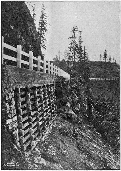
REINFORCED CONCRETE CRIBBING NEAR PRESCOTT ON THE COLUMBIA RIVER
HIGHWAY IN COLUMBIA COUNTY. BUILT IN 1918
General Tabulated Information
and
Highway Maps
TABLES
Table A—
Miles of Highway Construction Completed by the Highway Department during 1917 and 1918.
Table B—
Tabulation of Bridge Design and Construction.
Table C—
Miles of Location Surveys made by the Department during 1917 and 1918.
Table D—
Miles of Different Types of Roads in each County.
Table E—
Motor Vehicle Registration by Counties.
Table F—
County Bond Issues.
Table G—
Tabulation of Contract Prices.
Table H—
Yearly Expenditure of State Funds in Counties.
Table I—
Mileage Table of Main Traveled Roads.
Table J—
Official Designation of State Highways.
Table K—
Employes of the State Highway Department.
Table L—
Numbers and Mileages of State Highways.
MAPS
Map I.—
Main Traveled Roads of the State.
Map II.—
State Highway System.
TABLE A
MILES OF HIGHWAY CONSTRUCTED BY HIGHWAY DEPARTMENT 1917-1918
Jobs
Concrete
Pavement
Bitu-
minous
Pavement
Broken
Stone
Macadam
Gravel
Macadam
Grading
Clackamas County—
Oregon City to Canby
...
7.5
...
...
...
New Era to Oregon City
...
...
...
...
4.5
Multnomah County Line to
Oswego
...
...
...
...
.2
Clatsop County—
Astoria to Svensen
...
3.5
5.5
...
1.2
Svensen to Westport
...
...
17.2
1.7
...
Columbia County—
Multnomah County Line-
Scappoose
...
2.5
...
...
...
Westport to Clatskanie
...
...
8.6
...
...
Clatskanie to Delena
...
...
9.0
...
...
Delena to Goble
...
...
7.6
...
...
Goble Section
...
...
2.0
...
2.0
Beaver Valley Section
...
...
...
...
4.0
Rainier Hill Section
...
...
...
...
2.2
Coos County—
Marshfield to Curry County
Line
...
...
...
...
20.0
Coquille to Myrtle Point
...
...
...
...
3.0
Deschutes County—
Bend to Lapine (cinder
macadam)
...
...
...
12.5
...
Douglas County—
Myrtle Creek to Dillard
...
...
...
...
12.8
Oakland to Yoncalla
...
...
...
...
10.4
Divide to Comstock
...
...
2.4
...
2.4
Comstock to Leona
...
...
4.6
...
4.6
Gilliam County—
Mayville to Wheeler County
Line
...
...
1.0
...
...
Condon to Thirty Mile Creek
...
...
5.7
...
...
Hood River County—
Cascade Locks Section
...
...
...
...
8.2
Viento Section
...
...
...
...
3.6
Ruthton Hill Section
...
...
...
...
2.4
Cascade Locks to Hood River
...
...
...
18.0
...
Jackson County—
Siskiyou Mountain Section
...
...
6.5
...
...
Ashland Undercrossing
...
...
...
...
.8
Ashland Paving
.8
...
...
...
...
Josephine County—
Wolf Creek to Grave Creek
...
...
...
...
4.9
Grants Pass-Jackson County
Line
...
...
...
...
3.3
Lake County—
Lakeview to Paisley
...
...
4.0
...
6.4
Lane County—
Divide to Cottage Grove
...
...
1.0
...
...
Lincoln County—
Pioneer Mountain Section
...
...
...
...
1.0
Tillamook County—
Tillamook-Cloverdale Paving
...
5.0
...
...
5.0
Umatilla County—
Pendleton-Adams Section
...
10.0
...
...
...
Pendleton-West
...
1.0
...
...
...
Union County—
Elgin to Minam
...
...
...
...
.8
Union to Telocaset
...
...
...
...
3.0
La Grande to Hot Lake
...
...
...
...
3.7
Washington County—
Multnomah County Line to
Newberg
...
12.5
...
...
12.5
Wheeler County—
Cummins Hill Section
...
...
3.5
...
3.5
Fossil-Cummins Hill Section
...
...
1.0
...
...
Bridge Creek Section
...
...
...
...
.9
Yamhill County—
Sheridan Paving
4.0
...
...
...
4.0
Multnomah County Line,
Newberg Paving
...
3.2
...
...
3.2
Totals
4.8
45.2
79.6
32.2
134.5
TABLE B
BRIDGE AND CULVERT DESIGN AND CONSTRUCTION DECEMBER 1ST, 1916, TO NOVEMBER 30TH, 1918
Name of Structure
Struc-
ture
No.
Type of Structure
Total
Length
of
Bridge
and Ap-
proaches
(Feet)
Width
of
Road-
way
(Feet)
Loading
(See
Foot- note)
TOTAL COST
Actual Cost
if Complete;
Estimated
if Uncompleted
Benton:
Culvert on West Side Highway, 4
1⁄
2Mi. No.
of Corvallis
207
Double 5′ x 5′ R. C. Culvert
12
24
Heavy
[1]$ 800.00
Culvert on West Side Highway, 5 mi. No.
of Corvallis
208
Double 6′ x 8′ R. C. Culvert
14
24
Heavy
[1]1,300.00
Bridge over Mill Race South of Corvallis
230
Reinforced concrete bridge
85
20
Heavy
[1]7,000.00
Clatsop:
Drawbridge over John Day River
148
2-108′ Wood Spans 1-40′ Lift Span
296
18
Heavy
[2]25,000.00
Plympton Creek Bridge at Westport
185
R. C. Thru Span
60
20
Heavy
[2]6,413.19
Big Creek Bridge near Knappa
186
R. C. Bridge
90
20
Heavy
[2]8,446.70
Little Creek Culvert near Knappa
198
6′ x 12′ R. C. Culvert
14
24
Heavy
[2]929.69
Bridge over McDonald’s Log Chute on
Columbia River Hwy.
214
20′ R. C. Bridge
20
20
Heavy
[1]1,600.00
Columbia:
Beaver Creek Bridge No. 1
132
90′ R. C. Bridge
90
20
Heavy
[1]5,000.00
Beaver Creek Bridge No. 2
134
70′ R. C. Bridge
70
20
Heavy
[1]4,300.00
Beaver Creek Bridge No. 3
136
70′ R. C. Bridge
70
Beaver Creek Bridge No. 4
138
70′ R. C. Bridge
70
Beaver Creek Bridge No. 5
140
60′ R. C. Bridge
60
Beaver Creek Bridge No. 6
142
70′ R. C. Bridge
70
—20
Heavy
[2]32,000.00
Beaver Creek Bridge No. 7
144
60′ R. C. Bridge
60
Beaver Creek Bridge No. 8
146
50′ R. C. Bridge
50
Beaver Creek Bridge No. “A”
157
70′ R. C. Bridge
70
Beaver Creek Bridge No. “B”
155
105′ R. C. Bridge
105
Beaver Creek Bridge No. 10
150
30′ R. C. Bridge
30
20
Heavy
[1]3,600.00
Beaver Creek Bridge No. 11
152
30′ R. C. Bridge
30
20
Heavy
[2]3,600.00
Culvert near Scappoose on Columbia River
Highway
188
8′ x 10′ R. C. Culvert
12
24
Heavy
[2]1,834.60
Graham Creek Culvert near Clatskanie
184
Double 6′ x 6′ R. C. Box
14
24
Heavy
[2]804.49
Goble Creek Bridge at Goble
191
90′ R. C. Bridge
90
20
Heavy
[2]5,907.14
Half viaduct near Little Jack Falls
236
R. C. Half Viaduct
75
20
Heavy
[2]2,000.00
Coos:
Overhead Railway Crossing at Overland
110
R. C. Viaduct
114
18
Heavy
[3]10,000.00
45′ Wooden Truss
111
Wooden truss
45
24
Medium
[3]500.00
Haynes Slough Bridge
113
40′ Lift (Wood)
60
16
Medium
[3]4,000.00
North Slough Bridge
114
40′ Lift (Wood)
60
16
Medium
[3]4,000.00
Isthmus Slough Bridge
115
80′ Draw Span
180
16
Medium
[3]12,500.00
Larson Slough Bridge
116
40′ Wood Lift and Trestle
60
16
Medium
[3]4,500.00
Powers Bridge
252
2-126′ Wood Spans
520
18
Medium
[1]12,000.00
Bridge at Gravel Ford—No. Fork of
Coquille River
125
126′ Wood Span
790
16
Medium
[3]8,000.00
Douglas:
Pheasant Creek Culvert near Curtin
187
8′ x 8′ R. C. Culvert
10
24
Heavy
[2]1,804.69
Pass Creek Culvert, 1 mi. North of Comstock
194
20′ R. C. Bridge
20
20
Heavy
[2]2,184.00
Umpqua River Bridge South of Dillard
195
2-144′ Wood Spans
330
18
Heavy
[2]19,000.00
Rock Creek Bridge near Anlauf
196
30′ R. C. Bridge
30
20
Heavy
[2]2,169.70
Umpqua River Bridge north of Dillard
202
3-144′ Wood Spans
480
18
Heavy
[2]26,500.00
20′ R. C. Bridge
216
20′ R. C. Bridge
20
20
Heavy
[1]1,200.00
Van Tyne Creek Bridge between Myrtle
Creek and Dillard
234
60′ R. C. Bridge
60
20
Heavy
[2]3,575.70
Viaduct 1 mile North of Myrtle Creek
245
58′ R. C. Viaduct
58
20
Heavy
[2]2,648.54
Viaduct 1 mile North of Myrtle Creek
246
45′ R. C. Viaduct
45
20
Heavy
[2]2,415.28
Pass Creek Culvert 1
1⁄
2miles North of
Comstock
190
Double 6′ x 7′ R. C. Culvert
14
24
Heavy
[2]1,380.03
Grant:
John Day River Bridge at Monument
124
180′ Wood Span
450
16
Medium
[1]11,000.00
Gulch
239
40′ Wood Span
40
18
Medium
[1]600.00
Gulch
240
40′ Wood Span
52
18
Medium
[1]700.00
Gulch
241
40′ Wood Span
52
18
Medium
[1]700.00
Rock Creek
242
40′ Wood Span
86
18
Medium
[1]1,700.00
John Day River at Goose Rock
243
108′ Wood Span
150
18
Medium
[1]8,800.00
North Fork John Day River
244
144′ Wood Span
184
18
Medium
[1]11,500.00
Holmes Creek
255
40′ Wood Span
78
18
Medium
[1]1,500.00
Rattlesnake Creek
256
40′ Wood Span
52
18
Medium
[1]1,000.00
Dixie Creek Bridge at Prairie City
282
50′ Wood Span
50
18
Medium
[2]6,000,00
Hood River:
East Fork of Hood River
119
140′ R. C. Viaduct
140
16
Heavy
[1]8,400.00
Neal Creek Bridge
120
25′ Bridge, R. C.
25
16
Heavy
[3]1,000.00
Bridge over Hood River at Dee
121
126′ Wooden Span
126
16
Medium
[3]3,500.00
Odell Creek Bridge
122
15′ R. C. Bridge
15
18
Heavy
[3]600.00
Herman Creek Bridge
159
100′ R. C. Bridge
100
20
Heavy
[2]7,389.06
Culvert for Flume Line at Mitchell Point
162
R. C. Culvert
...
24
Heavy
[2]378.44
Culvert for Pipe Line at Cascade Locks
171
3′ x 6
1⁄
2′ R. C. Culvert
8
24
Heavy
[2]642.41
Viento Creek Bridge at Viento
172
20′ R. C. Bridge
20
20
Heavy
[2]1,650.97
Gorton Creek Bridge
173
50′ R. C. Bridge
50
20
Heavy
[2]3,153.90
Parham Creek Culvert near Viento
182
4′ x 10′ R. C. Culvert
12
24
Heavy
[2]965.85
Indian Creek
197
Culvert
10
...
...
[3]1,500.00
Hood River Bridge at Hood River
200
420′ R. C. Arch and Viaduct
420
20
Heavy
[2]48,000.00
Half Viaduct on Ruthton Hill
273
54′ Half Viaduct
74
...
Heavy
[2]1,563.01
Jackson:
Big Applegate near Jacksonville
147
126′ Wood Span, 100′ approach
226
16
Medium
[1]4,000.00
Josephine:
Trestle over Dry Gulch East of Wolf Creek
210
120′ Wood Trestle
120
18
Medium
[3]1,852.78
Coyote Creek Bridge East of Wolf Creek
211
58′ Wood Trestle
58
18
Medium
[3]811.28
Lane:
Overhead Railway Crossing at Divide
163
92′ R. C. Viaduct
92
20
Heavy
[1]6,500.00
Lincoln:
Alsea River, 7 miles above Waldport
260
144′ Wood Span
258
18
Medium
[3]10,000.00
Linn:
Bridge over Mill Race in Lebanon
274
40′ R. C. Bridge
40
24
Heavy
[1]2,000.00
Marion:
Willamette River Bridge at Salem
123
Steel Bridge
2220
24
(¶)
[3]250,000.00
Slough
253
6′ x 7′ R. C. Culvert
...
...
Heavy
[1]1,200.00
Slough
254
Double 2
1⁄
2′ x 3′ R. C. Culvert
...
...
Heavy
[1]500.00
Multnomah:
Overhead Crossing—Ore. Elec. Ry. at
Capital Hill
169
106′ Wooden Overcrossing
106
20
Heavy
[2]800.00
Slough
258
60′ Wooden Span
60
16
Medium
[2]1,000.00
Polk:
Mulkey Cut-off near Monmouth
201
40′ Wood trestle
40
18
Medium
[1]600.00
LaCreole Creek in Dallas (not designed by
State)
231
70′ R. C. Arch
70
22
Heavy
[3]10,755.68
R. C. Bridge between Dallas and Monmouth
233
36′ Wood Bridge
36
20
Heavy
[3]1,898.17
Little Luckiamute
238
72′ Wood Span
130
18
Medium
[3]3,615.00
Big Luckiamute, at Montgomery School
(See also
Marion Countyfor Salem Bridge)
283
160′ Suspension Foot Bridge
160
4
...
[3]500.00
Sherman:
John Day River Bridge on Columbia River
Highway
108
2-126′ Wood Deck Spans
372
18
Heavy
[1]20,000.00
Tillamook:
Bridge over North Fork of Nehalem River
127
40′ Lift and 90′ Span
750
16
Medium
[2]11,000.00
Bridge over Beaver Creek, North of Beaver
153
172′ R. C. Bridge
172
20
Heavy
[1]8,000.00
Bridge over Beaver Creek in Beaver
154
120′ R. C. Bridge
120
20
Heavy
[2]6,000.00
Munson Creek Bridge
160
16′ R. C. Bridge
16
20
Heavy
[2]500.00
Umatilla:
Bridge over Washout Gulch near Reith
229
54′ Wood Span
54
18
Medium
[1]1,500.00
Union:
Grand Ronde River Bridge
174
2-126′ Wooden Spans
270
16
Medium
[1]8,000.00
Grand Ronde River Bridge
175
1-162′ Wooden Spans
200
16
Medium
[1]8,000.00
Bridge between La Grande and Hot Lake
275
12′ R. C. Bridge
12
24
Heavy
[1]1,000.00
Bridge between La Grande and Hot Lake
276
10′ R. C. Bridge
10
24
Heavy
[1]900.00
Bridge between La Grande and Hot Lake
277
26′ R. C. Bridge
26
20
Heavy
[1]2,000.00
Bridge between La Grande and Hot Lake
278
18′ R. C. Bridge
18
20
Heavy
[1]1,500.00
Bridge between La Grande and Hot Lake
279
14′ R. C. Bridge
14
20
Heavy
[2]1,400.00
Box Culvert near Hot Lake
215
7′ x 8′ R. C. Box Culvert
10
24
Heavy
[2]800.00
Wasco:
Eight Mile Creek Bridge East of the Dalles
106
60′ R. C. Box Culvert
60
20
Heavy
[2]3,000.00
Three Mile Creek Bridge—East of the
Dalles
109
6′ x 6′ R. C. Culvert
...
20
Heavy
[2]700.00
Mosier Creek Bridge at Mosier
118
175′ R. C. Viaduct
175
20
Heavy
[2]7,000.00
Butler Creek Bridge
128
36′ R. C. Bridge
36
20
Heavy
[2]1,800.00
Tygh Creek Bridge near Tygh Valley
129
78′ R. C. Bridge
78
20
Heavy
[2]5,500.00
Rock Creek Bridge
203
45′ R. C. Bridge
45
20
Heavy
[1]2,700.00
Washington:
Onion Flat Trestle between Rex and
Tigardville
199
599′ Wood Trestle
599
18
Heavy
[3]8,372.22
Tualatin River Bridge, 2 mi. So. of
Tigardville
204
144′ Wood Span
310
18
Heavy
[3]12,968.60
Fanno Creek Bridge at Tigard
264
70′ Wood Trestle
70
18
Heavy
[3]1,882.81
Wheeler:
Bridge over Bridge Creek, near Mitchell
176
162′ Wooden Span
333
16
Medium
[1]10,000.00
Bridge over Bridge Creek, 4 mi. West of
Mitchell
177
90′ Wooden Span
105
16
Medium
[3]6,774.15
Bridge over West Branch Creek, near
Mitchell
178
30′ Wooden Span
30
16
Medium
[1]500.00
Bridge at Mitchell
179
162′ Wooden Span
200
16
Medium
[1]8,000.00
Yamhill:
Bridge over Yamhill River—6 mi. West of
Grande Ronde
262
40′ Wooden Span
97
18
Medium
[1]1,000.00
Bridge over Cedar Creek—4 mi. West of
Grande Ronde
263
30′ Wooden Span
68
18
Medium
[1]800.00
Total
$ 788,788.09
[2] Designed by Highway Department and construction supervised by Counties.
Where loading is referred to as "Heavy," the structure is designed for a twenty-ton roller and for 100 lbs. per sq. ft. Where loading is referred to as "Medium," the structure is designed for a fifteen-ton roller and for 75 lbs. per sq. ft.
[3] Designed and construction supervised by Highway Department.
[1] Designed by Highway Department but not yet constructed.
[1] Designed by Highway Department but not yet constructed.
[2] Designed by Highway Department and construction supervised by Counties.
[3] Designed and construction supervised by Highway Department.
Where loading is referred to as "Heavy," the structure is designed for a twenty-ton roller and for 100 lbs. per sq. ft. Where loading is referred to as "Medium," the structure is designed for a fifteen-ton roller and for 75 lbs. per sq. ft.
SUMMARY OF BRIDGE AND CULVERT DESIGN AND CONSTRUCTION
Designed and Construction Supervised by Highway Department
$ 527,788.09
Designed by Highway Department and Construction supervised by Counties
89,600.00
Designed by Highway Department but not yet constructed
171,400.00
Total
$ 788,788.09
TABLE C
MILES OF LOCATION SURVEYS MADE BY HIGHWAY DEPARTMENT 1917-1918
Jobs
Miles
Baker County—
Baker to Middle Bridge
17.0
Canyon Section of Baker-Cornucopia Road
4.5
Sag Section of Baker-Cornucopia Road
4.9
Middle Bridge to Black Bridge
13.0
Clackamas County—
Canby to Oregon City
7.5
Oregon City to Multnomah County Line
6.5
Aurora to Canby
5.0
Columbia County—
Columbia City to Scappoose
11.2
Coos County—
Myrtle Point to Douglas County Line
24.4
Marshfield to Curry County Line
39.2
Coquille to Myrtle Point
9.0
Curry County—
Coast Highway
20.0
Douglas County—
Johns Ranch to Jacques Ranch
7.2
Canyon Creek Pass to Johns Place
2.3
Coos County Line to Roseburg
28.7
Gilliam County—
Columbia River Highway
34.0
Grant County—
Big Basin Section of John Day River Highway
23.5
John Day to Fisk Creek
7.4
Fisk Creek to Hall Hill
3.5
Hall Hill to Prairie City
2.2
Harney County—
Burns to Crane
6.0
Hood River County—
Hood River to Mosier
7.0
Jackson County—
Ashland to Klamath Falls
15.6
Josephine County—
Wolf Creek to Grave Creek
4.0
Grants Pass to Grave Creek
17.2
Wolf Creek to Stage Road Pass
2.4
Klamath County—
Klamath Falls-Chiloquin
3.3
Lane County—
Goshen to Cottage Grove
18.2
Eugene to Florence
37.5
Divide to Overhead
1.3
Linn County—
Albany to Jefferson
7.8
Marion County—
Salem to Aurora
22.2
Salem to Jefferson
15.5
Morrow County—
Columbia River Highway
28.6
Heppner to Willows
43.0
Heppner to Umatilla County Line
28.4
Polk County—
Between Monmouth and Dallas
.7
Between Salem and Dallas
.8
Sherman County—
Columbia River Highway
14.0
Tillamook County—
Tillamook to Cloverdale
15.0
Neskowin to Salmon River
8.0
Umatilla County—
Pendleton to Umatilla
40.6
Pendleton to Pilot Rock
13.9
Pilot Rock to Morrow County Line
18.3
Pendleton to Kamela
26.8
Union County—
Elgin to Minam
9.4
Union to Telocaset
7.2
La Grande to Elgin
29.1
La Grande to Union
9.4
La Grande to Kamela
22.4
Wasco County—
Seuffert to Deschutes River
12.5
Washington County—
Multnomah County Line to Newberg
15.7
Beaverton to Hillsboro
7.6
Forest Grove to Gaston
6.7
Wheeler County—
Sarvice Creek to Grant County Line
25.5
Ochoco Forest to Grant County Line
50.5
Fossil to Gilliam County Line
4.5
Fossil to mouth of Sarvice Creek
21.0
Yamhill County—
McMinnville to Dayton
6.7
Grande Ronde Section
6.8
Total miles of surveys
902.1
TABLE D
MILES OF DIFFERENT TYPES OF ROAD IN EACH COUNTY
(These mileages are only roughly approximate as accurate data is obtainable in very few counties)
COUNTIES
Public
Roads
Concrete
Pave-
ment
Asphal-
tic
Concrete
Plank
Roads
Broken
Stone
Gravel
Roads
Improved
Earth
Roads
Un-
improved
Earth
Roads
Baker
3,500.0
...
...
...
...
30.0
470.0
3,000.0
Benton
550.0
...
...
...
10.0
200.0
200.0
140.0
Clackamas
1,220.0
2.0
24.0
99.0
177.0
221.0
441.0
256.0
Clatsop
310.0
4.5
25.0
26.0
94.0
19.0
141.0
...
Columbia
575.0
...
4.5
19.0
116.5
42.0
17.0
376.0
Coos
675.0
.5
1.5
51.0
16.0
86.0
86.0
434.0
Crook
1,450.0
...
...
...
2.0
50.0
300.0
1,098.0
Curry
140.0
...
...
...
2.0
52.0
53.0
33.0
Deschutes
1,500.0
...
...
...
...
25.0
300.0
1,175.0
Douglas
2,000.0
1.0
1.0
8.0
150.0
340.0
500.0
1,000.0
Gilliam
600.0
...
...
...
10.0
5.0
50.0
535.0
Grant
850.0
...
...
...
...
12.0
15.0
823.0
Harney
1,000.0
...
...
...
...
8.0
192.0
800.0
Hood River
250.0
...
1.0
...
7.0
32.0
110.0
100.0
Jackson
750.0
8.0
10.0
...
12.0
20.0
300.0
400.0
Jefferson
1,500.0
...
...
...
30.0
25.0
500.0
945.0
Josephine
700.0
...
...
...
4.0
52.0
400.0
244.0
Klamath
1,200.0
...
2.0
...
4.0
14.0
300.0
880.0
Lake
1,400.0
...
...
...
5.0
20.0
200.0
1,175.0
Lane
1,450.0
...
...
26.0
137.0
425.0
78.0
784.0
Lincoln
385.0
...
...
5.0
20.0
10.0
250.0
100.0
Linn
1,900.0
...
...
...
70.0
530.0
500.0
800.0
Malheur
1,800.0
...
...
...
...
25.0
200.0
1575.0
Marion
1,300.0
...
8.0
...
123.0
272.0
300.0
597.0
Morrow
900.0
...
...
...
4.0
...
33.0
863.0
Multnomah
500.0
12.0
77.0
3.0
125.0
136.0
120.0
27.0
Polk
1,100.0
...
1.0
...
40.0
300.0
300.0
459.0
Sherman
500.0
...
...
...
...
4.0
90.0
406.0
Tillamook
350.0
6.0
5.0
11.0
...
228.0
50.0
50.0
Umatilla
3,000.0
...
11.0
...
30.0
30.0
644.0
2,285.0
Union
800.0
...
...
...
3.0
10.0
187.0
600.0
Wallowa
1,500.0
...
...
...
...
...
300.0
1,200.0
Wasco
1,100.0
...
...
...
25.0
100.0
475.0
500.0
Washington
975.0
...
16.0
25.0
171.0
33.0
300.0
430.0
Wheeler
950.0
...
...
...
5.0
...
5.0
940.0
Yamhill
1,300.0
4.0
...
...
125.0
171.0
500.0
500.0
Total
39,980.0
38.0
187.0
273.0
1,518.0
3,527.0
8,907.0
25,530.0
TABLE E
1918 MOTOR VEHICLE REGISTRATION BY COUNTIES
County
Total
Number
of
Motor
Vehicles
Number
Persons
Per
Auto
County
Total
Number
of
Motor
Vehicles
Number
Persons
Per
Auto
Baker
1,409
12.8
Lane
2,618
12.9
Benton
1,080
9.9
Lincoln
170
34.6
Clackamas
2,299
13.0
Linn
2,184
10.4
Clatsop
1,409
11.4
Malheur
1,138
7.6
Columbia
632
16.8
Marion
3,982
10.0
Coos
1,128
15.9
Morrow
670
6.5
Crook
533
5.6
Multnomah
20,456
11.1
Curry
135
15.1
Polk
1,298
10.4
Deschutes
829
5.6
Sherman
737
5.8
Douglas
1,428
13.8
Tillamook
843
7.4
Gilliam
520
7.1
Umatilla
3,231
6.3
Grant
436
12.9
Union
1,609
10.1
Harney
488
8.3
Wallowa
811
10.3
Hood River
682
11.8
Wasco
1,324
12.3
Jackson
2,431
10.6
Washington
2,041
10.5
Jefferson
305
5.6
Wheeler
243
10.2
Josephine
743
12.9
Yamhill
1,862
9.3
Klamath
1,151
7.4
Total
63,318
10.6
Lake
463
10.0
STATE REGISTRATION
Total number of passenger vehicles
58,000
Total number of Ford trucks
2,266
Total number of trucks of other makes
3,052
Total number of trucks, all makes
5,318
Total number of motor vehicles of all types and all makes
63,318
TABLE F
COUNTY BOND ISSUES
As proof that the people of Oregon are awake to the value of good roads, the following list is given of Counties which have voted bond issues for the development of their road systems:
County
Amount of bonds
Date voted
Coos
$ 362,000.00
June
1916
Columbia
360,000.00
Feb.
1914
Clatsop
400,000.00
Nov.
4,
1913
Crook
90,000.00
1918
Douglas
500,000.00
Aug.
1917
Grant
140,000.00
June
4,
1917
Hood River
75,000.00
July
15,
1914
Jackson
500,000.00
Sept.
9,
1913
Multnomah
1,250,000.00
Mar.
1915
Wasco
260,000.00
Nov.
1916
Wheeler
80,000.00
Nov.
1916
Total
$ 4,017,000.00
TABLE G—TABULATION OF CONTRACT PRICES
GIVING UNIT PRICES OF ALL UNIT PRICE CONTRACTS FOR PAVING AND GRADING WORK, 1917-1918
Con-
tract
No
JOB
CONTRACTOR
Num-
ber
Miles
Kind of Work
Clearing
and
Grubbing
Lump Sum
EXCAVATION
Cubic Yards
Over-
haul,
Cu.
Yds.
Per 100′
CONCRETE
Cubic Yards
Rubble
Mason-
ry
Cu. Yds.
Metal
Re-
inforce-
ment
Pounds
Plain Concrete
Pipe
Lineal Feet
REINFORCED
CONCRETE PIPE
Lineal Feet
CORRUGATED
GALVANIZED IRON PIPE
Lineal Feet
6-Inch
Porous
Drain
Tile
Lin. Ft.
Guard
Fence
Lin. Ft.
Lumber
and
Timber
1,000 Ft.
B. M.
Asphaltic
Concrete
2 inches
on
RockBase
Sq. Yd.
MACADAM
Cubic Yards,
(Loose Measure)
Broken
Stone
Cu. Yd.
(Loose
Meas.)
Sand
Cu. Yd.
(Loose
Meas.)
Broken
Stone
Shoulders
Lin. Ft.
Clay
Filler
Cu. Yd.
Riprap
Cu. Yd.
Com-
mon
Inter-
me-
diate
Solid
Rock
Class
A
Class
B
Class
C
12-in.
18-in.
12-in.
18-in.
24-in.
30-in.
36-in.
12-in.
18-in.
24-in.
30-in.
36-in.
Broken
Stone
Gravel
Crushed
Gravel
1
Cummins Hill
Elliot Construction Co.
3.5
Grading
...
$ .40
$ .70
$ 1.35
...
...
...
...
$ 10.00
...
...
...
...
...
...
...
...
[4]$ .40
...
[4]$ 1.00
...
...
...
...
...
...
...
...
...
...
...
...
...
...
2
Wild Horse Paving
Warren Construction Co.
11.0
Paving
...
...
...
...
$ .01
...
...
...
...
...
...
...
...
...
...
...
...
...
...
...
...
...
...
...
...
$ 1.29
...
...
...
$ 1.87
...
$ .05
$ 1.00
...
3
Multnomah County Line-Newberg
Oskar Huber
15.7
Grading and Paving
$ 1,250.00
.34
.62
1.15
...
...
...
$ 8.50
...
...
...
...
$ 1.25
$ 1.75
$ 2.45
...
$ 4.25
...
...
...
...
...
$ .15
$ .45
$ 50.00
1.28
...
...
...
2.40
...
.06
.85
$ 2.75
5
Astoria-Svenson
Warren Construction Co.
9.0
Grading and Paving
5,610.00
.49
.75
1.20
.01
...
...
8.50
...
...
...
...
1.40
2.00
2.75
...
4.60
...
...
...
...
...
...
...
...
1.24
...
...
...
2.30
...
.05
.88
...
6
Goble Section
Warren Construction Co.
2.0
Grading
2,085.00
.45
.70
1.15
.02
...
...
15.00
9.00
...
...
...
1.50
...
3.30
...
5.30
...
...
...
...
...
...
.57
...
...
...
...
...
...
...
...
...
...
7
Rainier Hill
A. L. Clark
2.2
Grading
...
.30
.48
1.25
.03
...
...
12.00
...
...
...
...
...
...
...
...
...
1.00
...
...
...
...
...
1.50
...
...
...
...
...
...
...
...
...
...
8
Cascade Locks
A. D. Kern
8.2
Grading
Free
.42
.75
1.15
.03
20.00
...
14.00
7.00
...
...
...
1.75
2.25
3.00
...
4.75
...
...
...
...
...
...
.50
...
...
...
...
...
...
...
...
...
...
9
Viento Section
A. D. Kern
3.6
Grading
Free
.39
.70
1.10
.03
20.00
...
14.00
7.00
...
...
...
1.75
2.25
3.00
...
...
...
...
...
...
...
...
.50
...
...
...
...
...
...
...
...
...
...
10
Ruthton Hill
A. D. Kern
2.4
Grading
Free
.39
.70
1.05
.03
...
...
14.00
7.00
...
...
...
1.75
2.25
3.00
...
...
...
...
...
...
...
...
.50
...
...
...
...
...
...
...
...
...
...
11
Delena-Goble
Clark & Dibble
7.6
Macadam
...
.40
.60
1.15
.02
20.00
...
18.00
...
...
...
...
...
...
...
...
...
...
...
...
...
1.30
...
.60
...
...
2.18
...
...
...
...
...
1.00
...
12
Tillamook Paving
Oskar Huber
5.0
Grading and Paving
...
.60
.90
...
.02
...
...
17.70
...
...
...
...
[4].48
[4].78
[4]1.16
...
[4]1.80
...
...
...
...
...
.14
...
...
1.42
...
...
...
2.20
...
.06
1.00
...
13
Multnomah County Line-Scappoose
Warren Construction Co.
2.5
Paving
...
.45
.65
...
.02
...
...
...
...
...
...
...
...
...
...
...
...
...
...
...
...
...
...
...
...
1.17
...
...
...
1.90
...
.05
.90
...
18
Oregon City-Canby
Ore. Hassam Paving Co.
7.5
Paving
...
...
...
...
...
...
...
...
...
...
...
...
...
...
...
...
...
...
...
...
...
...
...
...
...
1.26
...
...
...
2.37
...
.05
1⁄
2.90
...
19
Yoncalla-Oakland
Warren Construction Co.
10.4
Grading
$ 6,350.00
.49
.77
1.30
.02
24.00
22.00
...
9.00
$ .08
$ 1.10
$ 2.02
...
...
3.27
...
5.50
2.07
2.75
3.44
...
...
.20
...
45.00
...
...
...
...
...
...
...
...
...
20
Comstock-Leona
Hall & Soleim
4.6
Grading & Macadam
2,247.00
.37
1⁄
2.61
1.12
.02
1⁄
218.00
16.05
...
14.80
.12
.67
1.55
...
...
2.90
...
5.50
1.55
2.00
3.00
...
...
...
...
32.00
...
4.89
...
...
...
$ 1.70
...
.62
...
21
Divide-Comstock
S. S. Schell
2.4
Grading
2,400.00
.45
.60
1.15
.03
24.00
16.00
...
8.00
.08
1.00
...
...
...
2.50
...
...
...
...
3.25
...
...
.20
...
20.00
...
...
...
...
...
...
...
...
...
25
Locust Hill
A. Anderson
1.0
Grading
125.00
.53
.63
1.20
.03
...
...
20.00
...
...
1.00
1.50
...
...
...
...
...
...
...
...
...
...
.25
...
...
...
...
...
...
...
...
...
...
...
28
Wolf Creek-Grave Creek
American Express Co.
4.9
Grading
3,500.00
.45
.45
1.25
.02
22.50
...
18.00
...
.15
[4].55
[4].80
...
...
[4]1.10
[4]1.50
[4]2.00
[4].30
[4].40
[4].50
[4].60
[4]$ .75
.40
.50
45.00
...
...
...
...
...
...
...
...
...
29
Myrtle Creek-Dillard
Calvert & Wolke
12.8
Grading
3,500.00
.35
.56
1.14
.02
22.00
...
20.50
...
.10
[4].35
...
...
[4].60
[4]1.05
[4]2.00
[4]3.00
[4].20
[4].30
[4].40
[4].60
[4].75
.25
.55
45.00
...
...
...
...
...
...
...
...
5.00
32
Bridge Creek
United Construction Co.
0.9
Grading
...
.60
.75
1.40
.03
34.00
...
31.00
12.50
...
...
...
...
...
...
...
...
[4].73
[4].90
...
...
...
...
.85
...
...
...
...
...
...
...
...
...
...
36
Canemah-new Era
Clackamas County Court
1.8
Grading
500.00
.60
.80
1.25
.02
15.00
...
12.00
1.25
...
...
...
...
1.25
...
...
...
4.00
...
...
...
...
.10
.35
...
...
...
...
...
...
...
...
...
...
64
Divide-Comstock Macadam
S. S. Schell
2.4
Macadam
...
...
...
...
...
...
...
...
...
...
...
...
...
...
...
...
...
...
...
...
...
...
...
...
...
...
3.35
...
...
...
...
...
.75
...
65
Union-Telocaset
State
6.0
Grading
...
.40
.75
1.35
.03
25.00
...
20.00
...
.08
1.25
...
...
...
...
...
...
...
...
...
...
...
...
...
...
...
...
...
...
...
...
...
...
...
66
Elgin-Minam
State
9.3
Grading
...
.40
.70
1.25
.03
22.00
20.00
...
10.00
.07
...
...
...
...
...
...
...
...
1.50
2.50
4.00
...
...
...
...
...
...
...
...
...
...
...
...
...
71
Hall Hill-Prairie City
A. D. Kern
2.2
Grading & Macadam
...
.72
...
1.60
.05
31.00
30.00
28.00
...
.10
...
...
...
...
...
...
...
...
1.80
2.70
...
...
...
...
...
...
...
$ 3.30
$ 3.70
...
...
...
.75
...
Lowest Unit Price
.30
.45
1.05
.01
15.00
16.05
8.50
1.25
.07
.67
1.50
1.35
1.75
2.45
[4]1.50
4.00
1.00
2.00
3.00
[4].60
[4].75
.10
.35
20.00
1.17
2.18
3.30
3.70
1.87
1.70
.05
.62
2.35
Highest Unit Price
.72
.90
1.60
.05
34.00
30.00
31.00
14.80
.15
1.25
2.02
1.75
2.25
3.30
[4]2.00
5.50
2.07
2.75
4.00
[4].60
[4].75
.40
1.50
50.00
1.42
4.89
3.30
3.70
2.40
1.70
.06
1.00
5.00
[4] Indicates that contract price on culvert pipe is for hauling and placing only, the pipe to be furnished to the contractor.
[4] Indicates that contract price on culvert pipe is for hauling and placing only, the pipe to be furnished to the contractor.
TABLE H
YEARLY EXPENDITURES OF STATE FUNDS IN COUNTIES 1914, 1915. 1916, 1917, 1918
Counties
1914
1915
1916
1917
1918
Total
Baker
...
...
$ 802.74
$ 1,214.01
$ 6,364.67
$ 8,381.42
Benton
...
$ 181.50
727.14
47.56
...
956.20
Clackamas
$ 587.74
...
1,013.37
12,519.70
143,341.40
157,462.21
Clatsop
64,587.44
35,110.03
20,823.44
54,294.83
290,092.40
464,908.14
Columbia
13,384.87
92,069.72
11,143.48
76,424.91
411,877.24
604,900.22
Coos
...
...
375.81
16,703.28
264.40
17,343.49
Crook
...
57.17
12,052.32
...
3,053.72
15,163.21
Curry
...
...
...
79.91
5,549.33
5,629.24
Deschutes
...
...
...
7,244.37
13,472.00
20,716.37
Douglas
...
15,701.12
25,188.08
8,803.50
150,966.08
200,658.78
Gilliam
...
...
7.42
4,443.52
31,555.96
36,006.90
Grant
...
...
26.95
2,980.16
4,488.62
7,495.73
Harney
...
...
...
...
1,873.45
1,873.45
Hood River
1,077.24
47,927.84
4,317.17
61,326.69
372,601.53
487,250.47
Jackson
59,569.82
31,954.91
25,774.49
54,476.20
32,143.68
203,919.10
Jefferson
...
...
...
...
...
...
Josephine
...
2,230.81
5,590.03
5,297.73
72,700.41
85,818.98
Klamath
...
...
...
27.75
791.48
819.23
Lake
...
...
...
15,215.57
176.10
15,391.67
Lane
...
61.11
4,639.07
12,247.61
2,281.91
19,229.70
Lincoln
...
11.95
12.88
2,054.05
943.42
3,022.30
Linn
...
208.81
37.32
287.67
503.40
1,037.20
Malheur
...
...
189.61
93.02
773.63
1,056.26
Marion
414.76
79.79
712.55
479.41
4,604.18
6,290.69
Morrow
...
...
105.18
4,200.72
6,662.38
10,968.28
Multnomah
1,068.08
107.03
...
...
...
1,175.11
Polk
414.15
74.54
6,614.53
137.78
665.14
7,906.14
Sherman
44,523.20
993.26
188.87
48.87
3,003.27
48,757.47
Tillamook
...
116.59
1,735.01
5,213.34
63,060.95
70,125.89
Umatilla
...
...
13.49
100,608.75
73,333.75
173,955.99
Union
...
...
42.20
5,975.15
26,213.02
32,230.37
Wallowa
...
...
...
...
765.07
765.07
Wasco
...
134.91
10.34
286.02
4,027.77
4,449.04
Washington
4,998.14
14,321.44
4,975.48
70,139.95
176,629.10
271,064.11
Wheeler
...
...
5.64
13,084.26
56,130.52
69,220.42
Yamhill
408.34
108.37
2,106.03
38,714.45
86,244.39
127,581.58
Totals
$ 191,033.78
$ 241,450.90
$ 129,230.64
$ 574,670.74
$ 2,047,154.37
$ 3,183,540.43
TABLE I
MILEAGE TABLE
Main Traveled Roads
Showing distances between some of the important towns; for convenience in obtaining mileage for long trips; to be used in connection with the official automobile road map on opposite page.
All distances between points west of the Cascade Range and Eastern Oregon points are via Portland and the Columbia River Highway, unless otherwise noted.
Portland
Salem
Albany
Eugene
Roseburg
Medford
Pendleton
Baker
Bend
Portland
...
53
78
126
203
318
240
345
253
Salem
53
...
25
73
150
265
293
398
[5]195
Albany
78
25
...
48
125
240
318
423
[5]170
Corvallis
89
36
11
40
117
232
329
434
[5]162
Eugene
126
73
48
...
77
192
366
[5]356
[5]122
Roseburg
203
150
125
77
...
115
443
[5]433
[5]199
Grants Pass
285
232
207
159
82
33
525
[5]515
[6]265
Medford
318
265
240
192
115
...
484
[6]490
[6]232
Ashland
331
278
253
205
128
13
471
[6]477
[6]219
Ore.-Cal. State Line
354
301
276
228
151
36
...
...
...
Crater Lake
401
348
323
275
198
83
372
378
120
Klamath Falls
395
342
317
269
192
77
407
413
155
Astoria
107
160
185
233
310
425
347
452
360
Tillamook
107
91
116
150
227
342
347
452
360
Marshfield
[7]253
[7]200
[7]175
[7]127
88
190
493
[5]483
[5]249
The Dalles
91
144
169
217
294
409
149
254
162
Pendleton
240
293
318
366
443
558
...
105
252
Walla Walla
285
338
363
411
488
603
45
150
297
La Grande
293
346
371
419
496
[6]542
53
52
305
Baker
345
398
423
[5]356
[5]433
[6]490
105
...
258
Huntington
395
448
473
[5]406
[5]483
[6]540
155
50
298
Prineville
244
[5]208
[5]183
[5]135
[5]212
[6]269
226
221
37
Bend
253
[5]195
[5]170
[5]122
[5]199
[6]232
252
258
...
Burns
396
[5]338
[5]313
[5]265
[5]342
[6]340
195
169
143
Lakeview
426
[5]368
[5]343
[5]295
[6]292
[6]177
358
332
173
Canyon City
317
[5]337
[5]312
[5]264
[5]341
[6]398
122
96
166
[5] Via Eugene and McKenzie River Highway.
[6] Via Klamath Falls.
[7] Via Scottsburg.
AUTOMOBILE ROAD MAP, SHOWING THE MAIN TRAVELED ROADS OF OREGON WITH MILEAGES
Prepared by the Oregon State Highway Department
See large-size map (1.1 MB.)
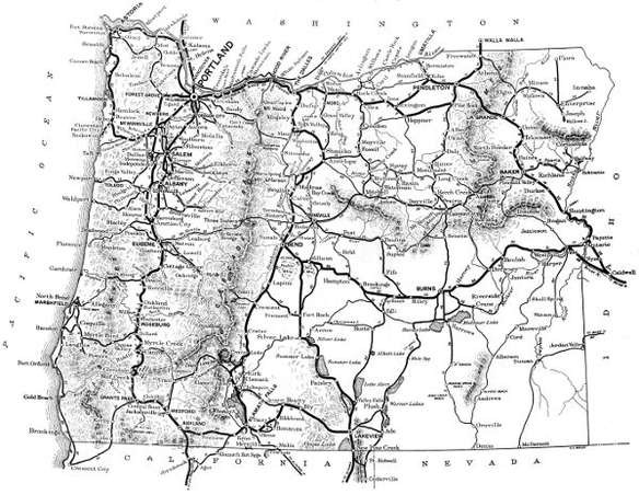
This Is Not a Map of the System of State Highways. This map is intended as a guide to the main traveled, existing, through highways and roads connecting important centers of population. The heavier weight lines are intended to designate the most generally traveled, through routes, rather than their relative condition or importance.
TABLE J
OFFICIAL DESIGNATION OF STATE HIGHWAYS
No. 1. Pacific Highway—
From Portland south via Oregon City, Salem, Albany, Eugene, Roseburg, Grants Pass, Medford and Ashland to the Oregon-California State Line.
No. 2. Columbia River Highway—
From Astoria east via Rainier, Portland, Hood River, The Dalles, Arlington and Umatilla, to Pendleton.
No. 3. Coast Highway—
From Astoria south via Tillamook, Toledo, Florence, Marshfield, Coquille and Gold Beach to Oregon-California State Line.
No. 4. The Dalles-California Highway—
From a point on Highway No. 2, at or near The Dalles, south via Shaniko, Redmond, Bend, LaPine and Klamath Falls to the Oregon-California State Line.
No. 5. The John Day River Highway—
From a point on Highway No. 2, at or near Biggs, southeasterly through Wasco, Condon, Fossil, Dayville, Prairie City and Vale to the Oregon-Idaho State Line at Ontario.
No. 6. The Old Oregon Trail—
From a junction with Highway No. 2, at Pendleton, southeasterly through La Grande, Baker and Huntington to a junction with Highway No. 5 at or near Ontario.
No. 7. Central Oregon Highway—
From a point on Highway No. 4, at or near Bend, easterly through Millican, Riley, Burns, Crane and Juntura to a junction with Highway No. 5, at or near Vale.
No. 8. Oregon-Washington Highway—
From a point on Highway No. 2, at or near Willows, through Ione, Heppner, Pendleton and Freewater to the Oregon-Washington State Line.
No. 9. Pendleton-John Day Highway—
From a point on Highway No. 8, at or near Pilot Rock south to a junction with Highway No. 5, at or near John Day.
No. 10. La Grande-Enterprise Highway—
From a point on Highway No. 6, at or near La Grande, through Elgin and Enterprise to Joseph.
No. 11. Enterprise-Flora Highway—
From a point on Highway No. 10, at or near Enterprise, north to Flora.
No. 12. Baker-Cornucopia Highway—
From a point on Highway No. 6, at or near Baker, east through Middle Bridge and Halfway to Cornucopia.
No. 13. Baker-Unity Highway—
From a point on Highway No. 6, at or near Baker, southwest to a junction with Highway No. 5, at or near Unity.
No. 14. Antelope-Mitchell Highway—
From a point on Highway No. 4, at or near Antelope to a junction with Highway No. 15, at or near Mitchell.
No. 15. McKenzie River Highway—
From a point on Highway No. 1, at or near Eugene, easterly through the McKenzie Valley and through Sisters, Redmond, Prineville and Mitchell to a junction with Highway No. 5, at or near Dayville.
No. 16. Albany-Sisters Highway—
From a point on Highway No. 4, at or near Albany, southeasterly to a junction with Highway No. 15 near Sisters.
No. 17. Bend-Sisters Highway—
From a point on Highway No. 4, at or near Bend, northwesterly to a junction with Highway No. 15, at or near Sisters.
No. 18. Lakeview-Burns Highway—
From a point on Highway No. 19, near Lakeview, northeasterly to a junction with Highway No. 7, at or near Burns.
No. 19. LaPine-Lakeview Highway—
From a point on Highway No. 4, at or near LaPine southeasterly through Fort Rock, Silver Lake, Paisley and Lakeview to the Oregon-California State Line.
No. 20. Klamath Falls-Lakeview Highway—
From a point on Highway No. 4, at or near Klamath Falls, east to a junction with Highway No. 19, at or near Lakeview.
No. 21. Ashland-Klamath Falls Highway—
From a point on Highway No. 1 near Ashland, east to a junction with Highway No. 4, at or near Klamath Falls.
No.22. Medford-Crater Lake Highway—
From a point on Highway No. 1 at Medford, northeasterly, through Trail and the Rogue River Valley to a junction with Highway No. 24 near Crater Lake.
No. 23. Klamath-Crater Lake Highway—
From a junction with Highway No. 22 near Crater Lake, southeasterly to a junction with Highway No. 4, at or near Chiloquin.
No. 24. The Rim Highway—
From a point on Highway No. 22 near Crater Lake, thence around Crater Lake to the point of beginning.
No. 25. Grants Pass-Crescent City Highway—
From a point on Highway No. 1 at Grants Pass, southwesterly through Kerby and Waldo to the Oregon-California State Line.
No. 26. Mt. Hood Highway—
From Portland through Gresham and Bull Run around the south and east sides of Mt. Hood and to a junction with Highway No. 2, at or near Hood River.
No. 27. Clackamas Highway—
From a point on Highway No. 1, at or near Oregon City, northeasterly to a junction with Highway No. 26, at or near Pleasant Home.
No. 28. The West Side Highway—
From a point on Highway No. 1, at or near Portland, thence south on the west side of the Willamette River through Newberg, McMinnville, Dallas, Independence and Corvallis to a junction with Highway No. 1, at or near Eugene.
No. 29. Forest Grove-McMinnville Highway—
From Portland through Hillsboro, Forest Grove and Carlton to a junction with Highway No. 28, at or near McMinnville.
No. 30. Salem-Independence Highway—
From a point on Highway No. 1, at Salem, southwesterly to a junction with Highway No. 28 at Independence.
No. 31. Albany-Corvallis Highway—
From a point on Highway No. 1, at Albany to a junction with Highway No. 28, at or near Corvallis.
No. 32. Yamhill-Nestucca Highway—
From a point on Highway No. 28, at or near McMinnville, through Sheridan, Willamina, and Dolph to a junction with Highway No. 3, at or near Hebo.
No. 33. Corvallis-Newport Highway—
From a point on Highway No. 28, at Corvallis westerly to a junction with Highway No. 3, at or near Toledo.
No. 34. Eugene-Florence Highway—
From a point on Highway No. 1, near Eugene, westerly through Goldson and Deadwood to a junction with Highway No. 3, near Florence.
No. 35. Coos Bay-Roseburg Highway—
From a point on Highway No. 3, at or near Coquille, easterly up the Middle Fork of the Coquille River, through Camas Valley and Brockway to a junction with Highway No. 1, near Dillard.
No. 36. Pendleton-Cold Springs Highway—
From a point on Highway No. 2, at or near Pendleton, northwest to Cold Springs.
TABLE K
EMPLOYES OF THE OREGON STATE HIGHWAY COMMISSION
November 30, 1918
Herbert Nunn, State Highway Engineer
R. A. Klein, Assistant Engineer
J. E. Nelson, Resident Engineer
C. A. Dunn, Assistant Engineer
J. E. Peck, Resident Engineer
M. O. Bennett, Division Engineer
R. A. Pratt, Resident Engineer
C. H. Whitmore, Division Engineer
W. P. Smith, Resident Engineer
J. C. McLeod, Division Engineer
C. E. Carter, Resident Bridge Engineer
C. W. Wanzer, District Engineer
J. M. Baker, Supt. of Construction
P. M. Hall-Lewis, Asst. Div. Eng’r
C. L. Grutze, Supt. of Construction
S. H. Probert, Office Engineer
W. H. Burtis, Foreman of Repair Shop
L. W. Metzger, Designing Engineer
W. S. Hodge, Transitman
E. A. Skelley, Chief Draftsman
Tom Opedal, Transitman
L. C. Elwell, Voucher Clerk
Wm. T. Nelson, Field Draftsman
C. L. Turner, Cost Clerk
H. R. Wessell, Field Draftsman
M. S. Farwell, Bridge Draftsman
Chas. E. Lytle, Timekeeper
C. E. Farnsworth, Office Draftsman
L. N. Russell, Timekeeper
Theo. Rowland, Office Draftsman
F. A. Keith, Levelman
James Moberg, Office Draftsman
H. W. Lange, Levelman
W. C. Crews, Office Draftsman
M. M. Brown, Field Computer
R. E. Raley, Office Computer
L. D. Coppock, Field Computer
J. C. Tibbits, Clerk
Jack Slavens, Head Chainman
L. N. Myers, Clerk
Chas. Collier, Rodman
H. M. McDaniel, Clerk
Clyde Leghorn, Rodman
C. F. Smith, Clerk
Ora L. Nochols, Rodman
Helen Ingrey, Stenographer
M. S. Parker, Rodman
Margaret H. Hodge, Stenographer
Katherine Riddle, Rodman
Grace Fugate, Stenographer
Orville Widdows, Rodman
Gertie Witzel, Stenographer
Fred Busch, Chainman
Delia Ferguson, Stenographer
Claire Hopper, Chainman
R. H. Baldock, Locating Engineer
J. F. Jones, Chainman
R. H. Coppock, Locating Engineer
J. A. Matott, Chainman
C. A. Harrington, Locating Engineer
Warren Pearson, Chainman
B. H. McNamee, Locating Engineer
Boyd Potter, Chainman
J. H. Scott, Locating Engineer
A. H. Rudd, Chainman
E. B. Bishop, Resident Engineer
J. J. Sturgill, Chainman
H. C. Compton, Resident Engineer
D. E. Tompkins, Chainman
M. E. DeWitt, Resident Engineer
E. Wiggins, Chainman
F. N. Drinkhall, Resident Engineer
Frank Galdabini, Rock Checker
H. B. Fletcher, Resident Engineer
Pete Knudson, Rock Checker
H. N. Hackett, Resident Engineer
L. Parker, Rock Checker
A. S. Kennedy, Resident Engineer
C. S. Peck, Rock Checker
TABLE L
STATE HIGHWAYS Names, Numbers, Mileages.
Highways
Miles
No.
1
Pacific Highway
352
No.
2
Columbia River Highway
360
No.
3
Coast Highway
430
No.
4
The Dalles-California Highway
342
No.
5
The John Day River Highway
285
No.
6
The Old Oregon Trail
190
No.
7
Central Oregon Highway
270
No.
8
Oregon-Washington Highway
148
No.
9
Pendleton-John Day Highway
105
No.
10
La Grande-Enterprise Highway
68
No.
11
Enterprise-Flora Highway
35
No.
12
Baker-Cornucopia Highway
76
No.
13
Baker-Unity Highway
42
No.
14
Antelope-Mitchell Highway
43
No.
15
McKenzie River Highway
229
No.
16
Albany-Sisters Highway
100
No.
17
Bend-Sisters Highway
27
No.
18
Lakeview-Burns Highway
159
No.
19
LaPine-Lakeview Highway
151
No.
20
Klamath Falls-Lakeview Highway
100
No.
21
Ashland-Klamath Falls Highway
51
No.
22
Medford-Crater Lake Highway
78
No.
23
Klamath-Crater Lake Highway
14
No.
24
The Rim Highway
39
No.
25
Grants Pass-Crescent City Highway
46
No.
26
Mt. Hood Highway
105
No.
27
Clackamas Highway
18
No.
28
The West Side Highway
120
No.
29
Forest Grove-McMinnville Highway
25
No.
30
Salem-Independence Highway
12
No.
31
Albany-Corvallis Highway
11
No.
32
Yamhill-Nestucca Highway
39
No.
33
Corvallis-Newport Highway
60
No.
34
Eugene-Florence Highway
76
No.
35
Coos Bay-Roseburg Highway
81
No.
36
Pendleton-Cold Springs Highway
30
Total mileage State Highways
4,317
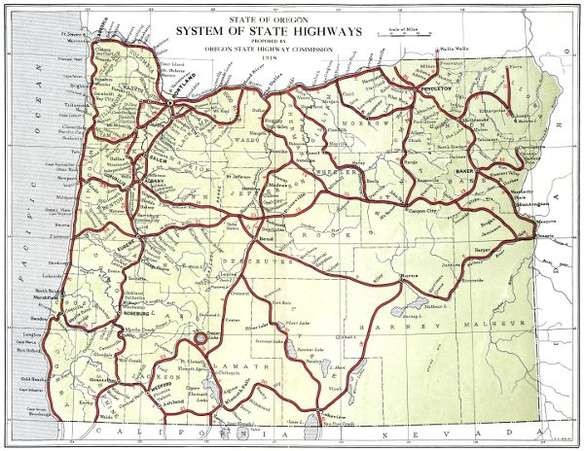
See large-size map (1.4 MB.)

THE PACIFIC HIGHWAY IN PASS CREEK CANYON, DOUGLAS COUNTY.
GRADED AND MACADAMIZED IN 1917 AND 1918
Description of Work of the State Highway Department In the Counties of the State 1917-1918
BAKER COUNTY
Although Baker County is generally well supplied with railroads there are sections still isolated and much in need of improved transportation facilities. Some of the most fertile and productive areas of the County are not served by rail transportation and depend upon roads for communication with railway points. This situation with the character of the winter season and soil conditions found here render improved highways of extreme importance.
Since State and Federal aid have been made available the people of Baker County are fast coming to a realization of the situation and are making strenuous efforts to co-operate in highway improvement. No bond issues have been voted in this County but an example of their enthusiasm is supplied by the fact that private donations for co-operative improvement of one road amount to $15,000.00.
State and Federal aid were extended in 1918 and the co-operation has resulted in plans for improving three sections of the Baker-Cornucopia Highway. Other roads in the County will receive the consideration of the Highway Commission during the coming season.
Four sections of the Baker-Cornucopia Highway have been surveyed, and plans for three of these are nearly complete. Together the four sections make about thirty-eight miles of location survey. Construction work will begin on this road early in the coming season.
Survey of the Baker-Cornucopia Highway
During 1917 and 1918 the State Highway Department surveyed a greater part of the Baker-Cornucopia Highway. The policy of giving first attention to those portions of the road most in need of improvement resulted in the surveying of four separate sections. These sections are designated as follows: Baker-Middle Bridge; Love Bridge-Black Bridge; Canyon and Sag Sections. These surveys were made under the direction of J. O. Kingsley and W. C. Crews, locating engineers for the State Highway Department.
The Baker-Middle Bridge section extends from Baker to a point near Middle Bridge on Lower Powder River. Beginning at Baker the line follows closely the present main traveled road east for about six miles, thence along the Palmer road to the present crossing at Ruckles Creek, thence down Ruckles Creek to a point about two miles south of Keating, thence easterly, leaving Ruckles Creek, and entering the lower Powder River Valley near Middle Bridge. This survey is 18.64 miles in length. The plans for this work are completed.
The Love Bridge-Black Bridge section covers that portion of the route through the canyon between the Keating and Richland districts. At present all traffic passes through Sparta and over the mountains to the north of the Powder River there being no road through the canyon. This survey is about ten miles long and involves heavy and expensive construction. This project begins at a point about seven miles east of Keating and ends about five miles west of Richland. There is a four-mile section of the Baker-Cornucopia Highway lying between Middle and Love Bridges that has not been definitely located. No office work has been done for this survey.
What is known as the Canyon Section extends through the canyon east of Richland. This survey begins at a point 1.5 miles east of Richland and parallels the Powder River along the north bank for a distance of 4.64 miles. The project ends at the point where the proposed route leaves the Powder River and leads over the mountains toward Pine Valley. Plans are almost completed for this project.
The Sag Section is that part of the road leading north from the divide between Powder River and Pine Valley. This survey which is 4.69 miles long begins at the divide and ends at a point in the edge of Pine Valley two miles south of Halfway. The location follows very near the route of the present road. The office work in connection with this survey is nearing completion.
Baker-Cornucopia Post Road Project
The State Highway Commission requested Government aid in the construction of the Baker-Cornucopia Highway and this request has resulted in the approval by the Federal Office of Public Roads of three projects on this highway. These three projects, namely, Baker-Middle Bridge, Canyon Section and Sag Section have a combined length of 27.97 miles, and the total estimated cost of these constructions is $94,731.00. Baker County will co-operate with the State and Government in defraying the cost of this construction. The following tabulation indicates the amounts and segregations of funds for each project.
Appropriated for expenditure in 1919
State
Funds
County
Funds
Government
Funds
Baker-Middle Bridge Section
$ 13,978.00
$ 15,000.00
$ 13,978.00
Canyon Section
8,249.00
6,000.00
8,249.00
Sag Section
11,639.00
6,000.00
11,639.00
Totals
$ 33,866.00
$ 27,000.00
$ 33,866.00
No plans have been made for financing the Love Bridge-Black Bridge Section which was surveyed in 1917. This is an important section of the road and will probably receive early attention from the State Highway Commission.
BENTON COUNTY
During 1917 and 1918, very little work was done by the Highway Department in Benton County. At the request of the County Court a short section of the West Side Highway north of Corvallis was staked for grading to be done by the County, and designs were prepared for three concrete structures. Two of these were for box culverts for the Pacific Highway about five miles north of Corvallis. The other was for an 85 foot reinforced concrete bridge over a mill race south of Corvallis. A short reconnaissance was made of the Corvallis-Newport road between Blodgett and Eddyville.
For work to be done in Benton County in 1919, the Highway Commission has set aside $129,500.00. With this amount it is planned to pave the West Side Highway from Corvallis north to the Polk County Line, approximately seven miles.
CLACKAMAS COUNTY
The work under the supervision of the Highway Department in Clackamas County during 1917 and 1918 has consisted of 4.5 miles of grading between New Era and Oregon City, 7.5 miles of paving between Oregon City and Canby, and 0.2 miles of grading between Oswego and the Multnomah County Line. The first of these jobs was done by the State and County in co-operation; the second was a strictly State job; and the third was a County job supervised by the State.
The total expenditure on the work done in Clackamas County was $198,952.24, of which Clackamas County paid $43,091.14 and the State $155,861.10.
Between New Era and Oregon City, the Pacific Highway has been graded on an entirely new location, paralleling the Southern Pacific Railway along the bank of the Willamette River instead of following the location of the old road farther back from the river, where the grading is not so heavy, but where a number of heavy grades are required. In addition to eliminating these heavy grades, a considerable saving in distance is effected, and the dangerous crossing under the Southern Pacific tracks at Oregon City is avoided.
Grading—Vicinity of New Era
On August 20, 1917, bids were considered by the State Highway Commission for the grading of two and one-half miles on the Pacific Highway near New Era. The most satisfactory proposal received was a cost plus ten per cent proposal submitted by the Warren Construction Company, and a contract was entered into with that firm on the cost plus ten per cent basis.
This work involved the grading of New Era Hill, just south of New Era, and some heavy rock excavation from New Era north. After the work had started, it was decided to pave between Oregon City and Canby, and the contract for this paving let to the Oregon Hassam Paving Company. The most feasible place to secure the crushed rock necessary for this paving was from the rock being excavated under the grading contract with the Warren Construction Company, and the Highway Department entered into an agreement with the paving company, whereby the state would crush the rock from a big cut at New Era, and furnish the crushed rock for the paving upon certain agreed terms, the crushing to be done under the cost plus contract with the Warren Construction Company.
On this basis the work was carried on by the Warren Construction Company until March 1, 1918, at which time it was deemed advisable by the Highway Commission to take the work over and complete it with State forces.
The total cost of the grading and rock crushing was $66,000.00, and the amount received for the crushed rock furnished for the paving was $19,850.00. Clackamas County co-operated with the State on this work, the total amount paid out of County funds being $15,009.91.
[6] Via Klamath Falls.
[5] Via Eugene and McKenzie River Highway.
[7] Via Scottsburg.
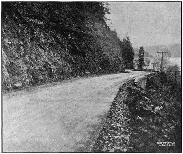
AT THE TOP OF CANEMAH HILL ON THE PACIFIC HIGHWAY IN CLACKAMAS COUNTY.
GRADED AND PAVED IN 1918
Grading—Canemah Hill Section
To complete the grading of the Pacific Highway between Oregon City and Canby preparatory to the paving of this section, Clackamas County agreed to appropriate $25,000.00 toward the grading between Fly Creek and Oregon City, known as the Canemah Hill Section. On December 10, 1917, the Highway Commission received bids for this grading and the lowest bid having been submitted by Clackamas County, the contract was awarded to the County. This piece of work was about one and one-half miles in length and involved some very heavy rock excavation.
There has been expended on this work to date the sum of $24,037.20, of which amount Clackamas County has paid $22,092.53. The work complete will cost approximately $27,500.00. Mr. M. E. DeWitt was the resident engineer in charge.
DETAILED STATEMENT OF EXPENDITURES TO NOVEMBER 30, 1918
GRADING—CANEMAH HILL (Work in progress)
Engineering
$ 1,944.67
Construction—
Clearing and grubbing
$ 500.00
Common excavation, 10,231 cu. yds. at 60c
6,138.60
Intermediate excavation, 8,689.4 cu. yds. at 80c
6,951.52
Solid rock excavation, 7,722.2 cu. yds. at $1.25
9,652.75
12-inch reinforced concrete pipe, 391 lin. ft. at $1.25
488.75
36-inch reinforced concrete pipe, 56 lin. ft. at $4.00
224.00
6-inch porous drain tile, 585 lin. ft. at 10c
58.50
Class A concrete, 48 cu. yds. at $15.00
720.00
Class C concrete, 2 cu. yds. at $12.00
24.00
Rubble masonry, 2 cu. yds. at $1.25
2.50
Overhaul per 100 lin. ft., 54,862 cu. yds. at 2c
1,097.24
Crushed rock for drain tile, 30 cu. yds.
46.20
18-inch concrete pipe in place, 45 lin. ft.
87.15
$ 25,991.21
Less 15 per cent retained pending completion
3,898.68
22,092.53
Total expended to November 30, 1918
$ 24,037.20
Paid by State—engineering
1,944.67
Paid by County—construction
22,092.53
Total
$ 24,037.20
This work is estimated to cost complete
$ 27,500.00
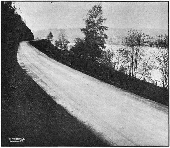
BITUMINOUS PAVEMENT ON THE PACIFIC HIGHWAY SOUTH OF OREGON
CITY IN CLACKAMAS COUNTY. GRADED AND PAVED IN 1918
Paving—Oregon City to Canby
A contract was awarded on September 4, 1917, to the Oregon Hassam Paving Company of Portland, for a sixteen-foot bituminous pavement between Oregon City and Canby, a distance of 7.5 miles.
A considerable part of the crushed rock used in this pavement was furnished by the Highway Department from a rock point which it was necessary to remove in connection with the grading just north of New Era.
The paving of this section is practically complete at this date and the contracting company is to be complimented upon the excellence of its work. The cost of the work completed will be about $135,000.00 of which amount $102,114.85 has been paid.
Mr. M. E. DeWitt acted as resident engineer for the Highway Department on this work.
DETAILED STATEMENT OF EXPENDITURES TO NOVEMBER 30, 1918
PAVING OREGON CITY TO CANBY
Engineering
$ 2,444.57
Construction—
Standard Bitulithic pavement, 70,170 sq. yds. at
$1.26
$ 88,414.20
Stone Shoulders, 68,208 lin. ft. at .05
1⁄
23,751.44
Hauling and placing broken stone furnished by
State, 6,168
1⁄
4cu. yds., at $1.18
7,278.54
Broken stone, loose measure, 12,872
1⁄
4cu. yds., at
$2.37
30,507.23
Installing wooden headers at railroad crossing
24.06
Filling low places after rolling, clearing debris
after forest fire
59.53
Excavating spongy place in subgrade and refilling
67.10
Loading and hauling to bring outside 2 ft. of
roadbed to grade; no material nearby
154.14
Grading 800 feet north from New Era, and
dismantling and loading crusher
1,726.40
Total due contractor for work done to
November 30, 1918
$ 131,982.64
Less 15 per cent retained pending completion
19,797.40
$ 112,185.24
Less plant rock and miscellaneous items furnished
by State
12,514.96
$ 99,670.28
Total expended to November 30, 1918
$ 102,114.85
This work is estimated to cost complete
$ 135,000.00
Oswego to the Multnomah County Line
On April 19, 1918, a contract was awarded by Clackamas County to the Glemorrie Quarry Company of Oswego for the regrading of a 0.2 mile section of the West Side Pacific Highway between Oswego and the Multnomah County Line. At the request of the Clackamas County Court the engineering supervision of this work was handled by the Highway Department, Mr. M. E. DeWitt, resident engineer, on work between Oregon City and Canby, being in charge.
This piece of work eliminated some very bad curves on the old road and greatly improved the grade. The work was completed on September 4, 1918, at a total cost of $5,746.68. Of this amount $507.98 was expended by the State for the engineering. The construction cost of $5,238.70 was paid by the County.
DETAILED EXPENDITURE STATEMENT
Grading—Multnomah County Line to Oswego
Engineering
$ 507.98
Construction—
Clearing and grubbing
$ 200.00
Common excavation, 1,167.3 cu. yds. at 75c
875.47
Intermediate excavation, 2,127.6 cu. yds. at $1.00
2,127.60
Solid rock excavation, 829.5 cu. yds. at $1.85
1,534.58
12-inch plain concrete pipe, 26 lin. ft. at $1.50
39.00
15-inch plain concrete pipe, 76 lin. ft. at $1.80
136.80
18-inch reinforced concrete pipe, 84 lin. ft. at $2.00
168.00
Class C concrete, 5 cu. yds. at $15.00
75.00
Drainage structures under roadbed to protect
embankment and private water supply
82.25
5,238.70
Total cost
$ 5,746.68
Paid by State
$ 507.98
Paid by County
5,238.70
Total
$5,746.68
Oregon City Bridge
The State Highway Department has been requested by the County Court of Clackamas County to prepare plans and estimates for a bridge over the Willamette River at Oregon City. This will replace the old suspension bridge at that place which is too light for the modern traffic conditions in that vicinity.
Surveys and studies of the site are being conducted at this time. In this case, as is customary, the State Highway Department will furnish plans free of cost to the County.
CLATSOP COUNTY
During the period from December 1, 1916, to November 30, 1918, the State Highway Department expended in Clatsop County the sum of $344,387.23. The work accomplished consists of 3.5 miles of bituminous paving, 22.7 miles of broken stone macadam, 1.7 miles of gravel macadam, 1.2 miles of new grading, one covered wood draw bridge, two reinforced concrete bridges, and 1-6x12 ft. reinforced concrete box culvert, all of these improvements being on the Columbia River Highway between Astoria and the Columbia County Line.
Astoria-Svensen Paving
On July 20, 1917, the State Highway Department contracted with the Warren Construction Company for nine miles of paving between Astoria and Svensen. This contract called for a 16-foot bituminous pavement on a crushed rock base and with two-foot macadam shoulders. The contract also included the grading of a section 1.2 miles in length about midway between Astoria and Svensen, this section being known as the John Day Cut-off.
Work was started on the grading of the cut-off on August 6, 1917, and on the erection of the paving plant on August 15. On September 20, the first batch of hot stuff was placed on the road at the Svensen end. The work was just nicely started, however, when the rainy season which came on unusually early, started in and the work had to be discontinued. At this time the work on the grading of the cut-off was but fifty or sixty per cent complete, and only one mile of paving had been laid.
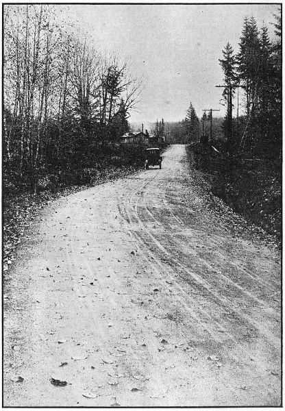
BITUMINOUS PAVING NEAR SVENSON
IN CLATSOP COUNTY ON THE COLUMBIA RIVER HIGHWAY.
PAVED IN 1917
The following season, the roadbed did not become sufficiently dry to permit of resumption of work until about the 15th of June, but even at that late date the contractors were not able to start work on account of the shortage in materials and labor resulting from the participation of the United States in the war, and it was not until July 23 the work was resumed. Continued shortage of labor and material made progress very slow particularly on the placing of rock base, and when the 1918 rainy season came on a total of only 3.5 miles of paving had been completed. The grading of the John Day Cut-off had been finished, however, and considerable progress made on the removal of slides and regrading of roadbed.
The paving was discontinued on October 2 but in order to provide a passable roadbed at as early a date as possible, it was decided to continue the placing of rock base during the winter months. This work is now in progress, and it is expected that a rocked surface over the remaining unpaved distance of 5.5 miles will be secured by about January 1, 1919.
The paving work will be continued again next season, and will undoubtedly be completed early in the season.
It is estimated that the grading and paving of this section will cost completed $236,000.00. The total expenditures to November 30, 1918, amounted to $96,955.97 and there remained unpaid to the contractor for work done to that date the sum of $15,225.64.
The engineering work was in charge of Mr. J. E. Nelson, during the 1917 season, and in charge of Mr. H. N. Hackett during the 1918 season.
Svensen-Westport Macadam
From Westport to Svensen in Clatsop County, 13.55 miles of 16-foot waterbound macadam, 3.6 miles of 9-foot waterbound macadam and 1.76 miles of gravel was laid. This work was handled by the Warren Construction Company prior to December 26, 1917, at which time the State Highway Department took the work over and proceeded with State forces.
On this section the unit costs show a slight advantage in favor of doing the work with State forces. Conditions were practically the same as on the Clatskanie-Westport Section in Columbia County—the State paying higher wages than the contractor, but the contractor having the disadvantage of more unfavorable weather conditions. The main advantage in the State doing this work was gained by having better control of the organization and more direct supervision of the work.
The original intention was to complete all macadam 16-feet wide but the increased cost of labor, supplies, etc., made it necessary to reduce the width of the macadam to nine feet so as to complete the full distance with the money available.
COST STATEMENT—SVENSEN-WESTPORT MACADAM
Item
Unit
Quantity
Cost
Unit
Cost
By Warren Construction Co., on cost
plus contract—
Clearing and grubbing
Acres
1
$ 112.18
$ 112.18
Excavation
Cu. Yd.
9,069
6,468.95
.71
6-inch by 12-inch pipe
Foot
1,519
4,472.69
2.90
Waterbound macadam
[8]Cu. Yd.
13,409
53,010.60
3.95
Engineering
...
...
971.84
...
By State Forces—
Excavation
Cu. Yd.
11,512
7,540.71
.64
6-inch by 12-inch pipe, laying only
Foot
1,760
328.80
.19
Waterbound macadam
Cu. Yd.
34,722
134,022.23
3.86
Engineering
...
...
1,651.69
...
Total
...
...
$ 208,579.69
...
[8] Including 1,839 cubic yards of gravel purchased at a cost of $1,839.00 and 5,278 cubic yards crushed rock purchased at a cost of $6,333.60. All other rock was crushed and cost of crushing is included in the cost of the macadam.
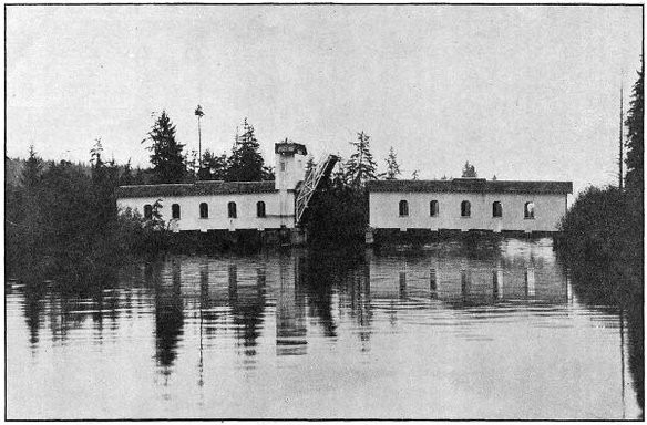
COVERED WOOD DRAWBRIDGE ON THE COLUMBIA RIVER HIGHWAY IN
CLATSOP COUNTY,OVER THE JOHN DAY RIVER EAST OF ASTORIA.
BUILT IN 1918. LIFT SPAN—40 FEET
John Day River Bridge
As a part of the improvement of the Columbia River Highway between Astoria and Svensen, a bridge was constructed over the John Day River about four miles east of Astoria.
The John Day River is a stream navigable to small boats, so it was necessary to provide a movable span of 40-foot clear opening. Owing to the unusually high price of steel it was decided to construct this bridge of wood. The movable span is of the single leaf bascule type operated by a windlass. Counter weights are employed to assist the movement of the span and in order to compensate for the variable pull required to lift the span at different phases of its movement, the counter weight cables operate over spiral drums in such manner that their pull is a maximum when the span is down, and is least when the span is raised, gradually changing between the two extremes. In order to guard against failure of the operator to close the gate on the side of the stream opposite the machinery, an automatic gate was constructed. It closes when the bridge starts to open and when the bridge closes it swings back out of the way automatically.
The bridge rests on concrete piers carried on piling, and besides the lift span there are two 90-foot covered wooden spans. The operating machinery is completely housed in by means of a tower.
The crossing was designed to carry 20-ton trucks and the covered spans have laminated wood floors with asphaltic wearing surface.
One of the most serious objections raised against covered wooden bridges is the lack of light. This was overcome in this case, as in other wooden bridges on primary roads designed by this Department, by whitewashing the interior and the addition of open windows at panel points. These are provided with returns, and with the asphaltic wearing surface on the floors of such bridges prevent moisture coming in contact with the structural timbers of the bridge.
This bridge was built by the Portland Bridge Company and the total cost will be about $25,000.00. The payments on the bridge to November 30, 1918, amounted to $21,051.52. Mr. Leigh M. Huggins was resident engineer in charge of construction.
Big Creek Bridge
This bridge is located on the Columbia River Highway near Knappa. It consists of two forty-five-foot reinforced concrete spans, and was built by the State Highway Department with State forces at a cost of $8,446.70.
Plympton Creek Bridge
The Plympton Creek Bridge is located on the Columbia River Highway in the town of Westport. It is a two thirty-foot span structure and was built by the State Highway Department with State forces at a cost of $6,413.19.
Little Creek Culvert
This is a 6 by 12 reinforced concrete structure and is located on the Columbia River Highway near Knappa. It was built by the Highway Department with State forces at a cost of $929.69.
COLUMBIA COUNTY
The State Highway Department expended in Columbia County during 1917 and 1918, the sum of $488,302.15, which is the largest amount expended in any one county in the state. With this amount the following work was completed:
2.5
miles of bituminous paving.
27.2
miles of broken stone macadam.
8.2
miles of grading.
11
reinforced concrete bridges.
2
reinforced concrete box culverts.
All of this work is on the Columbia River, and all but the 2.5 miles of paving is between the Clatsop County Line and a point about two miles east of Goble.
Multnomah County Line-Scappoose Paving
A contract was awarded to the Warren Construction Company, August 22, 1917, for 2.5 miles of bitulithic pavement sixteen feet wide on crushed rock base, with two foot macadam shoulders. The old road bed on this section was in excellent condition for base for pavement being old macadam about sixteen feet in width. The grade was followed closely, scarified, and clean crushed rock spread over the entire surface and rolled. Material was borrowed along each side to obtain the required twenty-four foot of roadbed.
A sixteen foot span wooden bridge was replaced by an 8x10 feet reinforced concrete culvert built by Lindstrom Bros. on the basis of cost plus ten per cent.
CONSTRUCTION COST OF CULVERT
Class A concrete, 64 cu. yds. at $22.43
$ 1,435.64
Reinforcing steel, 2,900 lbs. at 8c
232.00
$ 1,667.64
Contractors percentage
166.96
Total Cost
$ 1,834.60
Paving work was started November 5, 1917, and completed December 20, with the exception of about 200 feet of new fill made at the culvert which was completed in June, 1918.
Engineering work was done by P. W. Marx, under the supervision of Chas. H. Whitmore, assistant engineer.
DETAILED EXPENDITURE STATEMENT—PAVING—MULTNOMAH
COUNTY LINE TO SCAPPOOSE
Engineering
$ 1,364.28
Right-of-way attorney fees
35.00
Contract Construction Work as follows:
Common excavation, 800 cu. yds. at 45c
$ 360.00
Standard Bith. pavement, 24,248.2 sq. yds. at $1.17
28,370.39
Broken stone, loose measure, 3,115.5 cu. yds. at
$1.90
5,919.45
Broken stone shoulders, 26,974 lin. ft. at 5c
1,348.70
Force account:
34 feet of 12-inch corrugated iron pipe and
120 feet of 6-inch porous drain tile
254.77
Total paid to contractor
$ 36,253.31
Total cost
$ 37,652.59
Westport-Clatskanie Macadam
On the Clatskanie-Westport Section, which extended from Clatskanie to the Clatsop County Line, the work was handled originally by the Warren Construction Company, on a cost plus ten per cent. basis. The State Highway Department took this work over December 26, 1917, and from that time on the work was handled by this Department. This work consisted of 8.62 miles of sixteen-foot waterbound macadam.
On this section the costs show that the Warren Construction Company laid crushed rock slightly cheaper than the State. However, the State did all the finishing on this section, which is more expensive than laying the base rock and it was necessary to raise the wages twenty-five per cent. after the work was taken over by the Department. C. L. Grutze was resident engineer on this work.
COST STATEMENT—WESTPORT-CLATSKANIE MACADAM
Item
Unit
Quantity
Total cost
Unit cost
By Warren Construction Co. on cost
plus contract—
Clearing and grubbing
Acres
1⁄
2$ 49.87
$ 99.74
Excavation
Cu. yd.
6,200
6,820.70
1.10
6-ft. by 12-in. drain pipe
Foot
1,085
2,752.38
2.80
Water-bound macadam
[9]Cu. yd.
7,742
27,698.87
3.59
Engineering
497.03
By State Forces—
Excavation
Cu. yd.
8,299
5,594.75
.67
6-ft. by 12-in. drain pipe (laying)
Foot
298
21.05
.07
Water-bound macadam
Cu. yd.
17,977
68,168.50
3.79
Engineering
25.09
Total cost
...
...
$ 111,628.24
...
[9] 4,972 cu. yds. purchased at cost of $5,966.40, all other rock crushed on this job.
Clatskanie-Delena Macadam
The section extending from a point three miles east of Clatskanie to a point two and one-half miles east of Delena, known as the Clatskanie-Delena Section, was completed by L. O. Herrold on a basis of cost plus ten per cent. This work consisted of eleven miles of sixteen foot waterbound macadam, one and one-tenth miles of nine foot waterbound macadam and all necessary grading, drainage, etc. The foundation on part of this section was very poor and 10,233 cubic yards of rubble base was used in order to make satisfactory foundation for macadam. While this increased the cost of the macadam, it was the only way in which a permanent foundation could be secured on this section. P. M. Hall-Lewis was resident engineer on this work.
COST STATEMENT—CLATSKANIE-DELENA MACADAM
(COST PLUS 10 PER CENT)
Item
Cost
Engineering
$ 5,998.96
General construction
11,759.14
Clearing and grubbing
892.37
Excavation and embankment
22,529.95
Drainage structures
3,596.27
Miscellaneous structures
1,454.76
Quarrying and crushing
43,714.47
Placing, rolling, sprinkling, etc.
46,502.97
Camp construction and operation
111.51
Total
$ 136,560.40
This work includes 25,405 cubic yards of excavation, 22,170 cubic yards of crushed rock macadam and 10,298 cubic yards of rubble base, besides numerous small structures, drains, etc.
Delena-Goble Macadam
Clark & Dibble of Rainier contracted with the Highway Department to construct five and seven-tenths miles of broken stone macadam between Delena and Goble. The prices at which this work was taken by the contractors was very low, and the result was that almost from the first the work was handicapped by lack of proper finances. It became evident to the Department that the contractor would be unable to complete all of this work before the winter rains set in, so to facilitate matters and to provide a passable road for the winter, the Department took over the part of the work between Rainier and Goble after about $10,000.00 worth of work had been done on this part by Clark & Dibble. The work of the Highway Department on this section is described in the article on the Rainier-Goble macadam.
Clark & Dibble successfully carried to completion the two and one-tenths miles of macadam west of Rainier. A complete statement of the costs of the work handled by the contractors is given below.
DETAILED EXPENDITURE STATEMENT—
MACADAM—DELENA TO GOBLE
Engineering
$ 2,519.50
Construction—
Common excavation, 938 cu. yds. at 40c
$ 375.20
Intermediate excavation, 75 cu. yds. at 60c
45.00
Solid rock excavation, 25 cu. yds. at $ 1.15
28.75
Broken stone macadam, 12,911.5 cu. yds. at $ 2.18
28,147.07
12-inch corrugated iron pipe, 420 lin. ft. at $ 1.30
546.00
Clay filler, 1,403 cu. yds. at $ 1.00
1,403.00
Force Account—
Lowering 18-inch corrugated iron culverts
55.78
Lengthening existing culverts and opening
ditches
15.62
18-inch corrugated iron pipe, 80 lin. ft.
235.43
Clearing slides and ditching near Prescott
2,201.47
Removal of slides
1,377.22
Side ditches for macadam work
336.97
Preparation of subgrade for macadam
330.65
Spreading, sprinkling, and rolling macadam
27.07
35,125.23
Less credit for 24 days use of State roller at $ 5.00
120.00
Total amount paid to contractor
35,005.23
Total cost
$ 37,524.73
Rainier-Goble Macadam
In Columbia County the State Highway Department laid twenty-four and one-tenth miles of sixteen foot waterbound macadam and four and two-tenths miles of nine foot waterbound macadam between Goble and the Clatsop County Line. Of this the Rainier-Goble Section was taken over from the contractors, Clark & Dibble, after being partly completed. This was done in order to facilitate the work and get the road open for traffic before the rainy season.
While the work done by the State on this section cost more per cubic yard than the contractor was originally receiving, the actual difference in cost for the job was not sufficient to justify the Department in allowing the contractor to proceed with the work which would have entailed leaving the road closed to traffic for another winter.
COST STATEMENT—RAINIER-GOBLE MACADAM (STATE FORCES)
Item
Unit
Amount
Cost
Unit
Cost
Engineering
$ 382.85
Intermediate Excavation
Cu. yds.
1,078.97
.72
Quarrying and crushing
Cu. yds.
2,555
3,828.71
1.29
Hauling stone
Cu. yds.
2,555
3,243.99
1.27
Placing and rolling
Cu. yds.
2,555
2,979.22
1.17
Camp construction and operation
719.27
General construction
197.34
Total
...
...
$ 12,430.35
Goble Macadam Work
A contract was awarded to Warren Construction Company September 4, 1917, for macadamizing the Goble Cut-off on a basis of cost plus ten per cent.
Columbia County has a quarry on the old road about three-fourths of a mile west of Goble, which was equipped with complete crushing outfit and arrangements were made by the contractor for the use of this equipment and all the rock for this job was crushed and hauled from this quarry.
Work was started March 1, 1918, and completed June 25, 1918.
Engineering work was done by H. C. Compton as resident engineer under the supervision of Chas. H. Whitmore.
COST STATEMENT
Construction engineering
$ 548.12
Excavation and embankment
137.24
Drainage
21.11
Quarrying and crushing (6,504 cu. yds. crushed)
9,627.92
Spreading and rolling (6,504 cu. yds.)
5,913.53
Hauling (6,504 cu. yds)
4,371.62
Camp construction and operation
545.61
Corral construction and operation
313.82
Total cost
$ 21,478.97
Goble Grading Section
A new location of the Columbia River Highway was made from a point two miles east of Goble to Goble Creek and a new concrete bridge built over Goble Creek, making a saving in distance of about one-half mile and doing away with several excessive grades, sharp curves and narrow roadbed, also a dangerous bridge and trestle across Goble Creek.
A rock cut between Goble and Goble Creek was taken out by the S. P. & S. Ry. Co. with steam shovels and the material used by them for riprap, thus making a considerable saving to the State Highway Commission. The material for the west approach to the new bridge was obtained by blasting and barring down rock from a dangerous perpendicular cliff about 1,000 feet west of the bridge, from which large rocks had fallen onto the highway. To make the highway safe it was necessary to remove this material and by using it in the bridge approach, did away with other borrow which would have been necessary. The cliff is about 200 feet high with the highway and S. P. & S. Ry. side by side at the foot, necessitating very light shots and careful work and was completed without accident to men or interruption of traffic on the railroad.
[9] 4,972 cu. yds. purchased at cost of $5,966.40, all other rock crushed on this job.
[8] Including 1,839 cubic yards of gravel purchased at a cost of $1,839.00 and 5,278 cubic yards crushed rock purchased at a cost of $6,333.60. All other rock was crushed and cost of crushing is included in the cost of the macadam.
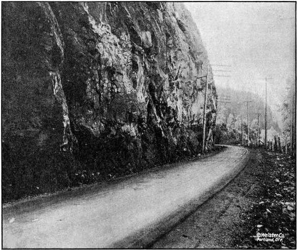
ON THE COLUMBIA RIVER HIGHWAY NEAR GOBLE IN COLUMBIA COUNTY.
GRADED AND MACADAMIZED IN 1917 AND 1918
The material for the east approach was obtained by trimming up the cut left by the railroad company.
A contract for grading the cutoff was awarded to the Warren Construction Company, August 7, 1917, and work started in July, 1917. From the east end of the section to Ruben, about one mile in length, the material was handled by teams. Rock work at Ruben and at Goble was sub-let to station men. The fill across the flat between Ruben and Goble was made from side borrow, by using a steam hoisting engine, with boom and clam shell bucket. This work was done in the fall and winter and the material was light loam and sand and very wet, and did not pack very solid in the fill, therefore a strip of rock sixteen feet wide and one foot in thickness, taken from the rock cuts at either end, was placed on the fill and rolled thus making a solid base for the crushed rock macadam.
The engineering work was done by A. F. Pratt, resident engineer and W. E. Eddy, assistant state highway engineer, until October 1, 1917, when it was taken over by H. C. Compton, resident engineer, under the supervision of Chas. H. Whitmore, assistant engineer.
DETAILED EXPENDITURE STATEMENT—GRADING GOBLE SECTION
Engineering
$ 2,925.64
Guarding S. P. & S. Ry. tracks
527.02
Right-of-way damages
73.56
Rental on State Industrial Ry. track furnished contractor
138.00
Payments to contractor for work as follows:
Clearing and grubbing
$ 2,085.00
Common excavation, 20,106.5 cu. yds. at 45c
9,047.92
Intermediate excavation, 3,534.9 cu. yds. at 70c
2,474.43
Solid rock excavation, 11,947.2 cu. yds. at $1.15
13,739.28
12-inch reinforced concrete pipe, 560 lin. ft. at $1.50
840.00
24-inch reinforced concrete pipe, 92 lin. ft. at $3.30
303.60
36-inch reinforced concrete pipe, 80 lin. ft. at $5.30
424.00
Overhaul per 100 lin. ft., 18,032 cu. yds. at 2c
360.64
Force account—
Replacing trestle for Warren Packing Co.’s
plant, Goble
256.00
Borrowing approximately 400 cu. yds. rock to
cover dirt fill
506.08
Removal of overhanging rock near Goble Creek
bridge
6,454.32
Widening grade and building fill from Goble
postoffice to Goble Creek bridge
5,853.31
Cutting off rock point to give safe sight
distance around curve
47.12
Removal of slide west of Goble Creek
18.66
Placing 400 feet drain tile in quicksand
137.01
Placing timber foundation for culvert
51.05
Total paid to contractor
$ 42,598.42
Grand total cost
$ 46,262.64
Rainier Hill Grading
On July 30, 1917, a contract was entered into with A. L. Clark of Rainier for the widening of the Rainier Hill Section, a section two and two-tenths miles in length, located just west of Rainier. This work was let under a unit price contract, but the nature of the work was such that a considerable part of it could not be fairly measured and paid for on a unit, and on this part the contractor was allowed cost plus ten per cent. The total cost of this improvement was $6,350.61. A detailed cost statement follows:
DETAILED EXPENDITURE STATEMENT—GRADING—RAINIER HILL SECTION
Engineering
$ 468.38
Construction—
Common excavation, 1,925 cu. yds. at 30c
$ 577.50
Intermediate excavation, 1,071.9 cu. yds. at 48c
514.51
Solid rock excavation, 1,039.7 cu. yds. at $1.25
1,299.62
Overhaul per 100 lin. ft., 905 cu. yds. at 3c
27.15
12-inch corrugated iron pipe, 228 lin. ft. at $1.00
228.00
Force account—
Excavation for cribbing and placing rip-rap
61.93
8-foot extension to 36-inch culvert
54.63
Widening old roadbed, removal of slides and general
improvement work not subject to measurement
3,082.56
Culvert pipe furnished by State
36.33
5,882.23
Total cost
$ 6,350.61
Beaver Valley Grading
Before the Columbia River Highway through Beaver Creek Canyon between Delena and Inglis was opened for traffic in July, 1918, in order to reach Clatskanie from Delena, it was necessary to travel over a narrow, dangerous, earth and corduroy road, either by way of Maygar and Quincy or through the hills about eight miles into Clatskanie. Both of these roads were passable for autos only about three months during the dry season.
The grading of this section was partly completed by the County under supervision of Mr. Bowlby, State Highway Engineer in 1914. This section being a very important link in the Columbia River Highway and no funds being available from County or State funds during 1915 or 1916, S. Benson decided to advance the necessary funds to make this section passable. About four miles of grading was completed between Inglis and Delena, leaving only the building of bridges to open this section. This work was later macadamized by the State.
The engineering work was done by A. K. Grondahl.
A bill was passed by the 1917 Legislature refunding to Mr. Benson $20,978.22 which is a large portion of the amount expended by him.
COST STATEMENT
Clearing and grubbing
$ 1,265.80
Grading—labor and teams
17,124.07
Explosives
2,275.31
Pipe culverts
313.04
Total
$ 20,978.22
Prescott Hill Section
This section of the highway was built along the steep hillside, several slides having occurred narrowing the roadbed in some places to about eight feet and making it very dangerous, it was necessary to build several retaining walls, half viaducts and guard fences.
This was done by Oscar Lindstrom on a basis of cost plus ten per cent.
A half-viaduct seventy-five feet in length was built containing fifty-three cubic yards of concrete and 4,100 pounds reinforcing steel, with standard bridge railing for guard fence.
Two hundred and fourteen linear feet of rubble masonry walls were built on a slope of three-fourths to one, and standard bridge railing placed on top for guard fence. These walls contain 438 cubic yards of rock.
A reinforced concrete crib forty-one feet long, fifteen feet high and seven feet wide was built and filled with large rock. The members were cast on the dock in Rainier and hauled to the location. A reinforced concrete slab on solid earth foundation was used for footing, on the required angle to give the crib a batter of one-fourth to one.
The total cost of the Prescott Hill improvement was $9,039.86.
Goble Creek Bridge
A ninety-foot reinforced concrete bridge was built over Goble Creek on the Columbia River Highway about one-half mile east of Goble. This bridge has a pile foundation which was put in by the Warren Construction Company on a cost plus basis for $1,583.32. The superstructure was built by Lindstrom and Fiegeson on a unit price basis. The cost of the structure complete was $5,907.14.
The engineering work in connection with this work was handled by H. C. Compton, resident engineer, on the Goble Section, and the inspection of the placement of steel and pouring of concrete was in charge of L. M. Huggins.
COST STATEMENT—GOBLE CREEK BRIDGE
Engineering
$ 77.47
Construction—
Class A concrete, 135 cu. yds. at $18.40
$ 2,447.20
Reinforcing steel, 17,925 lbs. at 7
1⁄
2c
1,344.38
Concrete hand rail, 186 lin. ft. at $1.75
325.50
Construction of cement shed and unloading cement
129.27
Pile foundation (force account)
1,583.32
Total construction cost
5,829.67
Grand total cost of bridge
$ 5,907.14
Beaver Creek Bridges
For a considerable distance between Rainier and Clatskanie the Columbia River Highway follows Beaver Creek, crossing the creek in many places. To replace a number of temporary wooden structures and to provide bridges at every crossing, the highway department in 1917 and 1918 constructed nine reinforced concrete bridges across this stream. The spans of these structures vary from thirty to 105 feet, there being one thirty-foot, one fifty-foot, two sixty-foot, four seventy-foot and one 105-foot spans in all.
The thirty-foot span structure was built by L. O. Herrold of Salem, on a cost plus ten per cent basis and cost $3,600.00.
The other eight structures were built by L. O. Herrold of Salem, on a unit price basis, the cost of the eight being $32,000.00.
Graham Creek Culvert
A double 6x6 foot reinforced concrete box culvert was built on the Columbia River Highway to provide passage for Graham Creek near Marshland. This culvert was built with State forces. It contains fifty cubic yards of concrete and cost $804.49.
Survey—Columbia City to Scappoose
A survey was made between Scappoose and McBride a distance of eleven and two-tenths miles. This survey follows the S. P. & S. Ry. on the south side the entire distance and is shorter than the present traveled road by about one mile, and also does away with six grade crossings. While most of the roadbed will be entirely new work, it will not be of heavy construction, the country being comparatively flat. Between Scappoose and St. Helens the material is mostly earth. Between St. Helens and McBride the material is mostly rock.
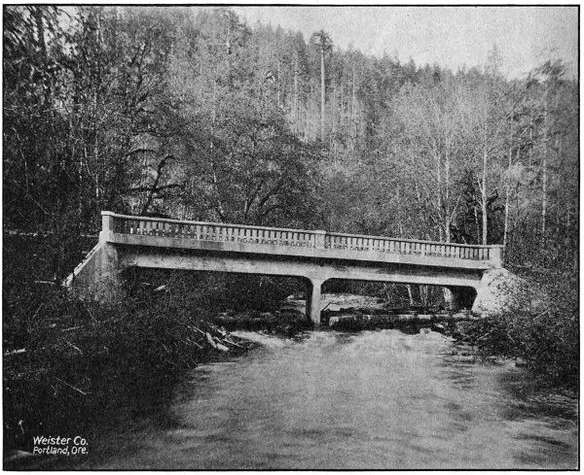
ONE OF NINE REINFORCED CONCRETE BRIDGES IN THE BEAVER CREEK VALLEY, COLUMBIA COUNTY,
ON THE COLUMBIA RIVER HIGHWAY BETWEEN RAINIER AND CLATSKANIE.
ALL BUILT IN 1917 AND 1918
Two bridges of thirty foot spans or more are needed, also several box culverts and pipe culverts.
The survey from Scappoose to St. Helens was made by P. W. Marx; from St. Helens to McBride by H. C. Compton.
COOS COUNTY
The work of the Highway Department in Coos County consisted entirely in assistance given the County in the making of surveys and the engineering of construction work done under the County’s bond issue of $362,000.00. For this purpose $16,967.68 of State funds were expended, and the total amount of County expenditures audited and vouchered through the Highway department was $170,781.83. These expenditures were made on work on the Coast Highway between Marshfield and the Curry County Line, and on the Coos Bay-Roseburg Highway between Coquille and Myrtle Point. The engineering work was in charge of R. B. Murdock.
CROOK COUNTY
Crook County is one of the districts of Eastern Oregon where the road program is an expensive one. Prineville now has rail communication with outside points, and in sections of the County there is found some good natural roads, but much is wanting in the line of transportation facilities. Owing to a large portion of the County being mountainous in character, much of the roads are little else than trails.
Formerly the boundaries of Crook County encircled an area now comprising several counties. The paring process, caused by the forming of new counties left Crook County in a peculiar position. The local road map indicates that the County is divided into two communities with the dividing line following the rugged country a few miles east of Prineville. A single road that is a succession of heavy grades and poor alignment, is the sole medium of traffic communication between the two ends of the County.
The people of Crook County are fully aware of the importance of highways. Although local funds will not go far, a remarkable beginning has been made. A County bond issue of $95,000.00 has been voted for road construction. The general progressiveness and co-operative spirit existing throughout the County is shown by the fact that $85,000.00 of the bond issue is to be expended on one road. Reference is made to the proposed road up Crooked River from Prineville, connecting the east and west end of the County.
The State Highway Commission has ordered a location survey made of the Crooked River Highway between Prineville and the Shorty Davis Ranch. The length of this line will be about thirty miles, and practically a water grade can be secured. This work will start easily in 1918.
The immediate purpose of the survey is to gather definite data for the consideration of the State Highway Commission. The County authorities have made application for State aid and request early consideration of the matter.
The State Highway Commission is cooperating in the construction of the Ochoco Forest Road in Crook County.
Ochoco-Canyon Forest Road
The State Highway Commission extended aid to Crook County by helping to secure Federal aid and by appropriating State funds for the construction of a nine and seven-tenths mile section of the McKenzie River Highway between Prineville and Mitchell. This section is adjacent to the Wheeler County Line and connects up with proposed grading work in Wheeler County.
Construction work is in progress under the direction of the United States Office of Public Roads. The cost of this work will be defrayed by co-operative funds from the State, County and Government. The total estimated cost is $52,500.00. The following statement shows the appropriations made for this work:
Total estimated cost of work
$ 52,500.00
Appropriated by State
17,500.00
Appropriated by Government
17,500.00
Appropriated by County
17,500.00
CURRY COUNTY
The most important highway in this County is, of course, the Coast Highway, which affords an outlet to California on the south and Coos Bay on the north. Between the Coos County Line and Port Orford the route of the Coast Highway lies along the foot of the mountains and on a comparatively level plain and, except in a few cases at river crossings, the grades of the present road are not excessive. The alignment could be improved but is satisfactory for the present. A gravel surfacing on this section makes it passable the whole year round.
South of Port Orford the topography of the County changes. The slopes are steep; in many cases reaching forty degrees, and are badly broken up. This section is also subject to slides of which there is abundant evidence of recent activity. The drainage being at right angles to the coast must be crossed by the highway requiring considerable rise and fall in the grade line.
A survey from Port Orford south was commenced in December of 1917. A line was located and staked ready for construction between Port Orford and Hubbard Creek, eliminating steep grades and sharp curves on the present road. A close preliminary line was run between Hubbard Creek and Mussel Creek (Arizona Inn), a thorough study made of the conditions and the following route recommended, which eliminates the excessive grades and high summit of 1,100 feet of the present road. The location lies between elevation 100 and 400, dropping into and crossing drainage as it is met, following close to the beach until Brush Creek is reached, then following up Brush Creek on the east side of Humbug Mountain until an intersection with the present road is reached, straightening out present road for about one mile, then following the coast between elevation 200 and 400, dropping into Mussel Creek.
The controlling points on this route are the slides which must be headed to secure a stable roadbed. A twelve-foot roadbed has been proposed for this project, with maximum six per cent grades and the construction even for this narrow width is heavy as it will be necessary to bench out the entire width of the roadbed on solid ground, the slopes being too steep for fill to catch. Considerable bridging is required and a gravel surface provided throughout the entire length to insure an all year road, so the cost of even this narrow roadbed will be high.
A beach route located about ten feet above high tide has been proposed, and, while this has the advantage of shorter distance and no rise and fall, this route is not believed to be feasible because the underlying rock is soft and disintegrates readily and is eroded by tidal action to a considerable extent. The numerous slides at this elevation would also make construction on this location inadvisable for a permanent road.
A reconnaissance was made between Mussel Creek and Gold Beach. After leaving Mussel Creek, considerable development work is required to attain standard grade, and but a small portion of the present road could be used. Passing Euchre Creek, there will be utilized along Cedar Creek a new section of road about eight miles in length which has been recently graded by the County. If widened and the alignment corrected in a few locations, this would afford a direct route to the Rogue River where a ferry runs regularly. Between the river crossing and Gold Beach there is a fair road requiring only straightening out and widening.
A large portion of the total area of Curry County is in the forest reserve making the taxable area relatively small. For this reason and in view of the heavy cost of construction, aid is asked by the County from State and Federal sources. The most needed improvement is the section between Port Orford and Brush Creek. In view of the increasing probability of the Coast Military Highway by the Federal Government, which would be a great benefit to this County as well as to the State in general, it is desired to construct such sections as are undertaken on the correct location and standard grades, so that future widening and surfacing only will be necessary to bring it to the high standards which will undoubtedly be maintained on this military highway.
It has been proposed by the Commission to co-operate with the Forest Service in a joint Forest Aid Project in Coos and Curry Counties, each contributing $50,000.00, the Forest money to be spent in northern Coos County and the State money, between Port Orford and Brush Creek. Curry County has offered to co-operate with County tax funds. It is hoped that this project can be carried out during the 1919 season.
DESCHUTES COUNTY
Bend-Lapine Cinder Macadam
During the year 1917, an appropriation was made by the Highway Commission for the construction of cinder macadam between Bend and Lapine. This work was advertised and, proposals were received on August 7, 1917. As the bids submitted at that time were not considered favorable, all were rejected, and the work was undertaken under the supervision of the County Court.
This section, which had been graded under a previous administration, passes through a flat, pine district, with a surface formation of volcanic ash, which is a very poor road material, roads without surfacing becoming practically impassable during the summer season.
As no rock or gravel was available for macadamizing, scoria or volcanic cinder was used, of which material there is an inexhaustible supply along the right-of-way. This scoria is very light, weighing about 1,700 pounds per cubic yard. It, however, has made an excellent macadam, and because of its lightness can be handled and placed cheaper than either rock or gravel. The results are as favorable as if the best pit-run gravel could have been had.
A total of 18,300 cubic yards of cinder macadam was placed on this section and twelve and five-tenths miles of completed surface was secured. The total cost was $20,183.60, giving a unit cost of approximately $1,600.00 per mile, which is proof of the economy of this type of construction where volcanic cinder is obtainable.
Survey—Rolyat to One Hundred Mile Road
In September and October, 1918, the State Highway Commission made a location survey on the section of the Bend-Burns Highway between Rolyat, in Deschutes County and the One Hundred Mile Road, in Harney County. The object of the survey at this time is to secure a more direct route and to avoid the bad section of the present road through the Glass Buttes district. The length of this survey is seventeen and one-tenth miles and it materially shortens the distance, as compared with the present road between the terminal points mentioned.
Fifteen and six-tenths miles of this line are in Deschutes County and one and five-tenths miles in Harney County. The northeast corner of Lake County is touched by the survey but only for a short distance. The definite limits are not shown as the County Lines could not be found and it was deemed not advisable to go to the cost of reestablishing the lines for the purpose of the survey. The new location leads in an easterly direction from Rolyat and continues to the north of the present road.
The plans for this survey will be made up in the near future. H. B. Wright was the locating engineer in charge.
DOUGLAS COUNTY
As a result of the liberal co-operation of Douglas County, a very large amount of work has been done during 1917 and 1918 on the Pacific Highway across that County. From a $500,000.00 bond issue the County set aside $200,000.00 for the improvement of the Pacific Highway north of Roseburg, with the understanding that the Highway Department would expend an equal amount on the same highway south of Roseburg. In accordance with this arrangement, it was agreed that the County would grade 10.4 miles between Yoncalla and Oakland, grade and macadamize 4.6 miles between Comstock and Leona, and grade 2.4 miles between Comstock and the Lane County Line; and that the State would grade 12.8 miles between Myrtle Creek and Dillard and macadamize 2.4 miles between Comstock and the Lane County Line. It was further agreed that if the County would cooperate with the State and Federal Government to the amount of $23,000.00 on the Canyonville-Galesville Forest Road Project, this amount would be considered a part of the $200,000.00 to be provided by the County in connection with the general scheme of improvement outlined.
All of the work contemplated in this co-operative agreement has been carried to completion, and when final payments have been made the total expenditure by the State will be approximately $205,000.00 and by the County $175,000.00.
The Canyonville-Galesville Forest Road Project referred to above involves the grading of a 9.7 mile section over Canyon Creek Pass, and it will eliminate one of the very worst stretches on the Pacific Highway between Portland and the California Line. This is estimated to cost $211,000.00, of which the County will pay $23,000.00, the State $94,000.00 and the Federal Government $94,000.00.
In summary, the improvement work on the Pacific Highway in Douglas County during 1917 and 1918, including the work now under way, consisted of 39.9 miles of grading and 7.0 miles of macadamizing.
The expenditures on the individual sections by the County, State and Federal Government when final payments are completed, will be approximately as follows:
Sections
By
State
By
County
By
Federal
Govt.
Total
Lane County Line-Comstock
Grading
$ 2,027.30
$ 17,119.44
...
$ 19,146.74
Lane County Line-Comstock
Macadam
15,185.09
...
...
15,185.09
Comstock-Leona Grading and
Macadam
5,650.28
74,349.72
...
80,000.00
Oakland-Yoncalla Grading
17,565.28
83,530.84
...
101,096.12
Myrtle Creek-Dillard Grading
120,000.00
...
...
120,000.00
Canyonville-Galesville Grading
94,000.00
23,000.00
94,000.00
211,000.00
Umpqua River Bridges
45,500.00
...
...
45,500.00
Total
$ 299,927.95
$ 198,000.00
$ 94,000.00
$ 591,927.95
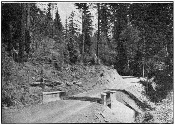
BRIDGE ON PASS CREEK—20 FT. SPAN. ON PACIFIC HIGHWAY NEAR
COMSTOCK IN DOUGLAS COUNTY
Grading—Comstock to the Lane County Line
This section runs through the northern portion of the Pass Creek Canyon, and has been the dread of tourists heretofore. It has always been a hard road to travel under summer conditions and absolutely impassable in winter, even for horse-drawn conveyances.
The contract for this improvement involved 2.4 miles of grading and was awarded to S. S. Schell of Oakland, Oregon on September 5, 1917. The bulk of the grading was done that fall and the job was completed in the spring of 1918. The road bed was graded to a width of 24 feet with 5 per cent maximum grades and easy curves. In addition to the grading, the contract included two drainage structures over Pass Creek, one a double 6x6 reinforced concrete box culvert and the other a 20-foot reinforced concrete bridge. All construction charges were paid by Douglas County. Engineering charges were paid by the State.
Mr. E. B. Bishop was the Resident Engineer in charge on this section.
DETAILED EXPENDITURE STATEMENT—GRADING COMSTOCK TO LANE
COUNTY LINE
Engineering
$ 2,029.80
Construction—
Clearing and Grubbing
$2,400.00
Common Excavation, 11,688 cu. yds. at 45c.
5,259.60
Intermediate Excavation, 6,085 cu. yds. at 60c.
3,651.00
Solid Rock Excavation, 1,016 cu. yds. at $1.15
1,168.40
Overhaul per 100 ft., 7,220 cu. yds. at 3c.
216.60
12-inch Plain Concrete Pipe, 134 lin. ft. at $1.00
134.00
24-inch Reinforced Concrete pipe, 160 lin. ft. at $2.50
400.00
6-inch Porous Drain Tile, 591 lin. ft. at 20c.
118.20
Class A Concrete, 120.46 c. y. at $24.00
2,891.04
Class B Concrete, 11.62 c. y. at $16.00
185.92
Metal Reinforcement, 7,625 lbs. at 8c.
609.84
Repairing Timber Bridge
26.34
Laying 315.5 lin. ft. of Drain Tile and Backfilling
56.00
Total paid to Contractor
17,116.94
Total Cost
$ 19,146.74
Paid by County
17,119.44
Paid by State
$ 2,027.30
Total
19,146.74
Macadam—Comstock to Lane County Line
On August 6, 1918, a contract was awarded to S. S. Schell for macadamizing the above newly graded section in Pass Creek Canyon, by the State Highway Commission, same to be a standard three course broken stone, water bound surface. This work was carried through in a very able manner on the part of the Contractor and completed November 16, 1918. This surfacing makes an all year road, of one of the worst pieces of road in the State. The entire cost of this work was paid by the State.
DETAILED EXPENDITURE STATEMENT—MACADAMIZING—COMSTOCK
TO LANE COUNTY LINE
Engineering
$ 302.09
Advertisements for bids
66.90
Construction—
Broken Stone Macadam, 4,354 cu. yds. at $3.35
$ 14,585.90
Earth Filler, 150 cu. yds. at 75c.
112.50
Removing Slides
117.70
Total Paid to Contractor
14,816.10
Total Cost
$ 15,185.09
Grading and Macadam—Comstock to Leona
This section is through the south end of Pass Creek Canyon, beginning approximately a mile and a half south of Comstock and extending to a point a half mile north of Leona, being 4.6 miles in length. The contract was a joint contract signed by the County Court and State Highway Commission and was awarded to Hall & Soleim of Eugene on September 5, 1917. Work covered by the contract was for grading and macadamizing, culverts and bridges.
Due to shortage of labor, poor shipments on macadam rock, and financial difficulties, the contractors were obliged to ask the State Highway Commission to take over the work. On August 20, 1918, after a conference with the County Court and the Contractor’s Surety Company, this was done. The work was completed November 30, 1918. The construction details under the State supervision were handled by a State construction engineer, representing the Contractors and Surety Company, and the engineering details by the resident engineer on the work—the latter rendering regular monthly estimates of work done on the unit contract prices, of the original contract.
This work complete will cost approximately $80,000.00 of which the County will pay $74,349.72 and the State $5,650.28.
The construction of this section was in charge of E. B. Bishop, resident engineer, and F. E. LaPointe, construction superintendent.
Grading—Oakland to Yoncalla
This work extends from the Calapooya River Bridge at Oakland to a point two miles south of Yoncalla, a total distance of 10.4 miles. A contract for clearing, grading and culverts was awarded the Warren Construction Company, September 5, 1917, being the last of three contracts signed jointly by the County Court and State Highway Commission.
This work was completed July 25, 1918, and is an excellent piece of standard construction 24 feet in width. It eliminates the old excessive grade over Rice Hill, and some bad sections just north of Oakland—there being now no grades over 5 per cent.
On the completion of the grading the State Highway Commission requested permission Of the Capital Issues Committee to sell bonds, part of which were to cover the rocking of this unit to make it passable for winter. This request was refused on the ground that it was not a necessary war measure. The road will therefore not be passable this winter, but it is expected that the section will be macadamized during the 1919 season.
Mr. Robert A. Pratt was resident engineer in charge of the construction.
DETAILED EXPENDITURE STATEMENT—GRADING—OAKLAND TO
YONCALLA
Engineering
$ 5,864.31
Construction—
Clearing and Grubbing
$ 6,350.00
Common Excavation, 45,563 cu. yds. at 49c
22,325.87
Intermediate Excavation, 37,544 cu. yds. at 77c
28,908.88
Solid Rock Excavation, 17,976 cu. yds. at $1.30
23,368.80
Overhaul per 100 lin. ft., 61,580 cu. yds. at 2c
1,231.60
12-inch Plain Concrete Pipe, 2,463 lin. ft. at $1.10
2,709.30
18-inch Corrugated Galvanized Iron Pipe, 742 lin. ft.
at $2.75
2,040.50
24-inch Corrugated Galvanized Iron Pipe, 108 lin. ft.
at $3.44
371.52
6-inch Porous Drain Tile, 1,055 lin. ft. at 20c
211.00
Class A Concrete, 146.5 cu. yds. at $24.00
3,516.00
Class B Concrete, 102.2 cu. yds. at $22.00
2,248.40
Metal Reinforcement, 9,057 lbs. at 8c
724.56
Lumber, 3,545 F. B. M. at $45.00
159.52
Extra work on culverts, drain ditches, rock back filling
174.48
Hauling and Placing rip-rap for embankments,
approximately 350 cu. yds.
203.97
Lowering water pipe crossing
13.64
Rebuilding right of way fence
170.50
Grubbing for borrow pit
21.12
Extra clearing and grubbing account of line change
74.82
Gasoline furnished State
9.19
32-ft. by 36-in. Corrugated Iron Pipe (Hauling and
Placing)
28.09
68-ft. by 36-in. Corrugated Iron Pipe in place
370.04
Total paid to contractor
$ 95,231.80
Total cost
$ 101,096.11
Paid by State
$ 19,015.09
Paid by County
82,081.02
Total
$ 101,096.11
